Forecasting Hailstorms: Predicting When the Sky Falls
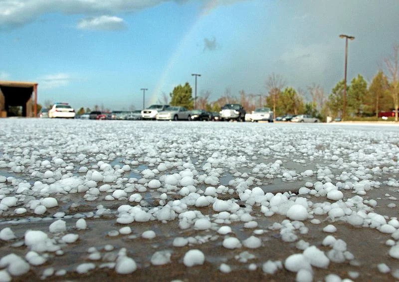
Hailstorms, those sudden onslaughts of ice from the sky, can wreak havoc on crops, property, and even lives. Predicting these events is crucial for issuing warnings and minimizing damage. While forecasting hailstorms remains a complex challenge, meteorological science has made significant strides in understanding the conditions that spawn these icy assaults.
Take, for instance, the hailstorm that struck Munich, Germany on July 12, 1984. This devastating event, often referred to as the “Munich Hailstorm”, resulted in over $1 billion in damages, making it one of the costliest hailstorms in history. The hailstones, some reaching the size of tennis balls, pummeled the city, shattering windows, damaging vehicles, and injuring hundreds of people. The storm’s intensity was fueled by a potent combination of atmospheric ingredients: a hot and humid air mass, strong instability, and significant wind shear. These conditions created a supercell thunderstorm with a powerful rotating updraft, the perfect environment for hailstone growth.
Hail forms within these supercell thunderstorms. They possess a rotating updraft, a column of rising air, that can reach speeds exceeding 100 miles per hour. This updraft acts as a hailstone elevator, repeatedly lofting developing hailstones to freezing heights where they accumulate layers of ice. The stronger and more sustained the updraft, the larger the hailstones can grow.
Several key atmospheric ingredients contribute to the formation of hailstorms. Firstly, ample moisture is necessary to fuel the development of the storm clouds and the growth of hailstones. The Munich hailstorm, for example, was preceded by a period of hot and humid weather, creating a moisture-rich environment. Secondly, instability in the atmosphere, often characterized by warm, moist air near the surface and colder air aloft, provides the energy needed for the storm’s powerful updrafts. In the case of Munich, a cold front approaching the city created a sharp temperature contrast, enhancing atmospheric instability. Lastly, wind shear, the change in wind speed and direction with height, plays a critical role in organizing the storm’s rotation and sustaining the updraft, allowing hailstones to grow larger. The Munich hailstorm exhibited significant wind shear, contributing to the storm’s longevity and intensity.
Meteorologists employ a variety of tools and techniques to forecast hailstorms. Doppler radar, for instance, is essential for detecting the presence of hail within a storm. By analyzing the radar echoes, meteorologists can estimate the size and intensity of the hail, along with the storm’s movement and structure. Additionally, sophisticated computer models that simulate atmospheric conditions help predict the likelihood and severity of hailstorms. These models incorporate data from weather balloons, surface observations, and satellites to paint a comprehensive picture of the atmospheric environment. Prior to the Munich hailstorm, meteorologists observed the developing atmospheric conditions and issued warnings of severe thunderstorms with the potential for large hail.
Despite these advancements, forecasting hailstorms remains an imperfect science. The complex interplay of atmospheric factors and the rapid evolution of thunderstorms can make precise predictions challenging. However, continuous research and development in meteorological observation and modeling techniques are steadily improving our ability to anticipate these icy onslaughts, providing crucial lead time for communities to prepare and protect themselves from the devastating impacts of hail.
Hail Forecasting Checklist:
Atmospheric Conditions:
- Moisture:
- Surface dewpoint: High dewpoints (above 60°F) indicate ample moisture for hail formation.
- Precipitable water: Values exceeding 1.5 inches suggest abundant moisture in the atmosphere.
- Instability:
- Convective Available Potential Energy (CAPE): CAPE values greater than 2000 J/kg indicate significant instability.
- Lifted Index (LI): Negative LI values, particularly below -6, suggest strong instability.
- Wind Shear:
- Analyze wind speed and direction at different levels (surface, 0-6 km, 0-3 km) to assess wind shear.
- Look for significant changes in wind speed and/or direction with height, indicating favorable conditions for supercell development and hail growth.
Radar Observations:
- Reflectivity:
- Look for strong reflectivity values (exceeding 50 dBZ) suggestive of large hail.
- Identify bounded weak echo regions (BWER), a radar signature often associated with hail.
- Doppler Velocity:
- Analyze for strong inbound/outbound velocity couplets, indicative of a rotating updraft within a supercell.
- Dual-Polarization:
- Utilize differential reflectivity (ZDR) and correlation ratio (RhoHV) to differentiate hail from rain and other precipitation types.
Worst Hailstorms:
- 1. April 2021: A Multi-State Hailstorm Outbreak
- Locations Affected: This widespread hailstorm event impacted multiple states across the central and southern U.S., including Texas, Oklahoma, Kansas, and Missouri.
- Damage: Large hail, ranging from golf ball- to baseball-sized, caused extensive damage to homes, businesses, vehicles, and crops. Roofs were punctured, windows shattered, and vehicles were left with significant dents and broken windshields.
- Cost: The total economic losses from this hailstorm outbreak were estimated to exceed $2 billion (USD), with insured losses surpassing $1.5 billion (USD).
- 2. April 2017: A Texas-Sized Hailstorm
- Location Affected: The San Antonio, Texas metropolitan area bore the brunt of this devastating hailstorm.
- Damage: Hailstones up to 4.5 inches in diameter pummeled the city, causing widespread damage to homes, vehicles, and businesses. The storm also resulted in significant flooding due to the accumulation of hail and heavy rainfall.
- Cost: The total economic losses from this hailstorm were estimated to be around $1.4 billion (USD), making it one of the costliest hailstorms in Texas history.
- 3. July 2009: A Colorado Cataclysm
- Location Affected: The Denver metropolitan area and surrounding communities in Colorado experienced a particularly damaging hailstorm.
- Damage: Large hail, exceeding 2 inches in diameter in some areas, caused extensive damage to roofs, vehicles, and crops. The storm also led to flash flooding and power outages.
- Cost: The total insured losses from this hailstorm were estimated to be around $1.4 billion (USD), making it one of the costliest hailstorms in Colorado history.