Storm Chasing in Canada: Tracking Nature’s Fury

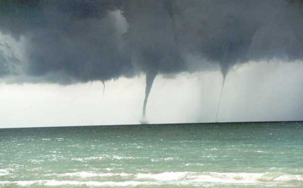
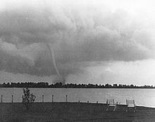
Canada, known for its diverse landscapes and vast expanses, is also home to a unique meteorological phenomenon – severe thunderstorms and tornadoes. While storm chasing is more commonly associated with the United States, particularly in the infamous “Tornado Alley,” Canada experiences its fair share of severe weather events, attracting both professional meteorologists and amateur storm chasers.

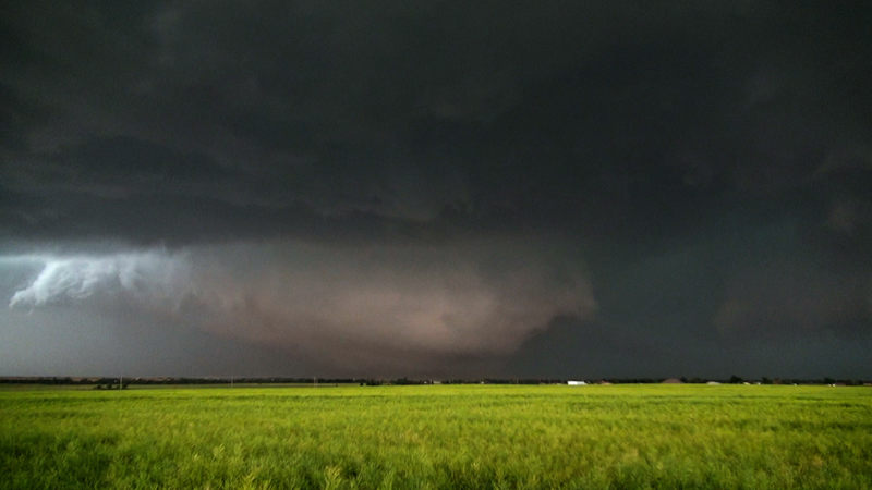
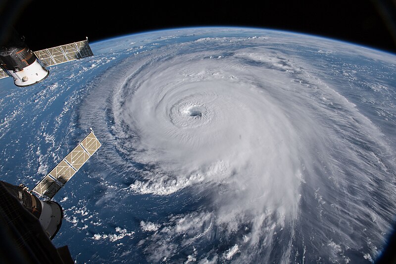
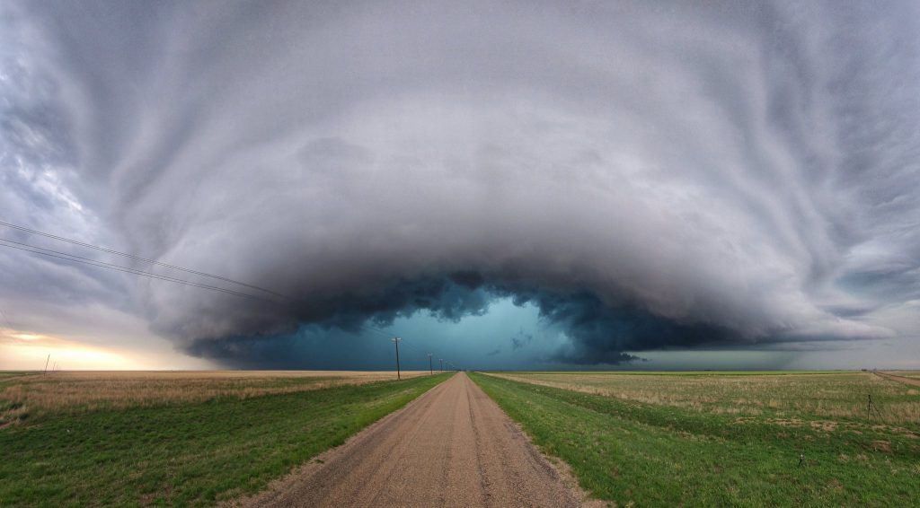
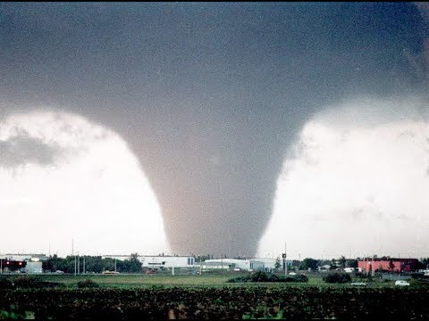
Meteorology Behind Canadian Storm Chasing The formation of severe thunderstorms and tornadoes in Canada is primarily influenced by the collision of contrasting air masses. During the summer months, warm, moist air from the Gulf of Mexico and the United States Great Plains often clashes with cooler, drier air from the Arctic. This collision creates instability in the atmosphere, leading to the development of powerful supercell thunderstorms.

Additionally, Canada’s unique topography plays a role in storm formation. The prairies, with their flat, open landscapes, allow for uninterrupted wind flow and the creation of strong updrafts necessary for tornado development. The presence of the Rocky Mountains to the west also contributes to the formation of severe weather, as the mountains can help channel and intensify storm systems.

Prime Storm Chasing Locations in Canada

  1. Southern Ontario: This region, particularly the area extending from Windsor to Toronto, experiences the highest frequency of tornadoes in Canada. The proximity to the Great Lakes and the convergence of air masses make this area a hotspot for severe weather.
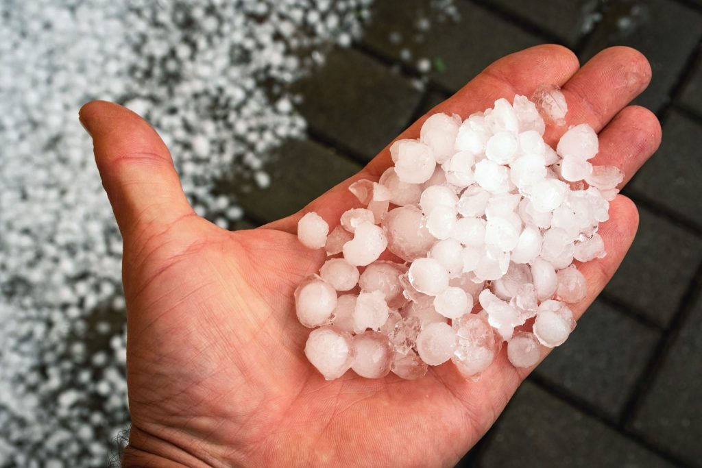
  2. Alberta: Known as “Hailstorm Alley,” central and southern Alberta often experience severe thunderstorms capable of producing large hail, damaging winds, and occasional tornadoes. Cities like Calgary and Red Deer are prime locations for storm chasers.
  3. Saskatchewan: The southern portions of Saskatchewan, especially along the border with the United States, are prone to severe thunderstorms and tornadoes. The flat, open prairies provide an ideal environment for storm development.
  4. Manitoba: Similar to Saskatchewan, southern Manitoba experiences severe weather due to its location and topography. The Red River Valley, in particular, is a corridor for intense storm systems.

Tornado Statistics by Province According to Environment and Climate Change Canada, the average number of reported tornadoes per year in each province is as follows:

  1. Ontario: 12-18
  2. Alberta: 10-15
  3. Saskatchewan: 8-12
  4. Manitoba: 6-10
  5. Quebec: 4-8
  6. New Brunswick: 1-2
  7. British Columbia: 0-1
  8. Nova Scotia: 0-1
  9. Prince Edward Island: 0-1
  10. Newfoundland and Labrador: 0-1

It is important to note that these numbers are based on reported tornadoes and may not reflect the actual occurrence, as some tornadoes in remote areas may go undetected.

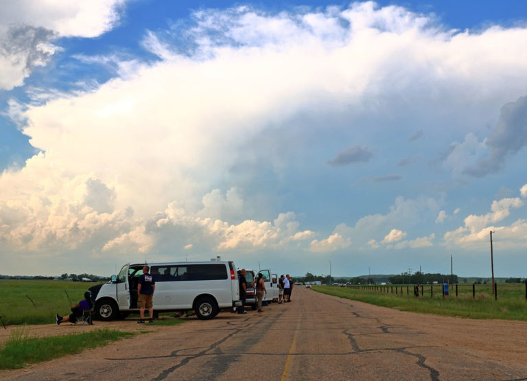
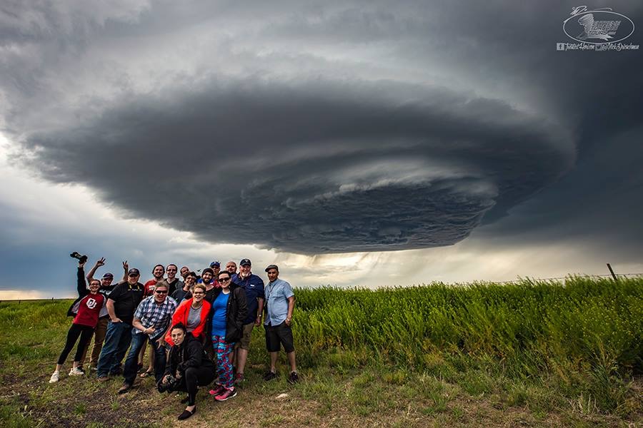
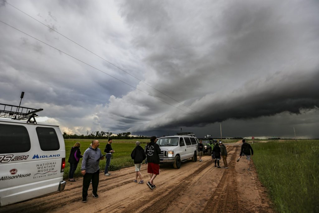
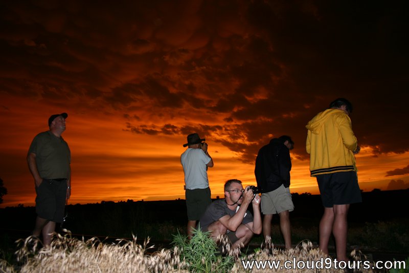
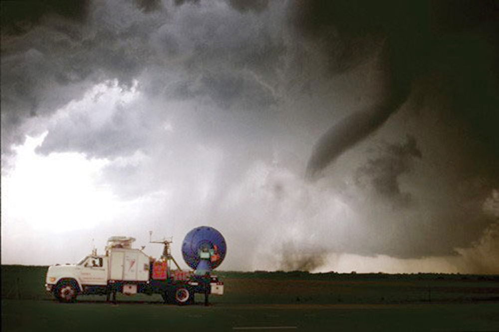
Storm chasing in Canada is a thrilling and scientifically valuable pursuit, but it also comes with inherent risks. Chasers must be well-prepared, equipped with proper safety gear, and knowledgeable about severe weather dynamics. It is crucial to respect the power of nature and prioritize personal safety above all else.

As climate change continues to influence weather patterns worldwide, studying severe weather events in Canada becomes increasingly important.

Top 5 Weather Events in Canada

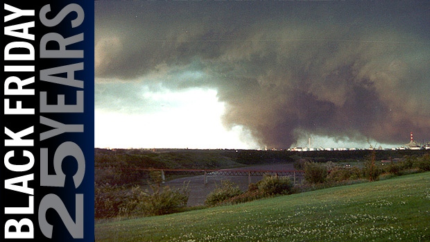
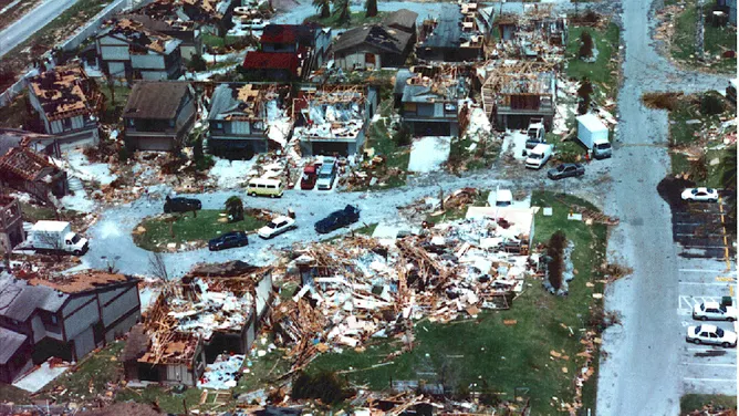
Edmonton Tornado (July 31, 1987)
Also known as “Black Friday,” this devastating F4 tornado struck eastern Edmonton, Alberta, causing 27 fatalities, injuring over 300 people, and resulting in an estimated $330 million in damages (adjusted for inflation). It remains the deadliest tornado in Canadian history and one of the most destructive in terms of property damage.


Pine Lake Tornado (July 14, 2000)
An F3 tornado touched down near Pine Lake, a popular camping area in central Alberta, claiming 12 lives and injuring over 100 people. The tornado caused widespread damage to the Green Acres Campground, destroying numerous trailers and vehicles. It is the second-deadliest tornado in Canadian history.


Windsor – Tecumseh, Ontario Tornado (June 17, 1946)
This powerful F4 tornado struck the towns of Windsor and Tecumseh in southwestern Ontario, causing 17 fatalities and over 200 injuries. It remains the third-deadliest tornado in Canadian history and caused significant damage to residential areas and infrastructure.


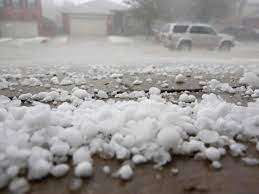
Calgary Hailstorm (June 13, 2020)
A severe thunderstorm produced large hail over Calgary, Alberta, causing an estimated $1.2 billion in insured damages, making it the fourth-costliest natural disaster in Canadian history. The hailstorm damaged numerous homes, vehicles, and buildings across the city.


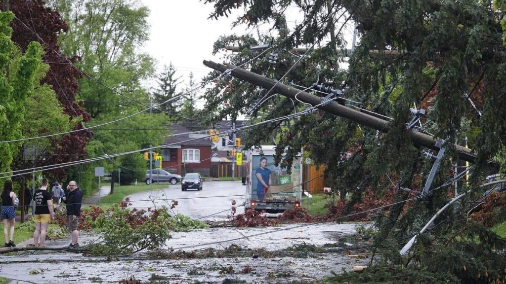
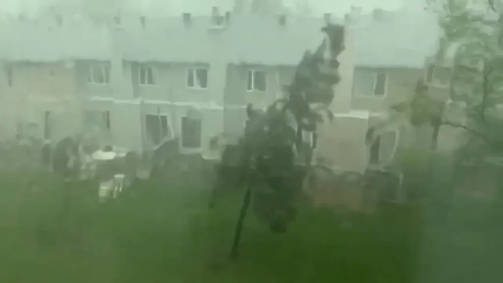
Southern Ontario Derecho (May 21, 2022)
A powerful derecho, a widespread and long-lived windstorm associated with a line of severe thunderstorms, swept across southern Ontario, causing significant damage and power outages. The storm resulted in 10 fatalities and affected major cities such as Toronto, Ottawa, and London. Wind gusts exceeding 120 km/h were recorded, and the event is considered one of the most impactful derechos in Canadian history.

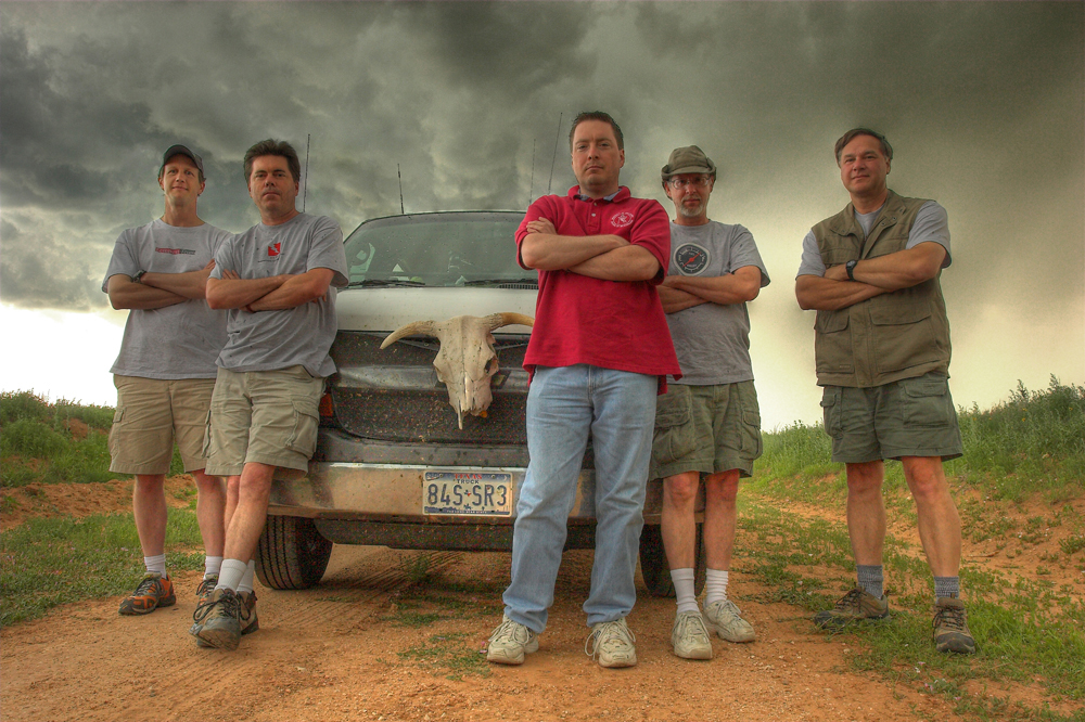
Well-known Storm Chasers in Canada:

Mark Robinson: A meteorologist and storm chaser based in Ontario, Robinson is the founder of The Weather Network’s “Storm Hunters” team. He has been chasing storms across Canada and the United States for over two decades.


Greg Johnson: Known as “Tornado Hunter,” Johnson is a Saskatchewan-based storm chaser and photographer who has been documenting severe weather events for more than 20 years. His work has been featured in numerous publications and documentaries.


Justin Hobson: A storm chaser and photographer based in Alberta, Hobson is known for his stunning images of severe weather events across the Canadian Prairies.

Weather Radar Network and Forecast Models:
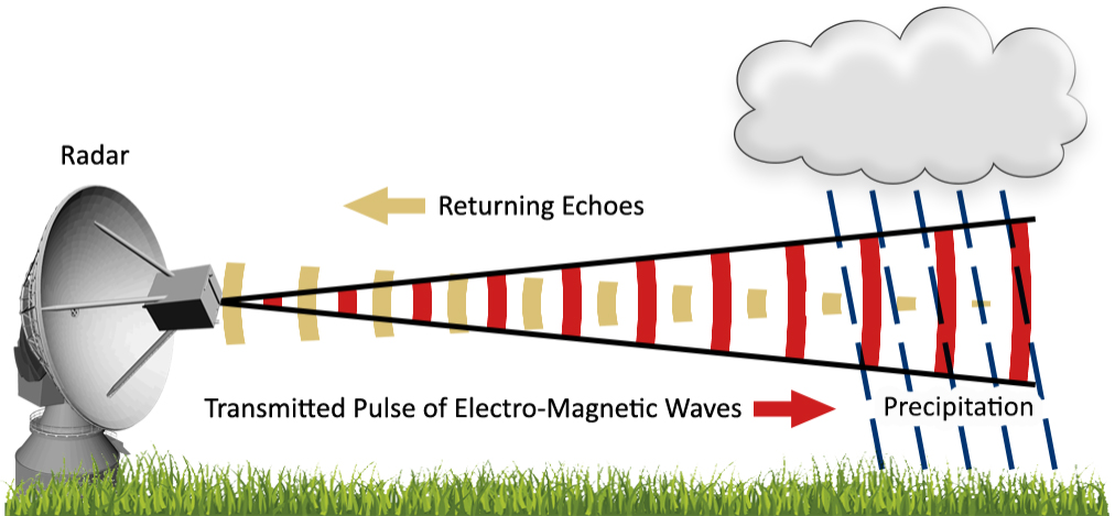
Environment and Climate Change Canada (ECCC) operates the Canadian weather radar network, which consists of 31 Doppler radars across the country. These radars provide real-time data on precipitation intensity, wind velocity, and storm structure, aiding in the detection and tracking of severe weather events.
ECCC also utilizes several forecast models to predict weather patterns and severe weather potential:

Global Environmental Multiscale (GEM) Model: This is the primary forecast model used by ECCC, providing short-range and medium-range weather forecasts for Canada and the world.
High Resolution Deterministic Prediction System (HRDPS): A high-resolution model that provides detailed short-range forecasts for specific regions in Canada, focusing on severe weather events.
Canadian Precipitation Analysis (CaPA): A system that combines radar, satellite, and surface observations to provide a comprehensive analysis of precipitation across Canada.

Links:

Environment and Climate Change Canada Weather Radar: https://weather.gc.ca/radar/index_e.html
Canadian Centre for Meteorological and Environmental Prediction: https://weather.gc.ca/ensemble/index_e.html
The Weather Network Storm Hunters: https://www.theweathernetwork.com/ca/news/storm-hunters
Greg Johnson Tornado Hunter: https://tornadohunter.com/
Justin Hobson Photography: https://justinhobson.ca/

Choosing the Best Tornado Tour Company: A Guide for New Storm Chasers

If you’re an adventurous soul looking to witness the raw power of nature up close, a tornado tour might be just the thrill you’re seeking. However, with numerous companies offering storm chasing experiences, it’s important to choose a reputable and experienced outfit to ensure your safety and satisfaction. We’ll guide you through the process of selecting the best tornado tour company and provide a list of well-known operators along with their website addresses.

Factors to Consider When Choosing a Tornado Tour Company:

  1. Experience and expertise: Look for companies with experienced guides who have a proven track record of successfully navigating severe weather conditions. Ensure that the guides are knowledgeable about meteorology and have the necessary skills to keep you safe.
  2. Safety measures: Your chosen company should prioritize safety above all else. Inquire about their safety protocols, emergency procedures, and the equipment they use to monitor and track storms.
  3. Group size: Smaller group sizes often lead to a more personalized experience and better access to the guides. Consider the company’s maximum group size and whether it aligns with your preferences.
  4. Tour duration and itinerary: Tornado tours can vary in length from a single day to a week or more. Consider your availability and the specific areas you’d like to explore when choosing a tour duration and itinerary.
  5. Reviews and testimonials: Read reviews and testimonials from previous clients to gauge the company’s reputation and the quality of their tours. Look for consistent positive feedback and how the company responds to any negative reviews.

Top Tornado Tour Companies:

1.Tempest Tours
Website: https://tempesttours.com/
Tempest Tours has been offering storm chasing expeditions since 2000 and is known for their experienced guides and commitment to safety.

    2. Silver Lining Tours
    Website: https://www.silverliningtours.com/
    With over 20 years of experience, Silver Lining Tours provides educational and thrilling storm chasing adventures across Tornado Alley.

      3. Storm Chasing Adventure Tours
      Website: https://stormchasing.com/
      Storm Chasing Adventure Tours offers a variety of tour options, from single-day excursions to week-long expeditions, led by experienced meteorologists and storm chasers.

        4. Extreme Tornado Tours
        Website: https://extremetornadotours.com/
        Extreme Tornado Tours specializes in small-group tours led by seasoned storm chasers, ensuring a personalized and immersive experience.

          5. Cloud 9 Tours
          Website: https://cloud9tours.com/
          Cloud 9 Tours offers both storm chasing and photography-focused tours, catering to those who want to capture the beauty and power of severe weather.

            Storm chasing tornado tours offer a unique and exhilarating experience for thrill-seekers and weather enthusiasts alike. These guided adventures take participants on a journey into the heart of Tornado Alley, where they witness the awe-inspiring power of nature firsthand. Experienced storm chasers lead the tours, using their expertise in meteorology and forecasting to navigate the group towards active storms. Participants can expect to spend long hours on the road, tracking weather patterns and chasing down potential tornado outbreaks. When a tornado does form, the rush of adrenaline is unparalleled as the group carefully positions themselves at a safe distance to observe the twisting vortex.

            However, storm chasing is not without its risks. Tornadoes are unpredictable and can change course or intensify rapidly, putting chasers in danger if they are not careful. Flying debris, hail, and strong winds can also pose a threat to safety. Storm chasing tour companies prioritize the well-being of their clients, but participants must be aware of the inherent dangers and follow instructions closely. Choose a reputable company with experienced guides who prioritize safety above all else. Participants should also be prepared for the physical demands of the tour, as it often involves long periods of driving and potentially rough terrain. Storm chasing is endless driving and sometimes you won’t see much so you have to be prepared to be on the road for up to 10 days.

            Despite the risks, the benefits of a storm chasing tornado tour are significant for those who crave adventure and have a deep appreciation for the power of nature. Witnessing a tornado up close is a once-in-a-lifetime experience that few people have the opportunity to enjoy. Storm chasing tours provide a controlled environment for this experience, with knowledgeable guides who can help participants understand the science behind the storms. Additionally, the tours often foster a sense of camaraderie among participants, as they bond over their shared passion for weather and adventure. For many, the thrill of the chase and the incredible photographs and memories they capture make the risks worthwhile.

            The El Reno Tornado: A Colossus on the Oklahoma Plains – May 31, 2013

            The late afternoon of May 31, 2013, witnessed the birth of a meteorological monster on the open plains west of Oklahoma City – the El Reno tornado. This colossal twister, eventually reaching a staggering 2.6 miles wide, etched its name in history as the widest tornado ever recorded. Its immense size and erratic behavior posed a significant challenge for storm chasers and researchers, ultimately claiming the lives of three experienced storm chasers who were caught in its unpredictable path.

            The day began with a heightened sense of awareness among meteorologists and storm chasers. The Storm Prediction Center had issued a high-risk warning for severe weather, highlighting the potential for strong, long-track tornadoes across central Oklahoma. As the afternoon progressed, supercell thunderstorms began to develop, their towering structures visible from miles away. Among these storms, one particular supercell exhibited ominous signs of rotation and quickly became the focus of attention.

            At approximately 6:03 pm, the El Reno tornado touched down, initially as a relatively narrow funnel. However, it rapidly intensified and expanded, growing wider and wider as it churned across the open landscape. The tornado’s erratic movements and multiple vortices made it difficult to track and predict, posing a significant danger to those in its path.

            Caught in the Colossus: Stories of Impact and Loss

            The El Reno tornado’s unpredictable nature and immense size had a profound impact on those who encountered it, including experienced storm chasers and researchers who dedicated their lives to understanding these powerful storms.

            • TWISTEX Team: The TWISTEX (Tactical Weather Instrumented Sampling in/near Tornadoes Experiment) team, a group of researchers studying tornadoes, was caught in the path of the El Reno tornado. Their vehicle was tossed by the tornado’s winds, resulting in injuries to several team members and tragically claiming the life of renowned storm chaser Tim Samaras, his son Paul Samaras, and fellow chaser Carl Young.
            • Other Storm Chasers: Several other storm chasers had close encounters with the El Reno tornado, capturing dramatic footage of the twister’s immense size and erratic movements. Many experienced the dangers of chasing such a large and unpredictable tornado firsthand, highlighting the risks associated with this activity.
            • Record-Breaking Width: At its peak, the El Reno tornado reached a staggering width of 2.6 miles, making it the widest tornado ever recorded. This immense size is attributed to the presence of multiple vortices within the parent circulation, effectively creating a massive wedge tornado with a broad damage path. The sheer width of the tornado made it difficult to perceive its full extent from the ground, leading to challenges in tracking and warning for its path.
            • Fluctuating Intensity: The El Reno tornado exhibited rapid fluctuations in intensity, ranging from EF3 to EF5 on the Enhanced Fujita scale. This variation in strength is a characteristic of many large tornadoes and is influenced by the complex dynamics of the storm’s updraft and the inflow of air feeding the tornado. The tornado’s multiple vortices also likely contributed to its fluctuating intensity, as each subvortex could possess varying degrees of strength.
            • Damage Indicators: Despite its immense size and fluctuating intensity, the El Reno tornado’s damage path was primarily rated EF3. This is because the tornado traversed mostly rural areas with few structures to serve as damage indicators. However, the few structures that were impacted sustained significant damage, indicative of the tornado’s potential for greater destruction had it tracked through a more densely populated area.
            • Reed Timmer and the Dominator Team: Veteran storm chaser Reed Timmer and his Dominator team were in close proximity to the El Reno tornado, capturing dramatic footage of its rapid expansion and erratic movements. They experienced the tornado’s powerful winds firsthand as their armored vehicle, the Dominator, was buffeted and pushed off the road. Timmer described the experience as “the most intense moment of my storm chasing career,” highlighting the sheer power and danger of the El Reno tornado.
            • Mike Bettes and The Weather Channel Team: The Weather Channel team, led by meteorologist Mike Bettes, was also chasing the El Reno tornado. Their SUV was caught in one of the tornado’s subvortices and thrown 200 yards, resulting in injuries to the team members. Bettes later recounted the experience as a “life-changing event” that underscored the unpredictable nature of tornadoes and the importance of safety precautions when chasing storms.

            The Tri-State Tornado: A Trail of Destruction Across Three States – March 18, 1925

            The afternoon of March 18, 1925, etched itself into the annals of American history as the deadliest tornado event the nation has ever witnessed. A single, monstrous tornado tore through portions of Missouri, Illinois, and Indiana, leaving behind a 219-mile path of devastation. In its wake, the Tri-State Tornado, as it came to be known, claimed 695 lives, injured over 2,000 people, and caused catastrophic damage to homes, businesses, and the landscape itself. The roar of the tornado was said to be audible from miles away, described by survivors as sounding like a freight train or the continuous rumble of thunder.

            Emerging in southeastern Missouri, the tornado first touched down around 1 p.m. near Ellington. Witnesses reported seeing a dark, swirling funnel cloud descend from the sky, growing in size and intensity as it moved across the countryside. The small community of Annapolis, Missouri was directly in its path, and within minutes, the town was reduced to rubble. Homes were obliterated, trees uprooted, and the local schoolhouse was completely destroyed with over 100 students inside. Miraculously, only one child lost their life due to the quick actions of the teachers who ushered the children into the basement just before the tornado struck. Sadly, 38 people lost their lives in Annapolis alone. Continuing its northeastward track, the tornado crossed the Mississippi River into southern Illinois, striking the towns of Gorham and Murphysboro. Murphysboro suffered the most significant loss of life with 234 fatalities. The business district was completely leveled, and the remains of the Murphysboro High School were scattered for miles.

            As the tornado moved into Indiana, its path widened, reaching an astonishing 2.5 miles at its maximum width. The towns of Griffin and Owensville were heavily impacted, with countless homes and businesses leveled. In Griffin, a local church was destroyed while a service was in progress, resulting in the tragic loss of 69 lives. The Tri-State Tornado finally dissipated near Petersburg, Indiana, after a horrifying 3.5-hour rampage. In total, 19 communities were directly affected, with thousands of buildings destroyed and an estimated $17 million in property damage (equivalent to over $250 million today). The aftermath resembled a war zone, with debris strewn across the landscape and survivors left in shock and despair.

            The meteorological conditions that spawned the Tri-State Tornado were a potent mix of atmospheric ingredients. A strong low-pressure system tracked across the central plains, dragging a warm front northward. To the south, warm, moist air surged from the Gulf of Mexico, while cold, dry air aloft created an unstable atmosphere. As the warm front collided with the colder air, powerful thunderstorms erupted, providing the energy needed for tornadic development.

            The specific dynamics of the storm system, including wind shear (changes in wind speed and direction with height), contributed to the tornado’s longevity and intensity. The wind shear created a horizontal rolling motion in the atmosphere, which helped to concentrate and stretch the storm’s rotation, leading to the formation of a long-lasting and powerful tornado. Additionally, the relatively flat terrain of the region offered little resistance to the twister’s path, allowing it to maintain its strength over a longer distance.

            The Tri-State Tornado remains a stark reminder of the destructive power of nature and the importance of severe weather preparedness. Its legacy has contributed to advancements in tornado research, forecasting, and warning systems, ultimately saving countless lives in the decades since this devastating event. The storm’s impact on the field of meteorology is undeniable, as it prompted further study of tornado formation and behavior, leading to improved understanding and prediction of these destructive forces.

            One of the closest comparisons in terms of path length is the Great Natchez Tornado of 1840. This devastating tornado, which struck Natchez, Mississippi and surrounding areas, carved a path estimated to be between 150 and 200 miles long. However, due to limitations in record-keeping and population density at the time, the exact number of fatalities remains uncertain, with estimates ranging from 100 to 317 deaths.

            Another notable tornado event was the 1974 Super Outbreak, which unleashed 148 tornadoes across 13 states in just 18 hours. This outbreak resulted in 330 fatalities and caused extensive damage. However, the Super Outbreak was characterized by numerous individual tornadoes, rather than a single, long-track event like the Tri-State Tornado.

            10 Essential Tools Every Storm Chaser Needs to Ride the Winds

            Storm chasing is an exhilarating pursuit that demands both courage and meticulous preparation. While the raw power of a storm itself is undeniable, venturing into such conditions requires a carefully curated arsenal of tools to ensure safety, capture the moment, and navigate the ever-changing environment. Here’s a breakdown of the 10 essential tools every storm chaser should have:

            1. Real-Time Weather Monitoring:

            • Weather Stations and Apps: Live weather data is paramount. Reliable weather stations and mobile applications provide crucial information on storm location, movement, intensity, and potential hazards like hail and tornadoes. Popular options include GRLevel3, Warn on Radar, and National Weather Service (NWS) apps.
            • Satellite Imagery: Real-time satellite imagery allows chasers to visualize cloud formations and storm structure. Services like GOES-16 and Himawari-8 offer valuable insights into storm development and movement.

            2. Navigation and Communication:

            • GPS Device: A reliable GPS device ensures you don’t get lost amidst confusing road closures or shifting weather patterns. Consider a ruggedized model with offline mapping capabilities for areas with spotty cellular reception.
            • Ham Radio: While cellular service might be unreliable during storms, a ham radio with proper licensing provides a vital communication lifeline. It allows chasers to connect with other storm chasers, emergency services, and weather spotters, sharing real-time updates and ensuring everyone’s safety.

            3. Safety Gear:

            • First-Aid Kit: A comprehensive first-aid kit is a must-have for any situation. Include essential supplies like bandages, antiseptic wipes, pain relievers, and medications specific to your needs.
            • Helmet: Flying debris is a real threat during storms. A sturdy helmet protects your head from hail, wayward branches, and other potential projectiles.

            4. Chasing Vehicle:

            • Reliable Transportation: Your vehicle is your mobile command center, so ensure it’s up to the challenge. Regular maintenance is crucial, and consider features like high ground clearance for navigating flooded roads and rough terrain.
            • Spare Tire and Tools: A flat tire in the middle of nowhere can be disastrous. Pack a spare tire, a jack, and basic tools for roadside repairs.

            5. Storm Documentation:

            • DSLR Camera with Sturdy Tripod: Capturing the raw beauty and power of a storm requires a high-quality camera. A DSLR allows for manual adjustments for optimal low-light and fast-action photography. A sturdy tripod ensures clear, shake-free footage.
            • Extra Batteries and Memory Cards: Running out of power or storage at a critical moment can be frustrating. Pack extra batteries and memory cards to ensure you don’t miss a single shot.

            6. Additional Considerations:

            • Flashlight and Headlamp: A reliable flashlight and headlamp provide hands-free illumination during low-visibility situations.
            • Cooler and Non-Perishable Food: Storm chases can be long and unpredictable. Pack a cooler with plenty of non-perishable food and water to stay hydrated and energized.
            • Weatherproof Clothing and Sturdy Boots: Dress for the conditions. Waterproof clothing, sturdy boots with good tread, and layers for varying temperatures are essential.

            7. Learning Cloud Formations and Storm Types:

            While sophisticated apps and weather stations provide valuable data, a storm chaser’s own knowledge of cloud formations and storm types is an invaluable tool. Understanding the visual cues associated with different storm types allows for better anticipation of their behavior and potential severity. Here are a few key cloud formations to be familiar with:

            • Wall Cloud: A low, rotating cloud base often associated with tornadoes.
            • Mammatus Clouds: Pouches or bulges that form on the underside of a thunderstorm, often an indicator of strong updrafts within the storm.
            • Supercell Storms: These powerful thunderstorms have rotating updrafts and are capable of producing tornadoes, large hail, and damaging winds.

            By recognizing these formations, storm chasers can make more informed decisions about approaching storms and maintain a safe distance from particularly hazardous weather phenomena.

            8. Choosing the Right Camera Settings for Storm Photography:

            Capturing the raw power and beauty of a storm requires an understanding of camera settings. Here are some basic tips:

            • Aperture: A wider aperture (lower f-number) allows more light in, which is crucial for low-light storm photography. However, be mindful of achieving a good depth of field to keep both the foreground and background in focus.
            • Shutter Speed: Adjust shutter speed based on the desired effect. A slower shutter speed creates motion blur, ideal for capturing lightning strikes or swirling cloud formations. Conversely, a faster shutter speed freezes action, useful for capturing hail or debris.
            • ISO: ISO controls camera sensitivity to light. Increase ISO in low-light situations, but be aware of introducing noise (graininess) into your image.

            Experimenting with these settings in different weather conditions allows storm chasers to develop their unique photographic style and capture stunning storm visuals.

            9. Storm Chaser Etiquette and Responsible Chasing:

            The thrill of the chase should never come at the expense of public safety or responsible storm observation. Here are some essential storm chaser ethics to follow:

            • Respect Road Closures: Never drive through flooded roads or enter restricted areas. This not only puts yourself at risk but also hinders emergency services.
            • Maintain a Safe Distance: Don’t crowd emergency vehicles or get dangerously close to a storm. There’s a difference between capturing a thrilling image and putting yourself in harm’s way.
            • Minimize Environmental Impact: Leave no trace behind. Respect private property and avoid causing damage to the environment while chasing storms.

            By following these guidelines, storm chasers can contribute to a positive and responsible storm chasing community.

            10. Documenting Your Chase Experiences:

            Storm chasing isn’t just about the adrenaline rush; it’s about capturing the experience and sharing it with others. Here’s how to effectively document your chase:

            • Detailed Notes: Jot down important details throughout your chase, including time, location, weather observations, and any interesting phenomena you encounter. These notes will become invaluable when reviewing footage or writing about your experience later.
            • Photography and Videography: As discussed, capture high-quality photos and videos that showcase the storm’s power and beauty. Experiment with different angles and techniques to create a compelling visual narrative.
            • Sharing Your Story: Consider creating a blog, social media channel, or online portfolio to share your storm chasing experiences with others. This allows you to educate the public about severe weather, contribute to storm chasing discussions, and inspire others to appreciate the wonders of nature.

            Beyond the Essentials:

            While the above tools form a strong foundation, storm chasers can further enhance their preparedness with:

            • Storm Chasing Community Forums: Participating in online forums allows chasers to connect with experienced individuals, share intel, and learn valuable safety tips.
            • Weather Spotter Training: Consider becoming a trained weather spotter. This not only enhances your own understanding of storm behavior but also allows you to contribute valuable data to weather services.
            • Power Inverter: A power inverter allows you to power essential electronics like laptops and cameras using your vehicle’s battery.

            Remember: Safety Always Comes First

            Storm chasing is an activity that demands respect for the immense power of nature. Always prioritize safety. Never chase into a tornado, maintain a safe distance from storms, and be prepared to retreat if conditions deteriorate. By using the right tools, staying informed, and prioritizing safety, storm chasers can capture the awe-inspiring power of storms while minimizing risks.pen_spark

            Tornado Vision: App Review

            Tornado Vision is an app that combines three separate features to be the ultimate assistant for those who are interested to keep situational awareness of severe weather.

            For one the app uses augmented reality to display the nearest storm to you with the latest data including the chance of hail, tornado and wind as well as information about warnings and storm reports as well as direction and distance. You can click on any of these icons to get a more detailed display.

            Here you can see a tutorial of all the individual augmented reality features for a storm when using Tornado Vision.

            Tornado Vision also has filters that were tested on hundreds of low contrast tornadoes, usually those hidden in the rain that help you bring out the details.

            This tornado WAS NOT visible to the naked eye at this point but with the help of Tornado Vision is 100% visible. The last feature of Tornado Vision is the lightning trigger, at night it’s incredibly hard to see a torando except for a momentary flash of lightning, by switching to night mode you can have it freeze whenever a certain illumination point is reached, this will help you see tornadoes more easily.

            Here are videos of Tornado Vision being used around severe storms.

            The full features of TornadoVision are:

            Augmented Reality displays chance of tornado, hail (and size) and wind when looking at a storm.

            Augmented Reality displays if you are in tornado or severe thunderstorm warning.

            Augmented reality displays any Tornado or Hail reports.

            Four specially designed camera filters help bring out tornadoes hiding in the rain.

            Night mode automatically captures hidden night-time tornadoes.

            Bring up data on storm characteristics, including rotation, maximum hail size and lightning flash rate.

            Bring up environmental data like storm relative helicity, CAPE and bulk wind.