Advancing Severe Weather Detection: The Rise of Dual Polarization Radar in the US

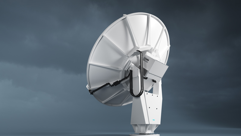
Weather radar has always been a cornerstone of meteorological observation and forecasting. Yet, traditional radar systems, while effective, were limited in their ability to decipher the complexities within storms, often leaving meteorologists with an incomplete picture. The advent of dual polarization radar technology marked a paradigm shift, ushering in an era of enhanced precision and understanding in severe weather detection and warnings.

Understanding the Dual Pol Advantage:

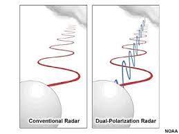
Traditional weather radars transmit and receive horizontally polarized waves, meaning the waves vibrate parallel to the ground. This provides information about the location and intensity of precipitation but lacks the ability to discern the size, shape, and variety of particles within a storm. Dual polarization technology builds upon this foundation by introducing a second dimension – vertical polarization. By transmitting and receiving both horizontally and vertically polarized waves, dual pol radar paints a more comprehensive picture of the storm environment.

Transforming Tornado Detection:

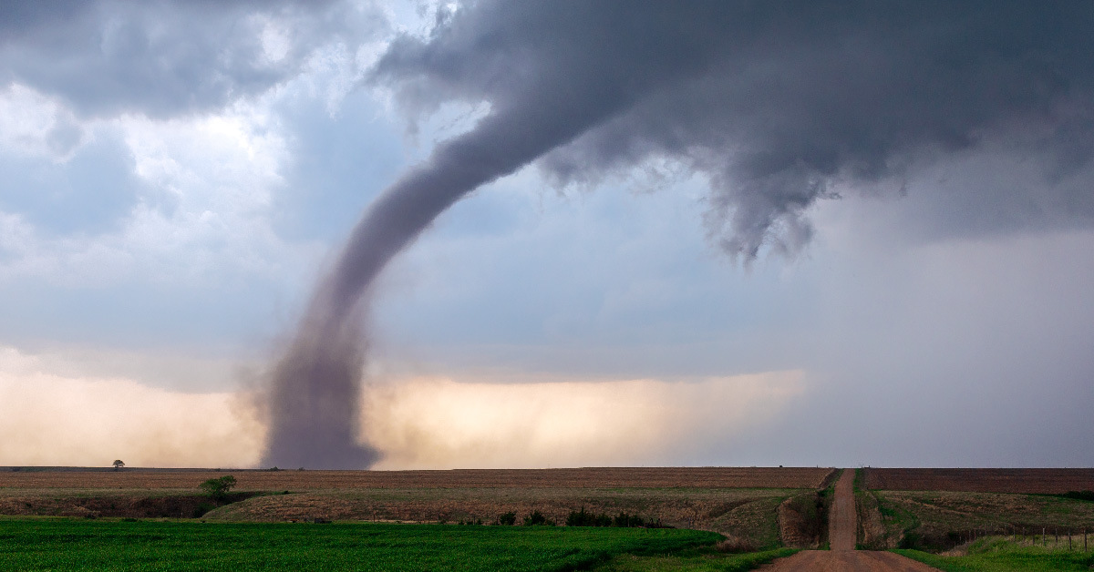
One of the most significant benefits of dual pol technology lies in its ability to enhance tornado detection and warnings. Traditional radar could identify areas of rotation within a storm, suggestive of a possible tornado. However, confirming the presence of a tornado often relied on visual sightings or the detection of debris lofted into the air, both of which could be unreliable or delayed.

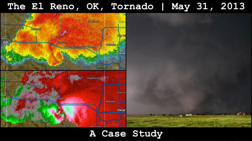
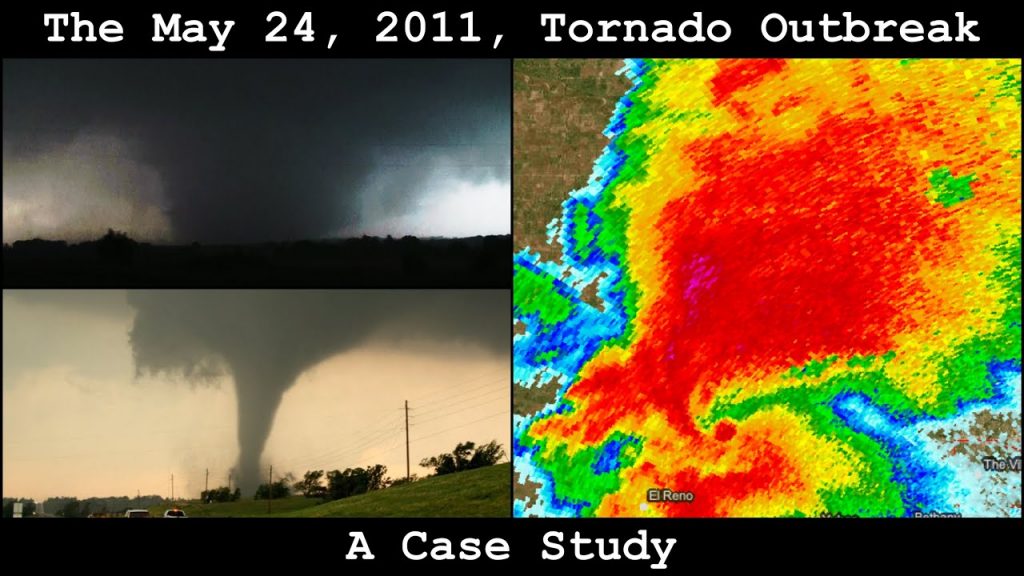
Dual pol radar brought a game-changing advantage: the ability to detect debris fields associated with tornadoes. When a tornado is on the ground, it lifts a variety of objects – from tree limbs and building materials to vehicles and even larger structures. These objects scatter radar waves differently than raindrops or hailstones, creating a distinct signature that dual pol radar can identify. This capability allows meteorologists to confirm the presence of a tornado with greater confidence and issue more timely and accurate warnings, potentially saving lives.

Sharper Images, Clearer Insights:

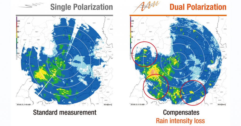
Beyond debris detection, dual pol technology enhances the overall resolution and clarity of radar data. By analyzing the way horizontally and vertically polarized waves interact with precipitation particles, meteorologists can estimate the size and shape of raindrops, hailstones, and snowflakes. This information provides valuable insights into the intensity of precipitation, the potential for flooding, and the type of winter weather expected.

A Nationwide Upgrade: The Dual Pol Rollout:

Recognizing the transformative potential of dual polarization technology, the National Weather Service (NWS) embarked on an ambitious endeavor to upgrade its entire network of radars across the United States. The rollout, initiated in 2010 and completed in 2013, involved retrofitting existing radars with dual pol capabilities, ensuring comprehensive coverage for the nation.

This nationwide upgrade has yielded substantial improvements in severe weather detection and warnings. Studies have shown a significant increase in lead times for tornado warnings and a reduction in false alarms, underscoring the life-saving potential of this technology.

Beyond Tornadoes: A Multifaceted Tool:

While the impact of dual pol radar on tornado warnings has been profound, its benefits extend far beyond this realm. The technology has proven invaluable for:

  • Improved Rainfall Estimates: By providing more accurate measurements of rainfall amounts, dual pol data enhances flash flood warnings and supports better water resource management.
  • Winter Weather Monitoring: The ability to differentiate between various types of frozen precipitation, such as snow, sleet, and freezing rain, leads to more precise winter storm forecasts and improved road condition monitoring.
  • Aviation Safety: Dual pol radar aids in identifying hazardous weather phenomena for aviation, including icing conditions and turbulence, contributing to safer air travel.

Hurricane Andrew: A South Florida Nightmare – August 24, 1992

The morning of August 24, 1992, dawned bright and clear in South Florida, but the calm was a cruel deception. Lurking in the Atlantic, Hurricane Andrew, a Category 5 monster, was on a collision course. By the time the sun set, Andrew would etch its name in history as one of the most destructive hurricanes to ever strike the United States, leaving behind a trail of devastation that would take years to rebuild.

Andrew’s journey of destruction began in the eastern Atlantic as a tropical wave, gradually gaining strength as it moved westward. By August 22nd, it had intensified into a Category 5 hurricane with sustained winds of 175 mph. After pummeling the northern Bahamas, Andrew set its sights on South Florida. Despite weakening slightly to a Category 4, Andrew remained a formidable force, boasting winds of 145 mph as it approached the coast.

Around 5 AM on August 24th, the hurricane’s eyewall slammed into Elliott Key, just south of Miami. The anemometer at the National Hurricane Center in Coral Gables clocked a peak gust of 177 mph before being destroyed by the wind. Homes were ripped apart, boats tossed ashore like toys, and palm trees stripped bare. The storm surge, a wall of water pushed ashore by the hurricane, inundated coastal areas, flooding streets and homes.

The devastation wasn’t confined to the immediate coastline. As Andrew moved inland, its powerful winds tore through Homestead, Florida City, and Kendall, leaving behind scenes reminiscent of a war zone. Homestead Air Force Base, located near the eye of the storm, was virtually destroyed, with aircraft hangars crumpled and fighter jets tossed about like paper airplanes. Mobile home parks were obliterated, shopping centers reduced to rubble, and thousands of homes left uninhabitable. The darkness of the early morning, combined with the howling winds and driving rain, created an atmosphere of pure terror for those trapped in the storm’s path.

Andrew’s destructive power was fueled by a combination of factors. The warm waters of the Atlantic provided ample energy for the storm to intensify. Additionally, a lack of wind shear, which can disrupt a hurricane’s organization, allowed Andrew to maintain its strength. The storm’s compact size, while limiting the geographic scope of its impact, concentrated its destructive winds over a smaller area, resulting in catastrophic damage. The pressure readings recorded in Homestead were some of the lowest ever observed in a hurricane striking the U.S. mainland, indicating the storm’s incredible intensity.

The aftermath of Hurricane Andrew revealed a landscape of unimaginable destruction. Over 125,000 homes were damaged or destroyed, leaving thousands homeless. Millions were left without power, and the economic losses reached an estimated $26 billion, making it the costliest natural disaster in U.S. history at the time. The storm exposed flaws in building codes and emergency preparedness, prompting significant changes in both areas.

The human cost of the disaster was equally staggering. In Florida alone, 44 deaths were directly attributed to the hurricane, with another 15 indirectly caused by the storm. Thousands more were injured, and the psychological scars left by the trauma of the event were deep and long-lasting.

While the physical scars of Hurricane Andrew have faded with time, the memories of its devastating impact remain vivid for those who lived through it. The storm serves as a stark reminder of the destructive power of nature and the importance of respecting and preparing for its fury. The lessons learned from Andrew have led to improved building codes, better emergency response systems, and a heightened awareness of hurricane preparedness, ultimately saving countless lives in subsequent storms.

Adjusted for inflation, the estimated $26 billion in damages translates to a staggering $55.6 billion in today’s dollars, underscoring the immense financial impact of the storm. This figure encompasses a wide range of losses, including:

  • Residential and Commercial Property Damage: Andrew obliterated thousands of homes and businesses, leaving behind a landscape of rubble. Rebuilding costs, coupled with lost economic activity, contributed significantly to the overall financial toll.
  • Infrastructure Damage: The storm inflicted severe damage on critical infrastructure, including power grids, communication systems, and transportation networks. Repairing and restoring these essential services added to the overall cost.
  • Agricultural Losses: The agricultural sector, particularly in South Florida, suffered extensive losses due to crop damage and destruction of farming infrastructure.
  • Insurance Payouts: Insurance companies faced massive payouts to cover property damage claims, leading to increased premiums and financial strain within the industry.

Timeline of Hurricane Andrew:

  • August 14, 1992: A tropical wave emerges off the coast of Africa, marking the genesis of what would become Hurricane Andrew.
  • August 16-22, 1992: The tropical wave strengthens as it tracks westward across the Atlantic, eventually becoming a tropical storm and then rapidly intensifying into a Category 5 hurricane by August 22nd.
  • August 23, 1992: Andrew makes landfall in the northern Bahamas as a Category 4 hurricane, causing significant damage.
  • August 24, 1992 (Early Morning): Hurricane Andrew makes landfall near Elliott Key, Florida, as a Category 5 hurricane with sustained winds of 165 mph, causing catastrophic damage in South Florida, including Homestead, Florida City, and Kendall.
  • August 24-26, 1992: Andrew weakens as it crosses the Gulf of Mexico but regains strength before making a second landfall as a Category 3 hurricane in Louisiana, causing further damage.
  • August 26-28, 1992: Andrew weakens into a tropical depression as it moves inland and dissipates over the eastern United States.

The Destructive Power of EF-5 Tornadoes: A Look at the Rarest and Most Devastating Twisters

The rarity of EF-5 tornadoes can be attributed to the specific atmospheric conditions required for their formation. These conditions include a combination of strong wind shear, instability, and moisture. The presence of a strong, persistent updraft is also crucial in allowing the tornado to maintain its intensity and reach EF-5 status.

Here are the last five EF-5 tornadoes recorded in the United States:

  1. Moore, Oklahoma (May 20, 2013): This devastating tornado tragically resulted in 24 fatalities and injured 210 people. The estimated population of Moore at the time was around 55,000.
  2. Joplin, Missouri (May 22, 2011): This catastrophic tornado caused immense destruction, claiming the lives of 158 people and injuring over 1,000. Joplin’s population was approximately 50,000 at the time.
  3. Parkersburg, Kansas (May 4, 2007): This powerful tornado resulted in significant damage and tragically took the lives of 11 people. The estimated population of Parkersburg was around 1,400.
  4. Greensburgh, Kansas (May 4, 2007): On the same day as the Parkersburg tornado, Greensburg was struck by another devastating EF5. The town was almost completely destroyed, with 11 fatalities reported. Greensburg’s population was approximately 1,500.
  5. Bridge Creek-Moore, Oklahoma (May 3, 1999): This intense tornado, part of a larger outbreak, caused widespread damage and resulted in 36 fatalities. The combined population of Bridge Creek and Moore was around 41,000 at the time.

The El Reno tornado is an example of a tornado exhibiting higher wind speeds than those indicated by the damage-based Enhanced Fujita (EF) Scale rating. In fact, there have been several instances where mobile Doppler radar or close-range dual-polarization (dual-pol) radar data have suggested wind speeds exceeding the EF Scale rating.

For example, the Chickasha, Oklahoma tornado of May 24, 2011, was rated as an EF-4 based on damage surveys. However, mobile Doppler radar data indicated wind speeds of up to 288 mph (463 km/h), which would have classified it as an EF-5. Similarly, the Tipton, Oklahoma tornado of May 16, 2015, was rated as an EF-3, but mobile radar data suggested wind speeds of up to 247 mph (398 km/h), putting it in the EF-5 range.

These discrepancies between damage-based ratings and radar-measured wind speeds highlight the limitations of the current EF Scale and the need for a more comprehensive approach to tornado intensity classification. By incorporating mobile and close-range dual-pol radar data, scientists and meteorologists could gain a more accurate understanding of a tornado’s true intensity and potential for damage.

It is worth noting that the Enhanced Fujita (EF) Scale, introduced in 2007, is an updated version of the original Fujita (F) Scale, which was developed by Dr. Theodore Fujita in 1971. The original F Scale was based on the damage caused by tornadoes to structures and vegetation, with ratings ranging from F0 to F5. However, the F Scale had some limitations, such as its subjective nature and the fact that it did not account for differences in building construction and materials.

The EF Scale was developed to address these limitations and provide a more consistent and objective approach to tornado intensity classification. The EF Scale still uses damage surveys as the primary basis for ratings, but it also takes into account the quality of construction and the types of materials used in structures. Additionally, the wind speed ranges for each EF rating were adjusted based on the latest scientific understanding of the relationship between wind speeds and damage.

Despite these improvements, the EF Scale still relies heavily on post-event damage surveys, which can be affected by factors such as the availability of damage indicators and the experience of the survey team. Incorporating mobile and close-range dual-pol radar data into the EF Scale could help to overcome these limitations and provide a more comprehensive and accurate assessment of tornado intensity.

The impact of EF-5 tornadoes on communities is devastating, with long-lasting effects on infrastructure, economy, and the lives of those affected. The high death tolls associated with these tornadoes can be attributed to the extreme wind speeds, the amount of debris generated, and the difficulty in providing adequate warning and shelter.

Advancements in tornado forecasting and warning systems have helped to reduce the loss of life from EF-5 tornadoes in recent years. However, the destructive power of these rare twisters remains a significant threat to life and property. Continued research into the formation and behavior of EF-5 tornadoes is crucial in improving our understanding and ability to mitigate their impact on communities.

The Top 10 Most Beautiful Places to Witness Unique Weather Phenomena

The Earth is a fascinating planet, filled with an incredible array of weather phenomena that can take your breath away. From the Northern Lights to the Morning Glory clouds, there are countless natural wonders that showcase the beauty and power of our planet’s atmosphere. In this article, we will explore the top 10 most beautiful places in the world to witness unique weather phenomena. These destinations offer a chance to experience some of the most awe-inspiring and unforgettable weather events on Earth, from the comfort of stunning natural landscapes. So pack your bags, grab your camera, and get ready to embark on a journey to witness the incredible beauty of our planet’s weather.

1.Aurora Borealis in Iceland The Aurora Borealis, also known as the Northern Lights, is one of the most spectacular natural phenomena in the world. This incredible light show is caused by charged particles from the sun colliding with the Earth’s atmosphere, creating a dazzling display of colorful lights in the night sky. While the Northern Lights can be seen from many places in the world, Iceland is one of the best destinations to witness this incredible phenomenon. With its stunning landscapes, including glaciers, waterfalls, and geothermal hot springs, Iceland offers a truly unforgettable backdrop for this celestial light show. The best time to see the Northern Lights in Iceland is from September to March, when the nights are long and dark.

    2.Thunderstorms in the Grand Canyon, USA The Grand Canyon is one of the most iconic natural wonders in the world, known for its stunning red rock formations and vast expanses of desert landscape. However, what many people don’t know is that the Grand Canyon is also one of the best places in the world to witness incredible thunderstorms. During the summer months, the heat of the day can trigger intense thunderstorms that light up the sky with lightning and fill the canyon with the sound of thunder. Watching a thunderstorm roll in over the Grand Canyon is an unforgettable experience, as the lightning illuminates the red rock walls and the thunder echoes through the vast expanse of the canyon.

      3.Rainbows in Hawaii, USA Hawaii is known for its stunning beaches, lush landscapes, and incredible natural beauty. However, one of the most spectacular weather phenomena that can be witnessed in Hawaii is the appearance of vibrant rainbows. Due to the island’s unique geography and climate, rainbows are a common sight in Hawaii, often appearing after a brief rain shower. The best place to see rainbows in Hawaii is on the island of Kauai, known as the “Garden Isle” for its lush landscapes and incredible natural beauty. Whether you’re hiking through the island’s stunning valleys or simply relaxing on the beach, keep an eye out for these incredible natural wonders.

        4.Monsoon Season in India India is a country of incredible diversity, with a wide range of landscapes and cultures that make it a truly unique destination. However, one of the most spectacular weather phenomena that can be witnessed in India is the annual monsoon season. From June to September, the country is drenched in heavy rains that transform the landscape into a lush, green paradise. The best place to experience the monsoon season in India is in the state of Kerala, known for its stunning backwaters and incredible natural beauty. Watching the rain pour down over the lush landscapes of Kerala is an unforgettable experience, as the sound of the rain mixes with the calls of exotic birds and the scent of spices in the air.

          6.Tornado Alley in the USA Tornado Alley is a region in the central United States that is known for its high frequency of tornadoes. While tornadoes can be incredibly dangerous and destructive, they are also a fascinating and awe-inspiring weather phenomenon to witness. The best place to see tornadoes in Tornado Alley is in the state of Oklahoma, where the flat, open landscapes provide the perfect conditions for these incredible storms to form. While it is never safe to chase tornadoes, there are many tour companies that offer guided tours of Tornado Alley, allowing visitors to witness these incredible storms from a safe distance.

            7.Sahara Desert Dust Storms in Morocco The Sahara Desert is one of the most iconic landscapes in the world, known for its vast expanses of sand and incredible natural beauty. However, one of the most spectacular weather phenomena that can be witnessed in the Sahara Desert is the appearance of dust storms. These incredible storms can reach heights of up to 10,000 feet and can travel for hundreds of miles, blanketing the landscape in a haze of red dust. The best place to witness Sahara Desert dust storms is in the country of Morocco, where the stunning landscapes of the Sahara Desert meet the rugged coastline of the Atlantic Ocean. Watching a dust storm roll in over the desert is an unforgettable experience, as the red haze of the storm mixes with the golden light of the setting sun.

              8.Midnight Sun in Norway The Midnight Sun is a natural phenomenon that occurs in the Arctic and Antarctic regions during the summer months, when the sun remains visible in the sky for 24 hours a day. While this phenomenon can be witnessed in many places around the world, one of the most beautiful destinations to experience the Midnight Sun is in the country of Norway. With its stunning fjords, rugged coastline, and incredible natural beauty, Norway offers a truly unforgettable backdrop for this incredible weather event. The best time to witness the Midnight Sun in Norway is from May to July, when the sun never sets below the horizon.

                9.Morning Glory Clouds in Australia Morning Glory clouds are a rare and incredible weather phenomenon that can only be witnessed in a few places around the world. These long, tubular clouds can stretch for hundreds of miles and are often accompanied by strong winds and turbulence. The best place to witness Morning Glory clouds is in the Gulf of Carpentaria in northern Australia, where they typically appear during the months of September and October. Watching these incredible clouds roll in over the stunning landscapes of northern Australia is an unforgettable experience, as the tubular clouds stretch out across the horizon like a celestial highway.

                  10. Yosemite Firefall in California, USA The Yosemite Firefall is a rare and incredible weather phenomenon that occurs in Yosemite National Park in California. During the last two weeks of February, the setting sun illuminates the Horsetail Fall waterfall, creating the illusion of a glowing, fiery cascade. This incredible phenomenon only occurs when the conditions are just right, with clear skies and the sun at the perfect angle. Watching the Yosemite Firefall is an unforgettable experience, as the stunning landscapes of Yosemite National Park are transformed into a glowing, otherworldly paradise.

                    11. Naga Fireballs in Thailand The Naga Fireballs are a mysterious and incredible weather phenomenon that occurs along the Mekong River in Thailand and Laos. During the full moon in October, thousands of glowing orbs rise from the river and float into the night sky, creating an incredible display of light and color. While the exact cause of this phenomenon is still unknown, it is believed to be related to the release of methane gas from the river. Watching the Naga Fireballs rise from the Mekong River is an unforgettable experience, as the stunning landscapes of Southeast Asia are transformed into a glowing, mystical wonderland.

                      10 Incredible Weather Phenomena That Occur Only Once in a Lifetime

                      The Earth’s atmosphere is a complex and dynamic system that can produce some of the most awe-inspiring and rare weather phenomena. From mesmerizing light shows to terrifying natural disasters, these events are so extraordinary that most people will only witness them once in their lifetime, if at all. In this article, we will explore ten of the most incredible and rare weather phenomena that have left even the most experienced meteorologists in awe.

                      1. Fire Rainbows
                        Fire rainbows, also known as circumhorizontal arcs, are a rare and breathtaking optical phenomenon that occurs when the sun is higher than 58° above the horizon. This creates a halo-like effect that appears to be a rainbow on fire, with colors ranging from red to violet. The conditions necessary for fire rainbows to form are incredibly specific, requiring cirrus clouds that are made up of plate-shaped ice crystals. These crystals act as prisms, refracting the sunlight and creating the illusion of a burning rainbow in the sky. Fire rainbows are most commonly seen in the summer months and are a true spectacle to behold.
                      2. Bioluminescent Waves
                        Imagine walking along a beach at night and suddenly seeing the waves glowing a brilliant blue. This incredible phenomenon is known as bioluminescent waves and is caused by tiny marine microbes called dinoflagellates. When these microbes are disturbed by the movement of the waves, they emit a bright blue light as a defense mechanism. Bioluminescent waves are most commonly seen in warm, tropical waters and are truly a sight to behold. Witnessing this phenomenon is a once-in-a-lifetime experience that will leave you in awe of the natural world.
                      3. Mammatus Clouds
                        Mammatus clouds are a rare and unusual type of cloud formation that look like pouches or udders hanging from the underside of a thunderstorm cloud. These clouds are formed when cold air sinks into warmer air, creating a series of bulges and pouches. Mammatus clouds are often associated with severe thunderstorms and can be a sign of impending hail or tornadoes. While they may look ominous, mammatus clouds are a fascinating and rare sight that most people will only witness once in their lifetime.
                      4. Volcanic Lightning
                        Volcanic lightning is one of the most awe-inspiring and terrifying weather phenomena on Earth. This rare event occurs when a volcano erupts, sending ash and other particles into the atmosphere. As these particles collide with each other, they create an electrical charge that can result in lightning strikes within the volcanic plume. Volcanic lightning is incredibly dangerous and can reach temperatures of up to 30,000°C (54,000°F). Witnessing this phenomenon is a once-in-a-lifetime experience that requires being in the right place at the right time.
                      5. Penitentes
                        Penitentes are a rare and eerie snow formation that can be found in high-altitude regions of the Andes Mountains. These tall, thin spires of hardened snow can reach heights of up to 4 meters (13 feet) and are formed by a combination of strong winds, dry air, and intense sunlight. As the sun melts the snow, the wind carves it into strange, towering shapes that resemble hooded monks. Penitentes are named after the pointed hoods worn by penitent monks during Easter processions and are a true wonder of the natural world.
                      6. Moeraki Boulders
                        The Moeraki Boulders are a collection of large, spherical boulders that can be found along the Otago coast of New Zealand. These boulders are made of mud, fine silt, and clay, and are believed to have formed around 60 million years ago. Over time, the boulders were exposed by erosion and have become a popular tourist attraction. What makes the Moeraki Boulders truly unique is their almost perfectly spherical shape and the intricate patterns on their surface that resemble turtle shells. Seeing these boulders in person is a once-in-a-lifetime experience that will leave you in awe of the power of nature.
                      7. Waterspouts
                        Waterspouts are a type of tornado that forms over water and can be just as dangerous as their land-based counterparts. These swirling vortexes of water and air are most commonly seen in tropical and subtropical waters and can reach heights of up to 100 meters (330 feet). Waterspouts are formed when a column of rotating air comes into contact with a body of water, creating a funnel-shaped cloud that can suck up water and debris. Witnessing a waterspout is a rare and unforgettable experience that requires being in the right place at the right time.
                      8. Nacreous Clouds
                        Nacreous clouds, also known as mother-of-pearl clouds, are a rare and beautiful type of cloud that can only be seen in polar regions during the winter months. These clouds form in the lower stratosphere at altitudes of around 20 kilometers (12 miles) and are made up of tiny ice crystals. What makes nacreous clouds so special is their iridescent appearance, which is caused by the way the ice crystals refract and reflect sunlight. Nacreous clouds are a true wonder of the natural world and are a sight that most people will only witness once in their lifetime.
                      9. Catatumbo Lightning
                        Catatumbo lightning is a unique and persistent lightning storm that occurs over the mouth of the Catatumbo River in Venezuela. This lightning storm is so consistent that it has been named the “Eternal Storm” and can produce up to 28 lightning strikes per minute. The exact cause of Catatumbo lightning is still unknown, but it is believed to be related to the unique topography and wind patterns in the area. Witnessing this incredible lightning storm is a once-in-a-lifetime experience that will leave you in awe of the raw power of nature.
                      10. Fallstreak Holes
                        Fallstreak holes, also known as hole-punch clouds, are a rare and fascinating cloud formation that looks like a circular hole in the sky. These holes are formed when the water droplets in a cloud layer freeze into ice crystals and begin to fall, leaving a circular gap in the cloud cover. As the ice crystals fall, they often create a streamer of wispy clouds that can resemble a jellyfish or a UFO. Fallstreak holes are most commonly seen in mid-level clouds and are a true wonder of the natural world.

                      While the ten weather phenomena mentioned above are some of the most incredible and rare, there are countless other weather events that are just as awe-inspiring. Here are three runner-up weather phenomena that deserve an honorable mention:

                      1. Lenticular Clouds Lenticular clouds are a type of stationary cloud that forms when moist air flows over a mountain or other obstacle. These clouds are often mistaken for UFOs due to their smooth, saucer-like shape and their ability to remain stationary in the sky. Lenticular clouds are most commonly seen near mountain ranges and are a favorite among photographers and cloud enthusiasts. While they may not be as rare as some of the other phenomena on this list, lenticular clouds are still a sight to behold and are sure to leave a lasting impression on anyone who witnesses them.
                      2. Sun Halos Sun halos are a beautiful and ethereal optical phenomenon that occurs when sunlight is refracted by ice crystals in the atmosphere. These halos appear as a circular rainbow around the sun and can sometimes be accompanied by sun dogs, which are bright spots on either side of the halo. Sun halos are most commonly seen in cold, polar regions where ice crystals are abundant in the atmosphere. While they may not be as rare as some of the other phenomena on this list, sun halos are still a breathtaking sight that is sure to leave a lasting impression on anyone who witnesses them.
                      3. Noctilucent Clouds Noctilucent clouds are a rare and mysterious type of cloud that can only be seen during the summer months in polar regions. These clouds form at incredibly high altitudes of around 80 kilometers (50 miles) and are made up of tiny ice crystals that reflect sunlight long after the sun has set. Noctilucent clouds are often described as having a bright, electric blue color and can be seen glowing in the night sky. While the exact cause of these clouds is still unknown, they are believed to be related to changes in the Earth’s atmosphere and climate. Witnessing noctilucent clouds is a truly unforgettable experience that is sure to leave a lasting impression on anyone who is lucky enough to see them.

                      The Best and Worst Places to Live Based on Climate and Weather Conditions

                      When it comes to choosing a place to live, climate and weather conditions are important factors to consider. The right climate can provide comfort, enjoyment, and even health benefits, while the wrong climate can lead to discomfort, inconvenience, and potential health risks. In this article, we’ll explore some of the best and worst places to live based on their climate and weather conditions.

                      Best Places to Live

                      San Diego, California San Diego is often considered one of the best places to live in the United States, thanks in large part to its near-perfect weather. With an average temperature of 70°F (21°C) and minimal rainfall, San Diego enjoys a Mediterranean climate that is comfortable year-round. The city experiences an average of 266 sunny days per year, making it an ideal location for outdoor activities like hiking, surfing, and golfing. Additionally, the low humidity levels in San Diego make it a great place for people with respiratory issues.

                      Honolulu, Hawaii Honolulu, the capital city of Hawaii, is another top contender for best weather in the United States. With an average temperature of 80°F (27°C) and consistent trade winds, Honolulu enjoys a tropical climate that is warm and pleasant throughout the year. The city experiences an average of 90 rainy days per year, but most of the rainfall occurs in the winter months and is brief and light. Honolulu’s climate is perfect for beach-goers, as the water temperature rarely drops below 75°F (24°C).

                      Malaga, Spain Moving across the globe, Malaga is a city on the southern coast of Spain that boasts an ideal climate for those who enjoy warm, sunny weather. With an average temperature of 69°F (20°C) and over 300 days of sunshine per year, Malaga is a popular destination for tourists and expats alike. The city’s location on the Mediterranean Sea moderates its temperature, preventing it from getting too hot in the summer or too cold in the winter. Malaga’s climate is perfect for outdoor activities like hiking, cycling, and swimming.


                      Medellin, Colombia Medellin, the second-largest city in Colombia, has been dubbed the “City of Eternal Spring” due to its pleasant weather year-round. With an average temperature of 72°F (22°C) and minimal temperature fluctuations throughout the year, Medellin’s climate is comfortable and consistent. The city experiences a rainy season from April to November, but the rain is usually brief and occurs in the afternoon or evening. Medellin’s climate is ideal for outdoor activities like hiking, paragliding, and exploring the city’s many parks and green spaces.

                      Kunming, China Kunming, the capital city of China’s Yunnan Province, is known as the “Spring City” due to its mild climate and year-round greenery. With an average temperature of 59°F (15°C) and low humidity levels, Kunming’s climate is comfortable and pleasant. The city experiences a rainy season from May to October, but the rainfall is usually light and occurs in the afternoon or evening. Kunming’s climate is perfect for outdoor activities like hiking, cycling, and exploring the city’s many parks and gardens.

                      Worst Places to Live

                      Yakutsk, Russia Yakutsk, located in the Russian Far East, is the coldest city in the world, with temperatures regularly dropping below -40°F (-40°C) in the winter months. The city’s average annual temperature is just 16°F (-9°C), and it experiences over 200 days of sub-zero temperatures each year. In addition to the extreme cold, Yakutsk also experiences heavy snowfall and limited daylight hours during the winter months. Living in Yakutsk requires special adaptations, such as wearing multiple layers of clothing and using specialized vehicles that can operate in extreme cold.

                      Mecca, Saudi Arabia On the opposite end of the spectrum, Mecca, located in the desert region of Saudi Arabia, is one of the hottest places on Earth. With summer temperatures regularly exceeding 110°F (43°C) and minimal rainfall throughout the year, Mecca’s climate is extremely hot and dry. The city’s location in a valley surrounded by mountains traps heat and makes it even more unbearable. Living in Mecca requires constant hydration, air conditioning, and limited outdoor activities during the hottest parts of the day.

                      Cherrapunji, India Cherrapunji, located in the northeastern state of Meghalaya in India, is one of the wettest places on Earth. The city receives an average of 463 inches (11,777 mm) of rainfall per year, with most of it occurring during the monsoon season from June to September. The heavy rainfall can lead to landslides, flooding, and damage to infrastructure. Living in Cherrapunji requires adaptations such as raised houses, covered walkways, and a reliance on rain harvesting for water supply.

                      Tornado Alley, United States Tornado Alley is a region in the central United States that is prone to frequent and severe tornadoes. The area includes parts of Texas, Oklahoma, Kansas, Nebraska, and South Dakota, among others. Tornadoes can occur at any time of year but are most common in the spring and summer months. Living in Tornado Alley requires constant vigilance and preparation, including having a designated storm shelter and an emergency plan in place.

                      Dhaka, Bangladesh Dhaka, the capital city of Bangladesh, is one of the most polluted cities in the world, with air quality levels that regularly exceed World Health Organization guidelines. The city’s rapid industrialization and population growth have led to high levels of air pollution from sources such as vehicle emissions, brick kilns, and waste burning. Living in Dhaka can lead to respiratory issues, cardiovascular disease, and other health problems associated with air pollution.

                      Factors to Consider When evaluating the best and worst places to live based on climate and weather conditions, there are several factors to consider:

                      Temperature

                      Temperature: Consider the average temperature range throughout the year, as well as the frequency and severity of extreme temperatures.

                      Precipitation

                      Precipitation: Look at the average amount and distribution of rainfall or snowfall throughout the year, as well as the potential for extreme weather events like hurricanes or monsoons.

                      Humidity: High humidity levels can make hot temperatures feel even more oppressive, while low humidity can lead to dry skin and respiratory issues.

                      Air Quality: Poor air quality due to pollution or natural factors like dust or pollen can have negative impacts on health and quality of life.

                      Natural Disasters: Some areas are more prone to natural disasters like earthquakes, wildfires, or tsunamis, which can pose significant risks to life and property.

                      Seasonal Changes: Consider the length and severity of different seasons, as well as the potential for seasonal affective disorder (SAD) in areas with limited daylight hours during the winter.

                      Outdoor Activities: Think about the types of outdoor activities that are important to you and whether the climate and weather conditions in a particular location will allow you to enjoy them year-round.

                      10 Surprising Ways Weather Affects Your Health (and How to Stay Safe)

                      1. Extreme Heat and Dehydration Prolonged exposure to high temperatures can lead to heat-related illnesses like heat exhaustion and heat stroke. As your body works harder to cool itself down, you lose fluids through sweating which can result in dehydration if those fluids are not replaced. Symptoms of dehydration include thirst, fatigue, dizziness, and dark urine. To prevent dehydration in hot weather:
                      • Drink plenty of water and electrolyte-rich fluids, especially if you’re active outdoors
                      • Take frequent breaks in the shade or air conditioning
                      • Wear light, loose-fitting clothing
                      • Avoid strenuous activity during the hottest parts of the day
                      1. Cold Temperatures and Heart Health Cold weather can be hard on your heart. When temperatures drop, your blood vessels constrict to conserve heat, which increases blood pressure. This extra strain on the cardiovascular system may trigger a heart attack, especially in people with pre-existing heart disease. To protect your heart in the cold:
                      • Bundle up in warm layers before going outside
                      • Avoid sudden exertion, like shoveling snow, without warming up first
                      • Talk to your doctor about safe activity levels if you have a heart condition
                      • Know the warning signs of a heart attack and seek emergency care if needed
                      1. Thunderstorms and Asthma Attacks Changes in humidity, temperature, and barometric pressure during a thunderstorm can cause asthma attacks in some people. Experts believe this “thunderstorm asthma” occurs when strong winds disperse high concentrations of pollen and mold spores in the air. Breathing in these irritants inflames the airways and makes it difficult to breathe. If you have asthma:
                      • Stay indoors with the windows closed during a thunderstorm
                      • Use your preventive medications as prescribed
                      • Keep your rescue inhaler with you at all times
                      • Seek medical help if your symptoms worsen or don’t improve with treatment
                      1. Rainy Days and Joint Pain Many people with arthritis report increased joint pain and stiffness when it rains. One theory is that a drop in barometric pressure causes the tissues around the joints to swell and press on nerves. While there’s no surefire way to prevent weather-related joint pain, these strategies may help:
                      • Stay warm and dry
                      • Use heat therapy to relax muscles and ease stiffness
                      • Try gentle range-of-motion exercises to keep joints flexible
                      • Take over-the-counter pain relievers as needed
                      • Talk to your doctor about adjusting your medication regimen
                      1. Dry Air and Respiratory Infections
                        Cold, dry air can irritate the respiratory tract and make you more susceptible to infections like the common cold and flu. Low humidity dries out the protective mucous membranes in your nose and throat, making it easier for viruses to invade.
                        To combat dry air:
                      • Use a humidifier to add moisture to your home or office
                      • Stay hydrated by drinking plenty of fluids
                      • Practice good hand hygiene to avoid picking up germs
                      • Get your annual flu vaccine
                      • See your doctor if you develop severe symptoms
                      1. Sunny Days and Skin Cancer Risk While some sun exposure is necessary for vitamin D production, too much UV radiation can damage your skin and increase your risk of skin cancer. This risk is highest during the summer months when the sun’s rays are most intense. To protect your skin:
                      • Use a broad-spectrum sunscreen with an SPF of at least 30 every day
                      • Wear protective clothing, like long sleeves, pants, and a wide-brimmed hat
                      • Seek shade during peak sun hours (10 a.m. to 4 p.m.)
                      • Check your skin regularly for new or changing moles
                      • See a dermatologist for an annual skin exam
                      1. Extreme Weather and Mental Health Severe weather events like hurricanes, tornadoes, and floods can take a toll on mental health. The stress of dealing with property damage, displacement, and financial losses can lead to anxiety, depression, and post-traumatic stress disorder (PTSD). If you’re struggling after a natural disaster:
                      • Reach out to loved ones for support
                      • Stick to a routine as much as possible
                      • Engage in healthy coping mechanisms like exercise and journaling
                      • Seek professional help if your symptoms are severe or persistent
                      • Call a crisis hotline if you’re having thoughts of self-harm
                      1. Air Pollution and Cognitive Function Exposure to air pollution has been linked to a decline in cognitive function, particularly in older adults. Fine particulate matter can enter the bloodstream and cause inflammation throughout the body, including the brain. Over time, this may contribute to the development of dementia and Alzheimer’s disease. To reduce your exposure to air pollution:
                      • Check the air quality index before going outside
                      • Limit outdoor activities on high pollution days
                      • Use an air purifier with a HEPA filter indoors
                      • Support policies that reduce emissions from vehicles and industry
                      • Talk to your doctor if you have concerns about your cognitive health
                      1. Seasonal Allergies and Quality of Life For many people, the arrival of spring means the start of allergy season. Pollen from trees, grasses, and weeds can trigger symptoms like sneezing, runny nose, and itchy eyes. While not usually life-threatening, allergies can significantly impact quality of life and lead to missed work or school days.
                        To manage seasonal allergies:
                      • Keep windows and doors closed to keep pollen out
                      • Shower and change clothes after being outdoors
                      • Use an over-the-counter antihistamine or nasal spray as needed
                      • Consider immunotherapy (allergy shots) for long-term relief
                      • See an allergist for personalized treatment recommendations
                      1. Climate Change and Global Health The effects of climate change on human health are far-reaching and complex. Rising temperatures, more frequent natural disasters, and changes in disease patterns pose serious risks to public health. Vulnerable populations, such as the elderly, children, and those with chronic illnesses, are particularly at risk. To mitigate the health impacts of climate change:
                      • Support policies that reduce greenhouse gas emissions
                      • Prepare for extreme weather events with an emergency plan and supply kit
                      • Stay informed about local health risks and advisories
                      • Take steps to reduce your own carbon footprint
                      • Advocate for equitable access to healthcare and resources

                      10 Insane Weather Records You Won’t Believe Are Real

                      The Earth’s weather can be both fascinating and terrifying, with extreme conditions that push the boundaries of our imagination. From scorching heat to bone-chilling cold, here are 10 insane weather records that you won’t believe are real.

                      1. Highest Temperature: 56.7°C (134°F) – Death Valley, California, USA
                        On July 10, 1913, the Furnace Creek Ranch in Death Valley recorded a blistering temperature of 56.7°C (134°F), which remains the highest officially recorded temperature on Earth. This record has been the subject of some debate, but it still stands as the hottest temperature ever measured.
                      2. Lowest Temperature: -89.2°C (-128.6°F) – Vostok Station, Antarctica
                        On July 21, 1983, the Vostok Station in Antarctica recorded an astonishing temperature of -89.2°C (-128.6°F), making it the coldest temperature ever recorded on Earth. This record was measured using ground-based thermometers and has been verified by satellite data.
                      3. Highest Rainfall in One Minute: 38 mm (1.5 inches) – Barot, Guadeloupe
                        On November 26, 1970, the town of Barot in Guadeloupe experienced an incredible 38 mm (1.5 inches) of rainfall in just one minute. This record-breaking downpour is the result of the town’s unique topography and its location in the path of frequent tropical storms.
                      4. Highest Rainfall in 24 Hours: 1,825 mm (71.8 inches) – Foc-Foc, La Réunion
                        From January 7-8, 1966, the village of Foc-Foc on the island of La Réunion was drenched with an astounding 1,825 mm (71.8 inches) of rainfall in just 24 hours. This record-shattering event was caused by the island’s steep topography and its location in the path of powerful tropical cyclones.
                      5. Longest Lightning Bolt: 768 km (477 miles) – Oklahoma to Mississippi, USA
                        On April 29, 2020, a lightning bolt stretched an incredible 768 km (477 miles) from southeast Oklahoma to southwest Mississippi in the United States. This record-breaking lightning bolt was detected by the National Oceanic and Atmospheric Administration’s Geostationary Lightning Mapper and confirmed by the World Meteorological Organization.
                      6. Largest Hailstone: 20.3 cm (8 inches) in diameter – Vivian, South Dakota, USA
                        On July 23, 2010, a massive hailstone measuring 20.3 cm (8 inches) in diameter and weighing 0.88 kg (1.94 pounds) fell in Vivian, South Dakota. This record-breaking hailstone had a circumference of 47.6 cm (18.75 inches) and is the largest officially recorded hailstone in terms of diameter and weight.
                      7. Highest Wind Speed: 408 km/h (253 mph) – Barrow Island, Australia
                        On April 10, 1996, during Tropical Cyclone Olivia, an unmanned weather station on Barrow Island off the coast of Western Australia recorded a gust of wind at 408 km/h (253 mph). This is the highest wind speed ever recorded on Earth, although the measurement is somewhat controversial due to the equipment used.
                      8. Longest Dry Period: 173 months – Arica, Chile
                        The city of Arica in northern Chile holds the record for the longest dry period, with no measurable rainfall from October 1903 to January 1918—a total of 173 months (over 14 years). This extreme dry spell is a result of Arica’s location in the Atacama Desert, one of the driest places on Earth.
                      9. Highest Atmospheric Pressure: 1,085.7 hPa (32.06 inHg) – Tosontsengel, Mongolia
                        On December 19, 2001, the weather station in Tosontsengel, Mongolia, recorded an atmospheric pressure of 1,085.7 hPa (32.06 inHg). This is the highest atmospheric pressure ever recorded at sea level, and it occurred during a period of intense cold in the region.
                      10. Lowest Atmospheric Pressure: 870 hPa (25.69 inHg) – Typhoon Tip, Pacific Ocean
                        On October 12, 1979, during the peak intensity of Typhoon Tip in the western Pacific Ocean, a reconnaissance aircraft measured a record-low atmospheric pressure of 870 hPa (25.69 inHg) at sea level. Typhoon Tip is also the largest tropical cyclone on record, with a diameter of approximately 2,220 km (1,380 miles).

                      These insane weather records showcase the incredible power and variability of Earth’s atmosphere, reminding us of the awe-inspiring forces of nature that shape our planet.

                      La Niña’s Impact on Weather Patterns in the United States

                      La Niña, a complex weather phenomenon, has a significant impact on the climate and weather patterns across the United States. This naturally occurring event is characterized by the cooling of the surface waters in the eastern equatorial Pacific Ocean, which alters atmospheric circulation and influences temperature and precipitation patterns worldwide.

                      According to the National Oceanic and Atmospheric Administration (NOAA), during a La Niña event, the jet stream tends to shift northward, causing changes in the distribution of temperature and precipitation across the country. This shift often results in below-average temperatures and above-average precipitation in the northern parts of the United States, while the southern states experience warmer and drier conditions.

                      The Pacific Northwest and the northern Rockies are particularly affected by La Niña. These regions often experience colder temperatures and increased snowfall during the winter months. In fact, the NOAA Climate Prediction Center’s data suggests that during a La Niña winter, the chances of above-average snowfall in the Cascades and the northern Rockies can increase by as much as 40%.

                      On the other hand, the southern states, particularly the Southwest and the Gulf Coast, tend to experience warmer and drier conditions during a La Niña event. This can lead to an increased risk of drought and wildfires in these regions. In the winter of 2020-2021, which was influenced by a moderate La Niña, the U.S. Drought Monitor reported that over 40% of the contiguous United States experienced some level of drought, with the most severe conditions in the Southwest and the Great Plains.

                      La Niña’s impact on the Atlantic hurricane season is also noteworthy. During a La Niña year, the atmospheric conditions in the Atlantic basin become more conducive to hurricane formation. Reduced wind shear and increased atmospheric instability allow tropical storms to develop and intensify more easily. The NOAA reported that the 2020 Atlantic hurricane season, which coincided with a La Niña event, was the most active on record, with 30 named storms, 13 of which became hurricanes.

                      1. La Niña 2010-2011: This was a strong La Niña event. Its impacts included increased rainfall in the western Pacific, leading to floods in Australia, Indonesia, and the Philippines. Conversely, it brought drought conditions to parts of Africa and South America.
                      2. La Niña 2011-2012: Following the previous event, this one was weaker but still brought heavy rainfall to parts of Australia, contributing to flooding in Queensland. It also influenced weather patterns in the Americas, affecting rainfall in regions such as the southern United States.
                      3. La Niña 2016-2017: This was another strong La Niña episode. It caused wetter-than-average conditions in parts of Southeast Asia and Australia, contributing to flooding. It also influenced global temperature patterns, with cooler-than-average temperatures in some regions.
                      4. La Niña 2020-2021: This event began in late 2020 and continued into early 2021. It contributed to above-average rainfall in parts of Southeast Asia, leading to flooding in Indonesia and the Philippines. It also influenced weather patterns in the Americas, affecting precipitation in regions such as the southwestern United States and South America.
                      1. La Niña 2007-2008: This was a moderate La Niña event. It caused above-average rainfall in parts of Southeast Asia, leading to flooding in Indonesia and Malaysia. Australia also experienced wetter-than-average conditions during this period.
                      2. La Niña 2017-2018: Following the 2016-2017 La Niña event, this one was weaker but still had notable impacts. It influenced weather patterns in various regions, including increased rainfall in parts of South America, contributing to flooding in Peru and Colombia.
                      3. La Niña 2021-2022: This event began in late 2021 and continued into 2022. It brought above-average rainfall to parts of Southeast Asia, contributing to flooding in Indonesia and Malaysia. Australia also experienced wetter conditions during this period.
                      4. La Niña 2022-2023: This event occurred in the latter part of 2022 and extended into 2023. It had varying impacts globally, with some regions experiencing above-average rainfall and others facing drier conditions. For example, parts of South America and the southern United States saw increased precipitation, while parts of Africa and the Middle East experienced drier-than-average conditions.