The Destructive Dallas 2012 Hail Storm

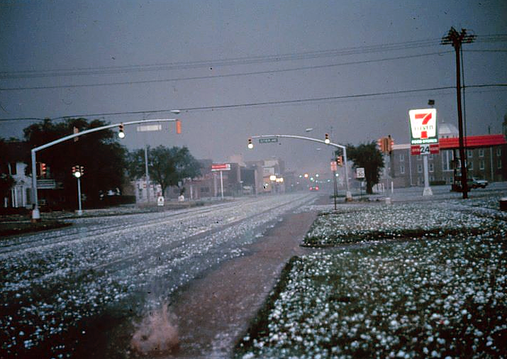
On June 13, 2012, a single, isolated supercell thunderstorm pummeled the Dallas-Fort Worth (DFW) metroplex with golfball-sized hail, ranging from 1.75 inches (4.4 cm) to a staggering 4.25 inches (10.8 cm) in diameter – some exceeding the size of softballs. This event, classified as a PDS (Particularly Destructive Storm) by the National Weather Service (NWS), caused widespread devastation, with estimated costs reaching $900 million. This white paper delves into the meteorological setup, the extent of the damage, and the community’s response and recovery efforts.

2. Meteorological Conditions

An analysis by the NWS Fort Worth office revealed the following key factors:

  • High CAPE (Cape Accumulation of Potential Energy): The atmosphere held a significant amount of potential energy (CAPE) exceeding 3,000 J/kg, which fueled the storm’s intensity.
  • Strong Vertical Wind Shear: A strong change in wind speed and direction with increasing altitude created powerful updrafts within the storm, allowing hailstones to grow significantly.
  • Moist Mid-Levels: Abundant moisture present in the middle levels of the atmosphere provided ample water vapor for hailstone formation.

3. Extent of Damage

Data from various sources paints a grim picture:

  • Hailstone Size Distribution: According to insurance claim data, approximately 60% of the hail measured between 1.75-2.75 inches (4.4-7 cm), with 25% reaching 2.75-3.75 inches (7-9.5 cm), and the remaining 15% exceeding 3.75 inches (9.5 cm).
  • Property Damage: Over 150,000 residential and commercial property claims were filed, with an estimated 70,000 roofs punctured or destroyed.
  • Vehicle Damage: Insurance companies reported over 600,000 auto hail damage claims, with many vehicles deemed totaled.
  • Infrastructure Damage: Power outages affected over 200,000 residents, and numerous communication towers were damaged, disrupting phone and internet services.
  • Agricultural Damage: Over 50,000 acres of crops were destroyed, impacting local agriculture and raising food prices.

4. Economic Impact

The estimated economic cost of the storm was staggering:

  • $600 million: Property damage repairs and replacements.
  • $200 million: Vehicle repairs and replacements.
  • $50 million: Lost business revenue due to power outages and infrastructure disruptions.
  • $50 million: Infrastructure repair costs.
  • $100 million: Crop losses and agricultural impact.

These figures highlight the significant economic burden placed on individuals, businesses, and local governments.

5. Community Response and Recovery

The DFW community demonstrated remarkable resilience:

  • Emergency Response: Over 1,000 emergency responders worked tirelessly to ensure public safety, clear debris, and provide assistance to affected residents.
  • Volunteer Efforts: Thousands of volunteers emerged to help with cleanup efforts, organize donation drives, and provide emotional support.
  • Government Assistance: Local, state, and federal governments declared disaster zones, offering financial assistance to individuals and businesses for repairs.
  • Building Code Review: Building code revisions were initiated, focusing on strengthening roof structures and improving hail resistance for new construction.

Predict Now – The Ultimate Weather Forecasting App for Enthusiasts

As the creator of Predict Now, I wanted an app that fit the needs of meteorologists, storm chasers, and weather enthusiasts who are passionate about forecasting severe weather. Predict Now is the result of thousands of hours of research, development, and conversations with people who forecast weather.

One of the standout features of Predict Now is its detailed radar maps. I have ensured that the app provides a comprehensive view of radar activity across the entire United States, enabling users to easily track storms and precipitation. Whether you’re monitoring a local thunderstorm or following the path of a hurricane, Predict Now’s radar maps will keep you informed and ahead of the game with updates every 2 minutes.

In addition to radar, I have incorporated a powerful front tracking feature in Predict Now. This allows users to visualize the movement of warm fronts, cold fronts, and other weather systems, providing valuable insights into upcoming changes in the weather pattern. By staying informed about frontal movements, users can make more accurate predictions and better prepare for potential severe weather events.

I am particularly proud of the integration of the Storm Prediction Center’s mesoanalysis tool in Predict Now. This feature grants users access to a wealth of data and visualizations, offering insights into current weather conditions and severe weather potential. Users can explore various indices like CAPE, wind shear, and more, empowering them to make well-informed forecasts and assess the likelihood of severe weather outbreaks.

Predict Now also includes a comprehensive surface observations feature, displaying detailed METARs from numerous locations across different regions, including the infamous Tornado Alley. This allows users to access real-time weather updates and monitor conditions on the ground, which is crucial for storm chasers and those in areas prone to severe weather. There are thousands of surface observations available in Predict Now.

To provide users with the most advanced satellite imagery available, I have integrated data from the cutting-edge GOES-16 satellite into Predict Now. This offers high-resolution visuals of water vapor, infrared, and visible satellite data, giving users a comprehensive understanding of atmospheric conditions. The GOES-16 imagery is a game-changer for weather enthusiasts, enabling them to analyze and predict weather patterns with unprecedented accuracy.

Predict Now also leverages the power of the High-Resolution Rapid Refresh (HRRR) model, which is particularly useful for tracking rapidly changing weather events. The HRRR provides short-term, high-resolution forecasts, allowing users to stay on top of evolving weather situations. Additionally, the app includes other weather models like the NAM and NSSL WRF, offering users a variety of forecasting perspectives to enhance their understanding and prediction capabilities.

I have designed Predict Now with the specific goal of aiding individuals interested in monitoring and preparing for severe weather events like tornadoes, hailstorms, hurricanes and flash floods. The app’s high-resolution data, sourced from advanced models and satellite imagery, ensures accurate and detailed weather visualization. Moreover, Predict Now is optimized for iPhone, providing a smooth and efficient user experience while minimizing data usage.

With its wide coverage spanning the United States and Southern Canada, Predict Now caters to a large user base, making it the go-to app for weather enthusiasts across the region.

I am confident that Predict Now will revolutionize the way you track, analyze, and forecast severe weather. Whether you’re a seasoned meteorologist, a passionate storm chaser, or simply someone who wants to stay informed about the weather, Predict Now is the ultimate tool to elevate your forecasting skills.

Download Predict Now today and join the community of weather enthusiasts who rely on this powerful app to stay one step ahead of the storm. I am committed to continuously improving and updating Predict Now based on user feedback, ensuring that it remains the leading choice for severe weather forecasting.