The Best Tornado Movies & Series

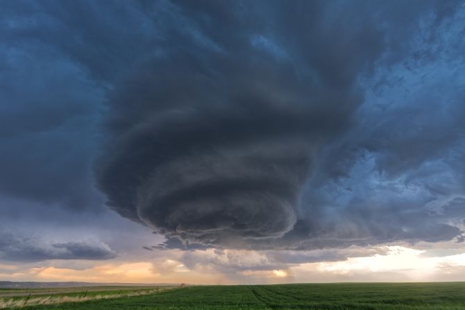
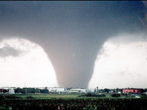
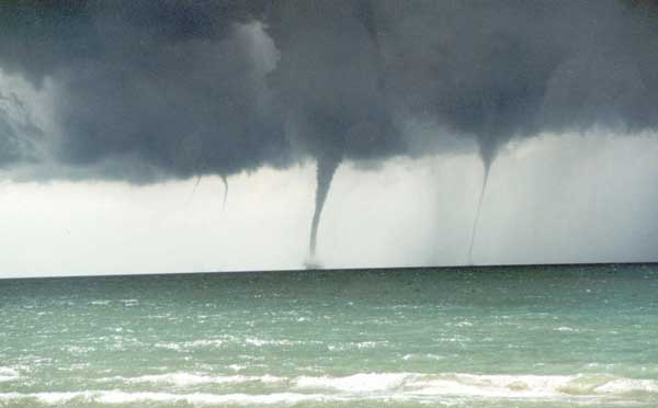
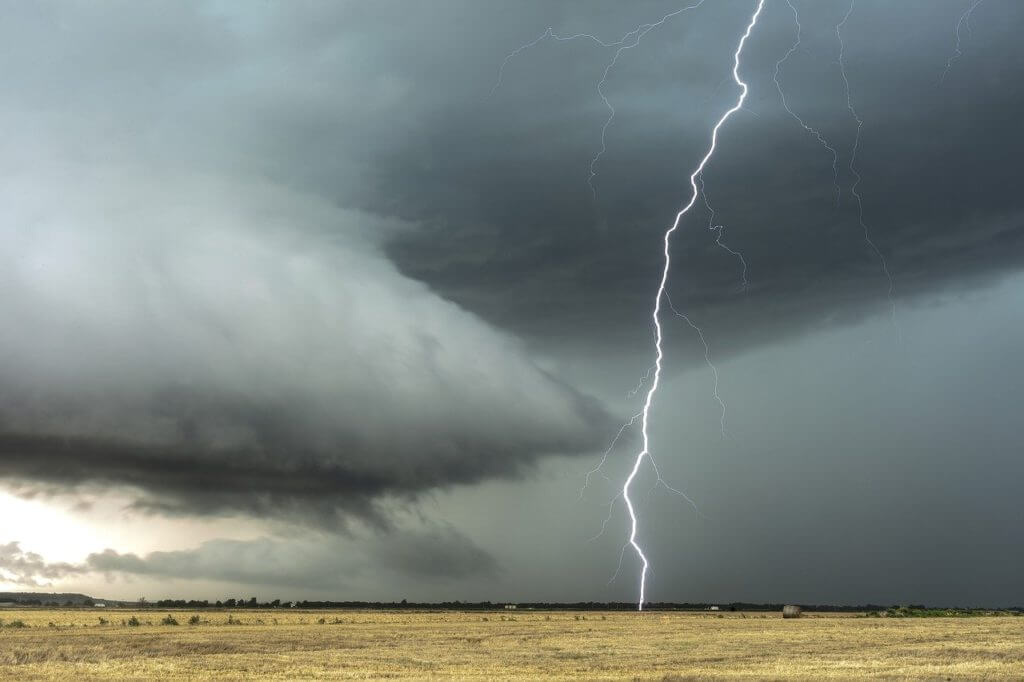
Storm chasing and tornado-themed movies and TV series have captivated audiences for decades, offering a thrilling glimpse into the world of extreme weather and the brave individuals who pursue it. These productions often blend scientific accuracy with dramatic storytelling, creating compelling narratives that keep viewers on the edge of their seats. In this article, we’ll explore some of the best storm chasing and tornado movies and TV series that have left a lasting impact on the genre.

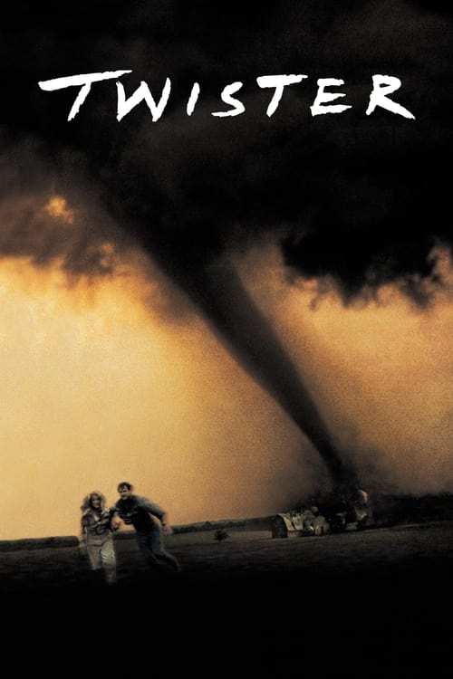
1.”Twister” (1996) – Directed by Jan de Bont and starring Helen Hunt and Bill Paxton, “Twister” is arguably the most iconic storm chasing movie of all time. The film follows a group of storm chasers as they pursue a series of powerful tornadoes across Oklahoma, all while navigating personal relationships and the challenges of their dangerous profession. “Twister” features groundbreaking special effects for its time, and its depiction of storm chasing has inspired countless aspiring meteorologists and storm chasers.

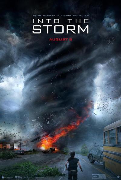
    2. “Into the Storm” (2014) – This found-footage style movie follows a group of storm chasers and a high school documentary crew as they encounter a series of devastating tornadoes in the town of Silverton, Oklahoma. “Into the Storm” showcases impressive visual effects and intense action sequences, immersing viewers in the heart of the storm. While the film takes some creative liberties with its portrayal of tornadoes, it still manages to capture the awe-inspiring power and destructive potential of these natural phenomena.

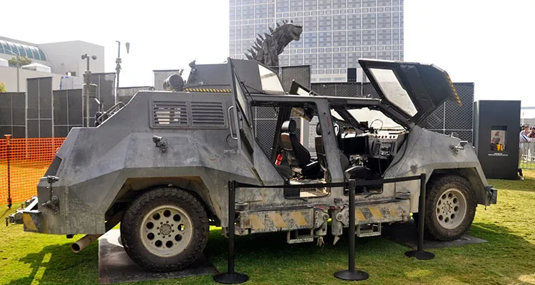
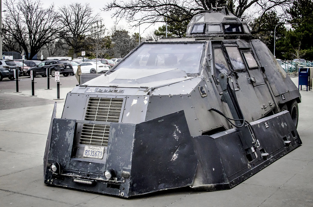
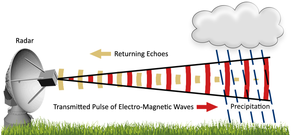
    3. “Storm Chasers” (2007-2012) – This Discovery Channel documentary series follows several teams of storm chasers as they pursue tornadoes across the United States. “Storm Chasers” offers a realistic and educational look at the science behind severe weather, as well as the challenges and risks faced by those who study it. The series features renowned storm chasers such as Reed Timmer, Tim Samaras, and Sean Casey, and their cutting-edge research vehicles, including the TIV (Tornado Intercept Vehicle) and the SRV (Dominator).

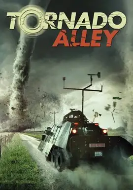
    4. “Tornado Alley” (2011) – Directed by Sean Casey, “Tornado Alley” is a documentary film that chronicles the adventures of storm chasers as they attempt to capture footage of tornadoes using the TIV. The film features stunning footage of tornadoes and severe weather, as well as insights into the lives and motivations of storm chasers. “Tornado Alley” also explores the science behind tornadoes and the importance of research in improving our understanding and prediction of these powerful storms.

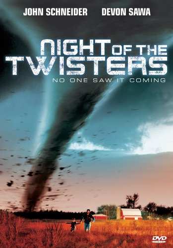
    5. “Night of the Twisters” (1996) – Based on the novel by Ivy Ruckman, “Night of the Twisters” is a made-for-TV movie that tells the story of a family’s struggle to survive a devastating tornado outbreak in Nebraska. “Night of the Twisters” also explores the psychological impact of severe weather events on individuals and communities.

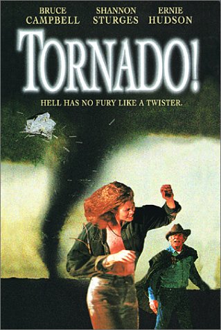
    6. “Tornado!” (1996) – Another made-for-TV movie, “Tornado!” follows a storm chaser and a meteorologist as they attempt to warn a small Texas town of an impending tornado. The film features impressive special effects for its time and offers a suspenseful look at the challenges of predicting and responding to severe weather events.

    7. “Storm Riders” (2015) – This short-lived TV series follows a group of storm chasers as they pursue tornadoes across the United States. “Storm Riders” offers a behind-the-scenes look at the lives of storm chasers, including the challenges they face both in the field and in their personal lives. The series features stunning footage of tornadoes and severe weather, as well as insights into the science and technology used to study these phenomena.

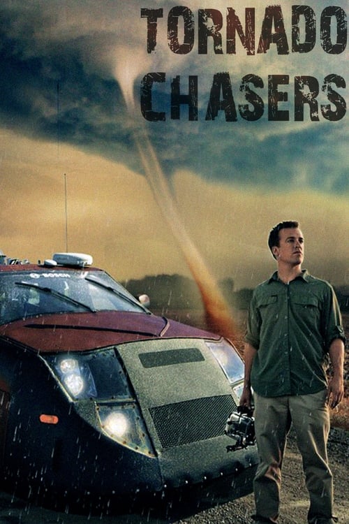
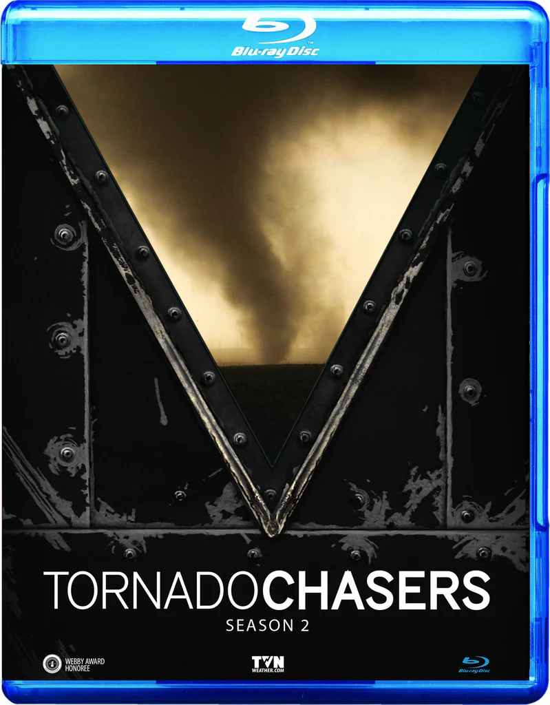
    8. “Tornado Chasers” (2012) – This National Geographic documentary follows a team of researchers and storm chasers led by meteorologist Reed Timmer as they attempt to collect data from inside a tornado using their custom-built armored vehicle, the Dominator 2. The documentary offers a fascinating look at the cutting-edge technology and innovative strategies used by storm chasers to study these powerful storms up close.

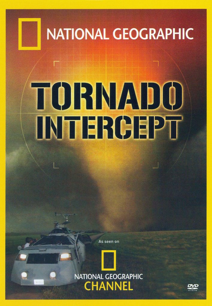
    9. “Tornado Intercept” (2005) – Produced by the Discovery Channel, “Tornado Intercept” is a thrilling documentary that follows a team of storm chasers as they pursue tornadoes across the Great Plains. The film features stunning footage of tornadoes and severe weather, as well as insights into the science behind these phenomena and the challenges faced by those who study them.

    10. “The Tornado Chasers” (2013) – This BBC documentary series follows a group of storm chasers and meteorologists as they attempt to unravel the mysteries of tornadoes and improve our ability to predict and respond to these devastating storms. “The Tornado Chasers” offers a global perspective on storm chasing.

    Classics:

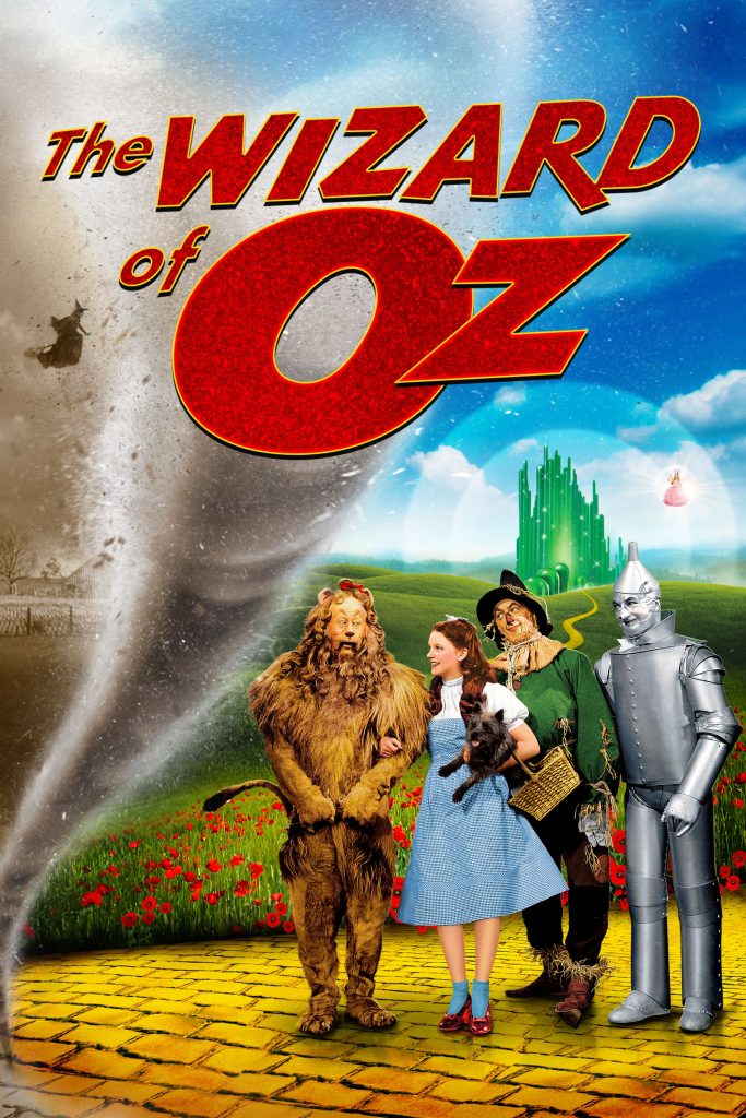
    1.”The Wizard of Oz” (1939) – This iconic film features one of the most memorable tornado scenes in cinema history. The movie follows Dorothy Gale as she is transported to the magical land of Oz by a powerful tornado. The tornado scene, with its impressive special effects for the time, has become a classic moment in film history and has inspired countless references and parodies in popular culture.

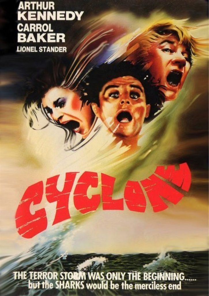
      2. “Cyclone” (1978) – This made-for-TV movie follows a group of people in a small Midwestern town as they struggle to survive a devastating tornado. “Cyclone” was one of the earliest films to focus specifically on tornadoes and their impact on communities. The movie features impressive special effects for its time and offers a suspenseful look at the challenges of predicting and responding to severe weather events.

      Building the Ultimate Storm Chasing Vehicle: From Basic Upgrades to Extreme Modifications

      The thrill of witnessing nature’s raw power draws countless adventurers into the world of storm chasing. However, venturing into the heart of extreme weather requires more than just courage; it demands a reliable and well-equipped vehicle capable of navigating challenging terrain and keeping you safe. So, whether you’re a seasoned storm chaser or a passionate beginner, let’s explore how to transform your ordinary car into the ultimate storm chasing beast.

      Laying the Foundation:

      • Choosing the Right Vehicle: Opt for a sturdy and reliable 4×4 with high ground clearance. Trucks or SUVs with robust frames are ideal for handling rough roads and potential debris.
      • Essential Upgrades: Invest in all-terrain tires, a reinforced suspension system, and additional undercarriage protection to tackle challenging landscapes. Consider a winch for potential recovery situations.

      Staying Connected & Informed:

      • Communication is Key: Install a ham radio for long-range communication with other chasers and emergency services, especially in areas with limited cell service. A cell phone signal booster antenna can also be a valuable addition.
      • Real-Time Weather Updates: Mount a laptop with dedicated weather software for tracking storms and analyzing data. Ensure a stable internet connection through mobile hotspots or satellite internet options.
      • Navigation & Mapping: Utilize GPS navigation systems with offline maps and weather overlays. Consider ruggedized tablets or laptops for durability.

      Capturing the Storm:

      • Dashcams: Install front and rear dashcams to document your chase and capture any unexpected events. Look for models with high resolution and good low-light performance.
      • External Cameras: Mount weatherproof action cameras like GoPros on the exterior of your vehicle for capturing stunning footage from various angles. Explore 360-degree cameras for immersive perspectives.
      • Stabilization Matters: Invest in camera stabilization systems, such as gimbals, to ensure smooth and professional-looking footage even on bumpy roads.

      Safety & Protection:

      • Hail Protection: Equip your windshield and windows with hail shields or protective film to prevent damage from hailstorms. Consider temporary window coverings for additional protection.
      • Emergency Supplies: Pack a comprehensive emergency kit including first-aid supplies, tools, fire extinguishers, extra food and water, and blankets.

      Taking it to the Extreme:

      • Inspired by the TIV & Dominator: If you’re seeking the ultimate protection, explore armoring your vehicle with reinforced steel plating, similar to the Tornado Intercept Vehicle (TIV) and Dominator. This provides enhanced safety from flying debris and extreme winds.
      • Hydraulic Anchoring System: Take inspiration from the TIV and install a hydraulic anchoring system that lowers your vehicle’s center of gravity, reducing the risk of being lifted by a tornado.
      • Weather Instruments: Equip your vehicle with advanced weather instruments like anemometers, barometers, and lightning detectors for real-time data collection.

      Building your ultimate storm chasing vehicle is a journey of continuous improvement, adapting to new technologies and challenges. As you chase storms responsibly and document nature’s fury, remember to prioritize safety and respect the power of the elements.

      Advancing Severe Weather Detection: The Rise of Dual Polarization Radar in the US

      Weather radar has always been a cornerstone of meteorological observation and forecasting. Yet, traditional radar systems, while effective, were limited in their ability to decipher the complexities within storms, often leaving meteorologists with an incomplete picture. The advent of dual polarization radar technology marked a paradigm shift, ushering in an era of enhanced precision and understanding in severe weather detection and warnings.

      Understanding the Dual Pol Advantage:

      Traditional weather radars transmit and receive horizontally polarized waves, meaning the waves vibrate parallel to the ground. This provides information about the location and intensity of precipitation but lacks the ability to discern the size, shape, and variety of particles within a storm. Dual polarization technology builds upon this foundation by introducing a second dimension – vertical polarization. By transmitting and receiving both horizontally and vertically polarized waves, dual pol radar paints a more comprehensive picture of the storm environment.

      Transforming Tornado Detection:

      One of the most significant benefits of dual pol technology lies in its ability to enhance tornado detection and warnings. Traditional radar could identify areas of rotation within a storm, suggestive of a possible tornado. However, confirming the presence of a tornado often relied on visual sightings or the detection of debris lofted into the air, both of which could be unreliable or delayed.

      Dual pol radar brought a game-changing advantage: the ability to detect debris fields associated with tornadoes. When a tornado is on the ground, it lifts a variety of objects – from tree limbs and building materials to vehicles and even larger structures. These objects scatter radar waves differently than raindrops or hailstones, creating a distinct signature that dual pol radar can identify. This capability allows meteorologists to confirm the presence of a tornado with greater confidence and issue more timely and accurate warnings, potentially saving lives.

      Sharper Images, Clearer Insights:

      Beyond debris detection, dual pol technology enhances the overall resolution and clarity of radar data. By analyzing the way horizontally and vertically polarized waves interact with precipitation particles, meteorologists can estimate the size and shape of raindrops, hailstones, and snowflakes. This information provides valuable insights into the intensity of precipitation, the potential for flooding, and the type of winter weather expected.

      A Nationwide Upgrade: The Dual Pol Rollout:

      Recognizing the transformative potential of dual polarization technology, the National Weather Service (NWS) embarked on an ambitious endeavor to upgrade its entire network of radars across the United States. The rollout, initiated in 2010 and completed in 2013, involved retrofitting existing radars with dual pol capabilities, ensuring comprehensive coverage for the nation.

      This nationwide upgrade has yielded substantial improvements in severe weather detection and warnings. Studies have shown a significant increase in lead times for tornado warnings and a reduction in false alarms, underscoring the life-saving potential of this technology.

      Beyond Tornadoes: A Multifaceted Tool:

      While the impact of dual pol radar on tornado warnings has been profound, its benefits extend far beyond this realm. The technology has proven invaluable for:

      • Improved Rainfall Estimates: By providing more accurate measurements of rainfall amounts, dual pol data enhances flash flood warnings and supports better water resource management.
      • Winter Weather Monitoring: The ability to differentiate between various types of frozen precipitation, such as snow, sleet, and freezing rain, leads to more precise winter storm forecasts and improved road condition monitoring.
      • Aviation Safety: Dual pol radar aids in identifying hazardous weather phenomena for aviation, including icing conditions and turbulence, contributing to safer air travel.

      The Destructive Power of EF-5 Tornadoes: A Look at the Rarest and Most Devastating Twisters

      The rarity of EF-5 tornadoes can be attributed to the specific atmospheric conditions required for their formation. These conditions include a combination of strong wind shear, instability, and moisture. The presence of a strong, persistent updraft is also crucial in allowing the tornado to maintain its intensity and reach EF-5 status.

      Here are the last five EF-5 tornadoes recorded in the United States:

      1. Moore, Oklahoma (May 20, 2013): This devastating tornado tragically resulted in 24 fatalities and injured 210 people. The estimated population of Moore at the time was around 55,000.
      2. Joplin, Missouri (May 22, 2011): This catastrophic tornado caused immense destruction, claiming the lives of 158 people and injuring over 1,000. Joplin’s population was approximately 50,000 at the time.
      3. Parkersburg, Kansas (May 4, 2007): This powerful tornado resulted in significant damage and tragically took the lives of 11 people. The estimated population of Parkersburg was around 1,400.
      4. Greensburgh, Kansas (May 4, 2007): On the same day as the Parkersburg tornado, Greensburg was struck by another devastating EF5. The town was almost completely destroyed, with 11 fatalities reported. Greensburg’s population was approximately 1,500.
      5. Bridge Creek-Moore, Oklahoma (May 3, 1999): This intense tornado, part of a larger outbreak, caused widespread damage and resulted in 36 fatalities. The combined population of Bridge Creek and Moore was around 41,000 at the time.

      The El Reno tornado is an example of a tornado exhibiting higher wind speeds than those indicated by the damage-based Enhanced Fujita (EF) Scale rating. In fact, there have been several instances where mobile Doppler radar or close-range dual-polarization (dual-pol) radar data have suggested wind speeds exceeding the EF Scale rating.

      For example, the Chickasha, Oklahoma tornado of May 24, 2011, was rated as an EF-4 based on damage surveys. However, mobile Doppler radar data indicated wind speeds of up to 288 mph (463 km/h), which would have classified it as an EF-5. Similarly, the Tipton, Oklahoma tornado of May 16, 2015, was rated as an EF-3, but mobile radar data suggested wind speeds of up to 247 mph (398 km/h), putting it in the EF-5 range.

      These discrepancies between damage-based ratings and radar-measured wind speeds highlight the limitations of the current EF Scale and the need for a more comprehensive approach to tornado intensity classification. By incorporating mobile and close-range dual-pol radar data, scientists and meteorologists could gain a more accurate understanding of a tornado’s true intensity and potential for damage.

      It is worth noting that the Enhanced Fujita (EF) Scale, introduced in 2007, is an updated version of the original Fujita (F) Scale, which was developed by Dr. Theodore Fujita in 1971. The original F Scale was based on the damage caused by tornadoes to structures and vegetation, with ratings ranging from F0 to F5. However, the F Scale had some limitations, such as its subjective nature and the fact that it did not account for differences in building construction and materials.

      The EF Scale was developed to address these limitations and provide a more consistent and objective approach to tornado intensity classification. The EF Scale still uses damage surveys as the primary basis for ratings, but it also takes into account the quality of construction and the types of materials used in structures. Additionally, the wind speed ranges for each EF rating were adjusted based on the latest scientific understanding of the relationship between wind speeds and damage.

      Despite these improvements, the EF Scale still relies heavily on post-event damage surveys, which can be affected by factors such as the availability of damage indicators and the experience of the survey team. Incorporating mobile and close-range dual-pol radar data into the EF Scale could help to overcome these limitations and provide a more comprehensive and accurate assessment of tornado intensity.

      The impact of EF-5 tornadoes on communities is devastating, with long-lasting effects on infrastructure, economy, and the lives of those affected. The high death tolls associated with these tornadoes can be attributed to the extreme wind speeds, the amount of debris generated, and the difficulty in providing adequate warning and shelter.

      Advancements in tornado forecasting and warning systems have helped to reduce the loss of life from EF-5 tornadoes in recent years. However, the destructive power of these rare twisters remains a significant threat to life and property. Continued research into the formation and behavior of EF-5 tornadoes is crucial in improving our understanding and ability to mitigate their impact on communities.

      Unraveling the Secrets of Severe Weather: The Supercell Composite Parameter and Its Vital Role in Forecasting

      In the world of meteorology, forecasting severe weather events is a complex and challenging task. To help predict the likelihood of severe thunderstorms and tornadoes, meteorologists rely on various tools and indices. One such tool is the Supercell Composite Parameter (SCP), a powerful indicator that combines multiple atmospheric variables to assess the potential for supercell thunderstorm development. In this article, we will dive deep into the Supercell Composite Parameter, exploring its components, its significance in severe weather forecasting, and how it helps protect lives and property.

      Understanding Supercell Thunderstorms: Before delving into the Supercell Composite Parameter, it’s essential to understand what supercell thunderstorms are and why they are so dangerous. Supercell thunderstorms are highly organized, rotating storms that can produce severe weather hazards such as large hail, damaging winds, and tornadoes. These storms are characterized by a persistent rotating updraft called a mesocyclone, which allows them to maintain their intensity for extended periods. Supercell thunderstorms are responsible for some of the most destructive and deadly severe weather events in history, making their accurate prediction a top priority for meteorologists.

      The Components of the Supercell Composite Parameter: The Supercell Composite Parameter is a mathematical formula that combines several key atmospheric variables to assess the potential for supercell thunderstorm development. The main components of the SCP are:

      1. Convective Available Potential Energy (CAPE): CAPE is a measure of the atmospheric instability, representing the amount of energy available for thunderstorm development. Higher CAPE values indicate a greater potential for strong updrafts and severe weather.
      2. Storm-Relative Helicity (SRH): SRH is a measure of the wind shear in the lower atmosphere, which is crucial for the formation of rotating updrafts in supercell thunderstorms. Higher SRH values suggest a greater likelihood of mesocyclone development and tornado potential.
      3. Bulk Wind Difference (BWD): BWD represents the change in wind speed and direction with height, another important factor in supercell development. Strong wind shear, as indicated by high BWD values, helps to create an environment conducive to supercell formation.
      4. Lifting Condensation Level (LCL): The LCL is the height at which air becomes saturated and condensation begins, leading to cloud formation. Lower LCL heights are associated with a greater potential for tornadoes, as they allow for a more concentrated and intense rotation near the ground.

      The SCP formula combines these variables in a specific way to create a single value that represents the overall potential for supercell thunderstorm development. Higher SCP values indicate a greater risk of severe weather, particularly supercell thunderstorms and tornadoes.

      The Significance of the Supercell Composite Parameter in Severe Weather Forecasting: The Supercell Composite Parameter is a crucial tool for meteorologists in their efforts to predict and warn the public about severe weather events. By analyzing SCP values, forecasters can identify areas where the atmospheric conditions are most favorable for supercell thunderstorm development. This information allows them to issue timely and accurate severe weather watches and warnings, giving people in affected areas the opportunity to take necessary precautions and seek shelter.

      One of the key advantages of the SCP is its ability to provide a comprehensive assessment of the severe weather potential. By combining multiple atmospheric variables into a single value, the SCP offers a more holistic view of the overall risk, rather than relying on individual factors alone. This approach helps to reduce the likelihood of false alarms or missed events, improving the overall accuracy and reliability of severe weather forecasts.

      Real-World Applications and Success Stories: The Supercell Composite Parameter has proven its value in numerous real-world severe weather events. Meteorologists have successfully used the SCP to anticipate and warn the public about impending supercell thunderstorms and tornadoes, saving countless lives and minimizing property damage.

      For example, during the devastating tornado outbreak of April 27, 2011, which affected multiple states in the southeastern United States, the SCP played a crucial role in the forecasting process. Meteorologists recognized the extremely high SCP values across the region, indicating an exceptionally high risk of violent, long-track tornadoes. This information allowed forecasters to issue strongly worded warnings and urge people to take immediate action to protect themselves. While the outbreak still resulted in significant damage and loss of life, the accurate and timely warnings based on the SCP undoubtedly saved many lives.

      Similarly, during the May 20, 2013, tornado outbreak in central Oklahoma, the SCP once again demonstrated its value. Forecasters identified the high SCP values in the region, suggesting a significant risk of strong to violent tornadoes. The warnings issued based on this information allowed people to seek shelter and prepare for the impending severe weather. The accurate forecasting and timely warnings were credited with saving numerous lives, even as the powerful tornadoes caused extensive damage.

      Limitations and Ongoing Research: While the Supercell Composite Parameter is a valuable tool in severe weather forecasting, it is not without its limitations. The SCP is designed specifically to assess the potential for supercell thunderstorm development and does not account for other types of severe weather, such as non-supercell tornadoes or severe wind events. Additionally, the SCP is based on atmospheric conditions at a specific time and location and may not capture the full evolution of a severe weather event over time.

      To address these limitations and further improve severe weather forecasting, ongoing research is focused on refining the SCP and developing new tools and techniques. Meteorologists and atmospheric scientists are working to incorporate additional variables, such as high-resolution radar data and machine learning algorithms, to enhance the accuracy and lead time of severe weather predictions.

      One area of active research is the development of probabilistic forecasting methods that provide a range of possible outcomes based on the uncertainty in the atmospheric conditions. By presenting severe weather forecasts in terms of probabilities, meteorologists can better communicate the level of risk to the public and support more informed decision-making.

      Reed Timmer: The Story of an Extreme Storm Chaser

      Reed Timmer: The life of a storm chaser

      Reed Timmer is a renowned meteorologist and extreme storm chaser who has dedicated his life to studying and documenting severe weather events. Born on March 17, 1980, in Grand Rapids, Michigan, Timmer developed a fascination with weather at a young age. He pursued his passion by earning a B.S. in Meteorology from the University of Oklahoma in 2002 and later obtained his Ph.D. in Meteorology from the same institution in 2015.

      Timmer’s storm chasing career began in 1999 when he joined the University of Oklahoma’s storm chasing team. He quickly gained notoriety for his fearless approach to intercepting tornadoes and hurricanes, often placing himself in harm’s way to gather valuable data and capture stunning footage.

      Timmer’s research focuses on collecting valuable data from within the heart of severe storms using state-of-the-art instruments, such as mobile tornado probes. By gathering this data, he has helped improve tornado forecasting and warning systems, ultimately saving lives and property. His innovative approach to storm chasing led him to design and build a series of armored vehicles called “Dominators,” which allow him and his team to safely navigate through the most intense weather conditions.

      In addition to his scientific contributions, Timmer has played a significant role in educating the public about severe weather and storm safety. He has been featured in numerous television shows and documentaries, including “Storm Chasers” on the Discovery Channel and “Extreme Weather” on National Geographic. These appearances have helped raise awareness about the dangers of severe weather and the importance of being prepared.

      Timmer’s commitment to education extends beyond the media. He frequently gives presentations at schools, universities, and community events, sharing his knowledge and experiences with audiences of all ages. His engaging and informative talks inspire future generations of meteorologists and emphasize the critical role that storm safety plays in protecting communities.

      Beyond his research and educational efforts, Timmer has also ventured into entrepreneurship. He founded TVN Weather, a company that provides live severe weather video content to media outlets, allowing viewers to witness the power and beauty of extreme weather events from the safety of their homes. Additionally, he established SRV Dominator, which offers storm chasing tours and experiences to the public, giving individuals a unique opportunity to learn about severe weather firsthand.

      In 2008, Timmer became a featured meteorologist on the Discovery Channel’s reality television series “Storm Chasers.” The show followed Timmer and his team as they pursued severe weather events across the United States. During his time on the show, Timmer showcased his expertise and innovative storm chasing techniques, including the use of armored vehicles like the “Dominator” to safely navigate through dangerous conditions.

      Throughout his career, Timmer has witnessed and documented over 1,000 tornadoes and numerous hurricanes, including Hurricane Katrina in 2005 and Hurricane Harvey in 2017. His up-close footage of these powerful storms has provided valuable insights for the scientific community and has helped raise public awareness about the dangers of severe weather.

      In addition to his storm chasing endeavors, Timmer is also an accomplished researcher. His doctoral thesis focused on the study of tornadoes and their environments using high-resolution radar data. Timmer’s research has contributed to a better understanding of tornado formation and has the potential to improve tornado warning systems.

      As an educator, Timmer has taught meteorology courses at the University of Oklahoma and has been a guest lecturer at numerous universities and conferences worldwide. He is also the author of the book “Into the Storm: Violent Tornadoes, Killer Hurricanes, and Death-Defying Adventures in Extreme Weather,” which chronicles his experiences as a storm chaser and meteorologist.

      Reed Timmer’s dedication to studying and documenting severe weather events has made him one of the most respected and well-known figures in the field of meteorology. His work has not only advanced our understanding of these powerful natural phenomena but has also helped to save lives by providing valuable information to the public and emergency management officials.

      20 Game-Changing Weather Apps You Can’t Afford to Miss

      In today’s world, being prepared for changing weather conditions is crucial. Fortunately, there are numerous weather apps available that can help you stay informed and safe. Here are 20 game-changing weather apps you can’t afford to miss:

      Dark Sky
      This app is known for its accurate hyperlocal forecasts and beautiful radar maps. It provides down-to-the-minute updates and alerts for precipitation, temperature, and severe weather events, making it a reliable choice for staying on top of changing weather conditions.

      Hail No
      Defend yourself from hailstorms with Hail No, the first hail app to provide real-time tracking and alert notifications. See where the hail is, create a defensive radius around any location, and get automatic alerts. Hail No provides access to the National Severe Storms Laboratory hail algorithm, the most accurate available,
      ensuring you’re always aware of potential hail threats.
      Apple: https://apps.apple.com/us/app/hail-no/id1469253867

      WeatherBug
      WeatherBug is a comprehensive weather app that offers real-time weather data, radar maps, and severe weather alerts. It also includes features like pollen and air quality forecasts, making it a great choice for those with allergies or respiratory issues. Stay informed about changing weather conditions and potential health impacts with WeatherBug.

      Tornado Vision
      See severe weather with augmented reality! Tornado Vision can help you see tornadoes hiding in the rain or at night. Simply point your phone at any severe storm, and you’ll get a heads-up display on what is happening inside the storm. This groundbreaking weather technology provides information on the chance of a tornado, hail size, wind speed, and more, right on your screen.
      iOS: https://apps.apple.com/us/app/tornado-vision/id1469550036
      Android: https://play.google.com/store/apps/details?id=com.tornadovision.app.presentation&hl=en&gl=US&pli=1

      RadarScope
      Designed for weather enthusiasts and professionals, RadarScope is a powerful radar app that provides high-resolution radar data, storm tracking, and advanced analysis tools. Dive deep into weather data and gain a comprehensive understanding of weather patterns with this feature-rich app.

      Predict Now
      Predict Now is a powerful weather app that provides hyperlocal forecasts and real-time alerts for severe weather events. With its user-friendly interface and advanced features, you can stay ahead of the game and plan your activities accordingly, ensuring you’re always prepared for changing weather conditions.
      Apple: https://apps.apple.com/us/app/predict-now/id1481839520

      NOAA Weather Radar Live
      This free app provides access to real-time weather radar data from the National Oceanic and Atmospheric Administration (NOAA). Stay informed about severe weather events in your area with up-to-date radar information from a trusted source.

      Weather Underground
      Weather Underground is a comprehensive weather app that offers hyperlocal forecasts, radar maps, and severe weather alerts. It also includes a community feature that allows users to share weather observations and photos, creating a collaborative weather-tracking experience.

      AccuWeather
      AccuWeather is a popular weather app known for its accurate forecasts and user-friendly interface. It provides detailed weather information, including hourly and daily forecasts, radar maps, and severe weather alerts, ensuring you have all the information you need to plan your day.

      The Weather Channel
      The Weather Channel app is a reliable source for weather information, offering forecasts, radar maps, and severe weather alerts. It also includes features like hurricane tracking and ski resort conditions, making it a versatile choice for various weather-related activities.

      Clime: NOAA Weather Radar
      Clime: NOAA Weather Radar is a free app that provides access to real-time weather radar data from NOAA. Stay informed about severe weather events in your area with this simple yet effective app.

      MyRadar Weather Radar
      MyRadar Weather Radar is a powerful app that offers high-resolution radar data, severe weather alerts, and customizable settings. Tailor the app to your specific needs and get a detailed view of weather conditions in your area.

      Windy
      Windy is a unique weather app that focuses on wind forecasts and patterns. It provides detailed wind maps, as well as forecasts for temperature, precipitation, and other weather conditions, making it an excellent choice for outdoor enthusiasts and those interested in wind-related activities.

      Weather Mate
      Weather Mate is a comprehensive weather app that offers hyperlocal forecasts, radar maps, and severe weather alerts. It also includes features like air quality and pollen forecasts, making it a great choice for those with allergies or respiratory issues. Stay informed about weather conditions and potential health impacts with this all-in-one app.

      Carrot Weather
      Carrot Weather is a unique weather app that combines accurate forecasts with a quirky and humorous personality. It provides detailed weather information, including hourly and daily forecasts, radar maps, and severe weather alerts, all delivered with a touch of humor to make weather tracking more enjoyable.

      Storm Radar
      Storm Radar is a powerful app that provides real-time radar data, severe weather alerts, and storm tracking capabilities. Stay informed about severe weather events in your area and track storms with this comprehensive app.

      Weather Live
      Weather Live is a comprehensive weather app that offers hyperlocal forecasts, radar maps, and severe weather alerts. It also includes features like air quality and pollen forecasts, making it a great choice for those with allergies or respiratory issues. Stay informed about weather conditions and potential health impacts with this versatile app.

      Flowx
      Flowx is a unique weather app that focuses on visualizing weather patterns and forecasts. It provides detailed weather information, including wind patterns, precipitation, and temperature, in a visually stunning format, making it an excellent choice for those who appreciate beautiful data visualization.

      Weather Maps
      Weather Maps is a powerful app that provides detailed weather maps and forecasts for various weather conditions, including precipitation, temperature, wind, and more. Get a comprehensive view of weather patterns with this data-rich app.

      Weather Radar by ICM
      Weather Radar by ICM is a free app that provides access to real-time weather radar data from various sources, including NOAA and Environment Canada. Stay informed about severe weather events in your area with this simple yet effective app.

      Understanding the EF (Enhanced Fujita Scale) Used For Tornadoes

      The Enhanced Fujita (EF) Scale is a system used to classify the strength of tornadoes based on the damage they cause to structures and vegetation. Developed in 2007 as an update to the original Fujita Scale, the EF Scale provides a more precise and comprehensive method for assessing tornado intensity.
      The EF Scale consists of six categories, ranging from EF0 to EF5, with EF0 being the weakest and EF5 being the strongest. Each category is defined by specific wind speed ranges and the corresponding damage expected at those wind speeds.


      EF0 (65-85 mph): These tornadoes cause light damage, such as broken tree branches, shallow rooted trees being toppled, and minor damage to chimneys or sign boards


      EF1 (86-110 mph): Moderate damage occurs, including roof surfaces being peeled off, mobile homes being pushed off foundations or overturned, and exterior doors and windows being damaged.


      EF2 (111-135 mph): Considerable damage is observed, with roofs torn off well-constructed houses, mobile homes completely destroyed, large trees snapped or uprooted, and light objects becoming projectiles.


      EF3 (136-165 mph): Severe damage happens, including entire stories of well-constructed houses being destroyed, trains overturned, and forests being heavily damaged.


      EF4 (166-200 mph): Devastating damage takes place, with well-constructed houses being leveled, structures with weak foundations blown away, and cars thrown.


      EF5 (>200 mph): Incredible damage occurs, with strong frame houses being lifted off foundations and carried considerable distances, automobile-sized missiles flying through the air, and trees being debarked.

      Storm Chasing in Canada: Tracking Nature’s Fury

      Canada, known for its diverse landscapes and vast expanses, is also home to a unique meteorological phenomenon – severe thunderstorms and tornadoes. While storm chasing is more commonly associated with the United States, particularly in the infamous “Tornado Alley,” Canada experiences its fair share of severe weather events, attracting both professional meteorologists and amateur storm chasers.

      Meteorology Behind Canadian Storm Chasing The formation of severe thunderstorms and tornadoes in Canada is primarily influenced by the collision of contrasting air masses. During the summer months, warm, moist air from the Gulf of Mexico and the United States Great Plains often clashes with cooler, drier air from the Arctic. This collision creates instability in the atmosphere, leading to the development of powerful supercell thunderstorms.

      Additionally, Canada’s unique topography plays a role in storm formation. The prairies, with their flat, open landscapes, allow for uninterrupted wind flow and the creation of strong updrafts necessary for tornado development. The presence of the Rocky Mountains to the west also contributes to the formation of severe weather, as the mountains can help channel and intensify storm systems.

      Prime Storm Chasing Locations in Canada

      1. Southern Ontario: This region, particularly the area extending from Windsor to Toronto, experiences the highest frequency of tornadoes in Canada. The proximity to the Great Lakes and the convergence of air masses make this area a hotspot for severe weather.
      2. Alberta: Known as “Hailstorm Alley,” central and southern Alberta often experience severe thunderstorms capable of producing large hail, damaging winds, and occasional tornadoes. Cities like Calgary and Red Deer are prime locations for storm chasers.
      3. Saskatchewan: The southern portions of Saskatchewan, especially along the border with the United States, are prone to severe thunderstorms and tornadoes. The flat, open prairies provide an ideal environment for storm development.
      4. Manitoba: Similar to Saskatchewan, southern Manitoba experiences severe weather due to its location and topography. The Red River Valley, in particular, is a corridor for intense storm systems.

      Tornado Statistics by Province According to Environment and Climate Change Canada, the average number of reported tornadoes per year in each province is as follows:

      1. Ontario: 12-18
      2. Alberta: 10-15
      3. Saskatchewan: 8-12
      4. Manitoba: 6-10
      5. Quebec: 4-8
      6. New Brunswick: 1-2
      7. British Columbia: 0-1
      8. Nova Scotia: 0-1
      9. Prince Edward Island: 0-1
      10. Newfoundland and Labrador: 0-1

      It is important to note that these numbers are based on reported tornadoes and may not reflect the actual occurrence, as some tornadoes in remote areas may go undetected.

      Storm chasing in Canada is a thrilling and scientifically valuable pursuit, but it also comes with inherent risks. Chasers must be well-prepared, equipped with proper safety gear, and knowledgeable about severe weather dynamics. It is crucial to respect the power of nature and prioritize personal safety above all else.

      As climate change continues to influence weather patterns worldwide, studying severe weather events in Canada becomes increasingly important.

      Top 5 Weather Events in Canada

      Edmonton Tornado (July 31, 1987)
      Also known as “Black Friday,” this devastating F4 tornado struck eastern Edmonton, Alberta, causing 27 fatalities, injuring over 300 people, and resulting in an estimated $330 million in damages (adjusted for inflation). It remains the deadliest tornado in Canadian history and one of the most destructive in terms of property damage.


      Pine Lake Tornado (July 14, 2000)
      An F3 tornado touched down near Pine Lake, a popular camping area in central Alberta, claiming 12 lives and injuring over 100 people. The tornado caused widespread damage to the Green Acres Campground, destroying numerous trailers and vehicles. It is the second-deadliest tornado in Canadian history.


      Windsor – Tecumseh, Ontario Tornado (June 17, 1946)
      This powerful F4 tornado struck the towns of Windsor and Tecumseh in southwestern Ontario, causing 17 fatalities and over 200 injuries. It remains the third-deadliest tornado in Canadian history and caused significant damage to residential areas and infrastructure.


      Calgary Hailstorm (June 13, 2020)
      A severe thunderstorm produced large hail over Calgary, Alberta, causing an estimated $1.2 billion in insured damages, making it the fourth-costliest natural disaster in Canadian history. The hailstorm damaged numerous homes, vehicles, and buildings across the city.


      Southern Ontario Derecho (May 21, 2022)
      A powerful derecho, a widespread and long-lived windstorm associated with a line of severe thunderstorms, swept across southern Ontario, causing significant damage and power outages. The storm resulted in 10 fatalities and affected major cities such as Toronto, Ottawa, and London. Wind gusts exceeding 120 km/h were recorded, and the event is considered one of the most impactful derechos in Canadian history.

      Well-known Storm Chasers in Canada:

      Mark Robinson: A meteorologist and storm chaser based in Ontario, Robinson is the founder of The Weather Network’s “Storm Hunters” team. He has been chasing storms across Canada and the United States for over two decades.


      Greg Johnson: Known as “Tornado Hunter,” Johnson is a Saskatchewan-based storm chaser and photographer who has been documenting severe weather events for more than 20 years. His work has been featured in numerous publications and documentaries.


      Justin Hobson: A storm chaser and photographer based in Alberta, Hobson is known for his stunning images of severe weather events across the Canadian Prairies.

      Weather Radar Network and Forecast Models:
      Environment and Climate Change Canada (ECCC) operates the Canadian weather radar network, which consists of 31 Doppler radars across the country. These radars provide real-time data on precipitation intensity, wind velocity, and storm structure, aiding in the detection and tracking of severe weather events.
      ECCC also utilizes several forecast models to predict weather patterns and severe weather potential:

      Global Environmental Multiscale (GEM) Model: This is the primary forecast model used by ECCC, providing short-range and medium-range weather forecasts for Canada and the world.
      High Resolution Deterministic Prediction System (HRDPS): A high-resolution model that provides detailed short-range forecasts for specific regions in Canada, focusing on severe weather events.
      Canadian Precipitation Analysis (CaPA): A system that combines radar, satellite, and surface observations to provide a comprehensive analysis of precipitation across Canada.

      Links:

      Environment and Climate Change Canada Weather Radar: https://weather.gc.ca/radar/index_e.html
      Canadian Centre for Meteorological and Environmental Prediction: https://weather.gc.ca/ensemble/index_e.html
      The Weather Network Storm Hunters: https://www.theweathernetwork.com/ca/news/storm-hunters
      Greg Johnson Tornado Hunter: https://tornadohunter.com/
      Justin Hobson Photography: https://justinhobson.ca/