The El Reno Tornado: A Colossus on the Oklahoma Plains – May 31, 2013

The late afternoon of May 31, 2013, witnessed the birth of a meteorological monster on the open plains west of Oklahoma City – the El Reno tornado. This colossal twister, eventually reaching a staggering 2.6 miles wide, etched its name in history as the widest tornado ever recorded. Its immense size and erratic behavior posed a significant challenge for storm chasers and researchers, ultimately claiming the lives of three experienced storm chasers who were caught in its unpredictable path.
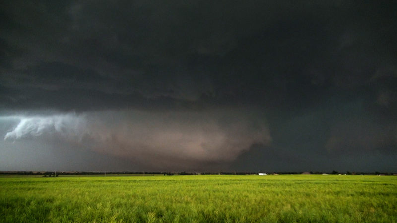
The day began with a heightened sense of awareness among meteorologists and storm chasers. The Storm Prediction Center had issued a high-risk warning for severe weather, highlighting the potential for strong, long-track tornadoes across central Oklahoma. As the afternoon progressed, supercell thunderstorms began to develop, their towering structures visible from miles away. Among these storms, one particular supercell exhibited ominous signs of rotation and quickly became the focus of attention.

At approximately 6:03 pm, the El Reno tornado touched down, initially as a relatively narrow funnel. However, it rapidly intensified and expanded, growing wider and wider as it churned across the open landscape. The tornado’s erratic movements and multiple vortices made it difficult to track and predict, posing a significant danger to those in its path.

Caught in the Colossus: Stories of Impact and Loss

The El Reno tornado’s unpredictable nature and immense size had a profound impact on those who encountered it, including experienced storm chasers and researchers who dedicated their lives to understanding these powerful storms.

  • TWISTEX Team: The TWISTEX (Tactical Weather Instrumented Sampling in/near Tornadoes Experiment) team, a group of researchers studying tornadoes, was caught in the path of the El Reno tornado. Their vehicle was tossed by the tornado’s winds, resulting in injuries to several team members and tragically claiming the life of renowned storm chaser Tim Samaras, his son Paul Samaras, and fellow chaser Carl Young.
  • Other Storm Chasers: Several other storm chasers had close encounters with the El Reno tornado, capturing dramatic footage of the twister’s immense size and erratic movements. Many experienced the dangers of chasing such a large and unpredictable tornado firsthand, highlighting the risks associated with this activity.
  • Record-Breaking Width: At its peak, the El Reno tornado reached a staggering width of 2.6 miles, making it the widest tornado ever recorded. This immense size is attributed to the presence of multiple vortices within the parent circulation, effectively creating a massive wedge tornado with a broad damage path. The sheer width of the tornado made it difficult to perceive its full extent from the ground, leading to challenges in tracking and warning for its path.
  • Fluctuating Intensity: The El Reno tornado exhibited rapid fluctuations in intensity, ranging from EF3 to EF5 on the Enhanced Fujita scale. This variation in strength is a characteristic of many large tornadoes and is influenced by the complex dynamics of the storm’s updraft and the inflow of air feeding the tornado. The tornado’s multiple vortices also likely contributed to its fluctuating intensity, as each subvortex could possess varying degrees of strength.
  • Damage Indicators: Despite its immense size and fluctuating intensity, the El Reno tornado’s damage path was primarily rated EF3. This is because the tornado traversed mostly rural areas with few structures to serve as damage indicators. However, the few structures that were impacted sustained significant damage, indicative of the tornado’s potential for greater destruction had it tracked through a more densely populated area.
  • Reed Timmer and the Dominator Team: Veteran storm chaser Reed Timmer and his Dominator team were in close proximity to the El Reno tornado, capturing dramatic footage of its rapid expansion and erratic movements. They experienced the tornado’s powerful winds firsthand as their armored vehicle, the Dominator, was buffeted and pushed off the road. Timmer described the experience as “the most intense moment of my storm chasing career,” highlighting the sheer power and danger of the El Reno tornado.
  • Mike Bettes and The Weather Channel Team: The Weather Channel team, led by meteorologist Mike Bettes, was also chasing the El Reno tornado. Their SUV was caught in one of the tornado’s subvortices and thrown 200 yards, resulting in injuries to the team members. Bettes later recounted the experience as a “life-changing event” that underscored the unpredictable nature of tornadoes and the importance of safety precautions when chasing storms.
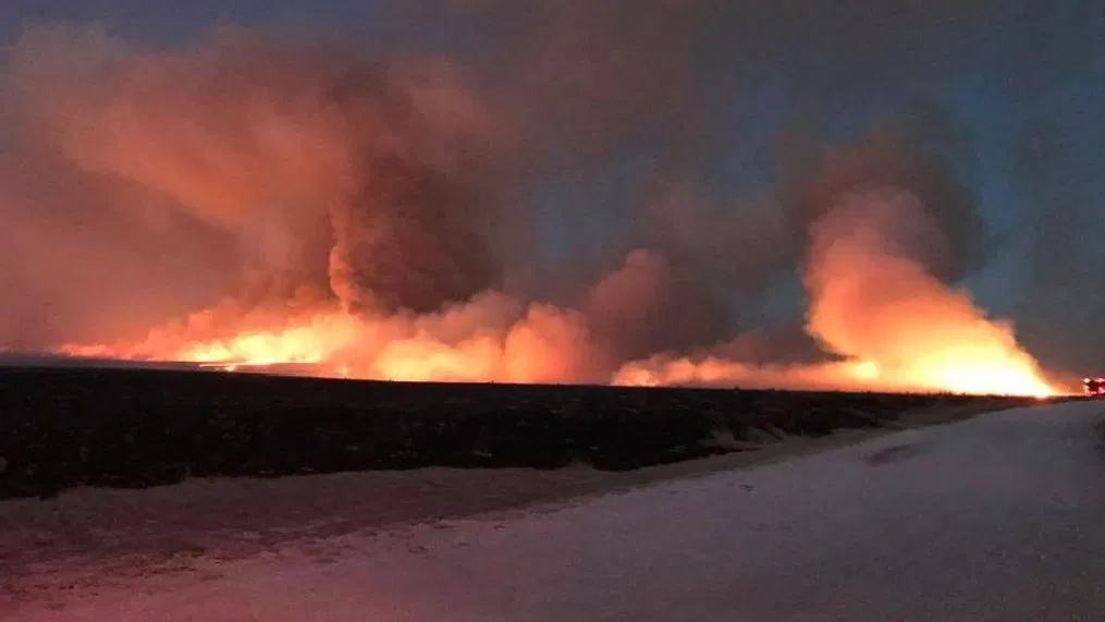
Wildfires Ravage the Texas Panhandle: A Destructive March Day – March 6, 2024

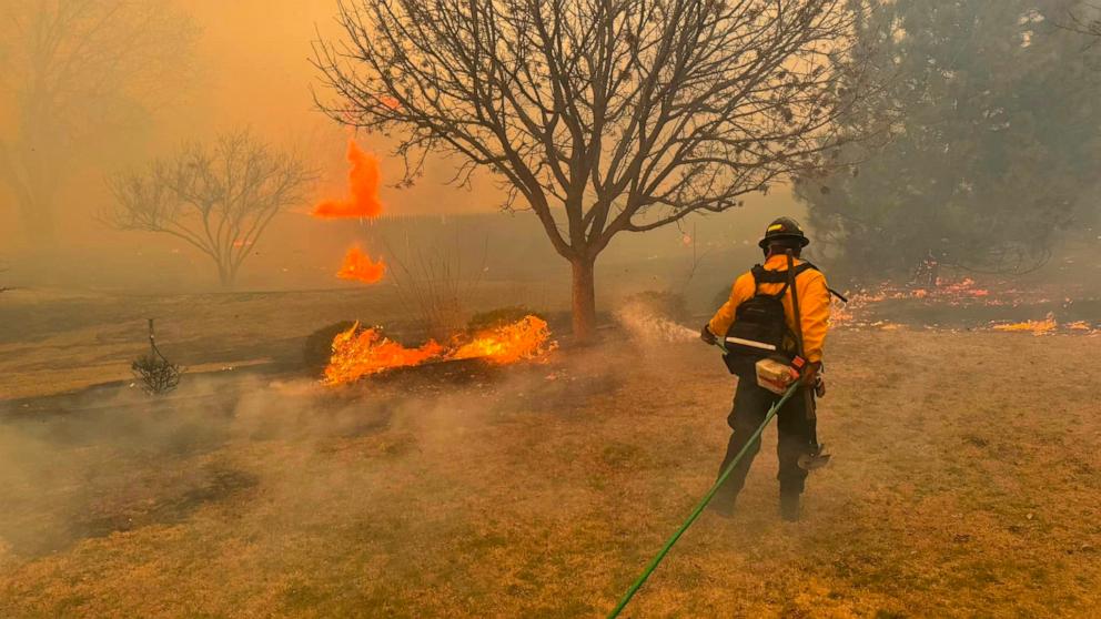
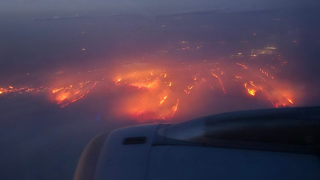
The devastating wildfires that swept across the Texas Panhandle on March 6, 2024, were not merely a result of chance; they were the culmination of a complex interplay of meteorological factors that created a tinderbox ready to ignite. Understanding these specific elements is crucial to grasping the severity and rapid spread of the fires.

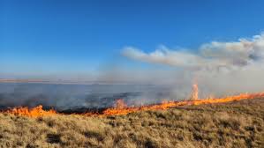
  • Critically Dry Conditions: The winter months leading up to March 2024 were exceptionally dry across the Texas Panhandle. Rainfall deficits accumulated, leaving the vegetation parched and highly susceptible to burning. The dry fuels, primarily consisting of grasses and shrubs, provided ample fuel for the fires to spread rapidly.
  • Dryline Dynamics: On March 6th, a dryline, a boundary separating moist air from dry air, pushed eastward across the Panhandle. This dryline passage resulted in a sharp decrease in humidity levels, creating an environment conducive to fire ignition and spread. The dry air mass also contributed to increased wind speeds, further exacerbating fire behavior.
  • Wind as the Driving Force: Strong winds played a crucial role in the rapid spread of the wildfires. Sustained wind speeds of 50 mph with gusts exceeding 70 mph were observed across the region. These winds fanned the flames, carrying embers long distances and igniting new spot fires ahead of the main fire front. The wind direction also influenced the fire’s movement, pushing it across the landscape and threatening communities in its path.
  • Atmospheric Instability: The combination of dry air, strong winds, and daytime heating created an unstable atmosphere. This instability enhanced the development of fire-induced convective columns, essentially updrafts of hot air and smoke that can reach thousands of feet into the atmosphere. These convective columns can generate their own weather, including strong winds and lightning, further contributing to the fire’s erratic behavior and spread.
  • Limited Moisture Relief: While there were some isolated rain showers in the region on March 6th, they were insufficient to provide any meaningful moisture relief. The rain was quickly evaporated by the dry air and strong winds, leaving the dry fuels readily available for combustion.

The confluence of these specific meteorological factors created a perfect storm for wildfire development and rapid spread in the Texas Panhandle. The dry fuels, low humidity, strong winds, atmospheric instability, and lack of moisture relief all contributed to the severity of the wildfires, making them a significant challenge for firefighters and emergency responders.

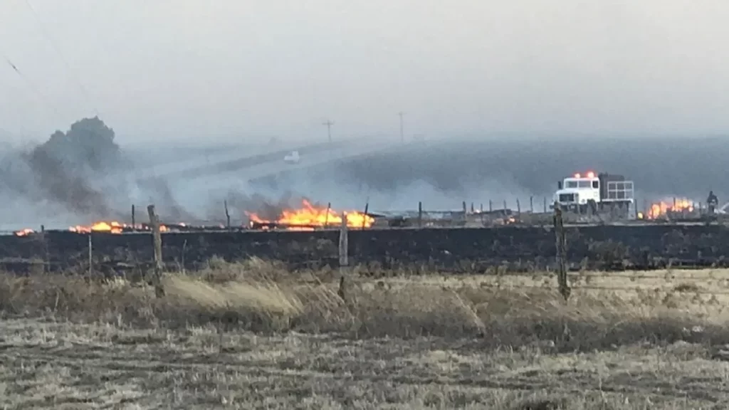
  • Over 800,000 acres burned: The wildfires consumed an area exceeding 800,000 acres, an expanse larger than the state of Rhode Island. The Perryton Fire, the largest of the blazes, alone accounted for over 315,000 acres. This makes it one of the largest wildfire events in Texas history, highlighting the severity and scale of the disaster.
  • Structures engulfed in flames: While the exact number of structures destroyed remains under assessment, initial estimates suggest that hundreds of homes, barns, outbuildings, and other structures were lost to the fires. In Gray County alone, 70 homes were confirmed destroyed, displacing families and leaving them with the daunting task of rebuilding their lives.
  • Livestock losses in the thousands: The wildfires inflicted a heavy toll on the region’s ranching community. Thousands of cattle perished in the flames, representing a significant financial loss for ranchers and a disruption to the agricultural industry. The loss of grazing land further compounded the challenges faced by ranchers, as they struggled to find ways to sustain their remaining herds.
  • Air quality plummets: The thick smoke plumes generated by the wildfires blanketed the region, leading to hazardous air quality conditions. Particulate matter levels soared, posing respiratory risks to residents, particularly those with pre-existing conditions. Schools and businesses were forced to close, and outdoor activities were restricted due to the poor air quality.
  • Ecological impact: A long road to recovery: The wildfires not only destroyed homes and property but also left a lasting impact on the region’s ecosystem. Native vegetation was decimated, wildlife habitats were disrupted, and the risk of soil erosion increased. The recovery of these ecosystems will take years, if not decades, and requires careful management and restoration efforts.

Specific Examples of the Devastation:

  • Perryton Fire: The largest of the wildfires, scorching over 315,000 acres and destroying numerous homes and structures in and around the town of Perryton.
  • Gray County Fires: Multiple fires burned across Gray County, resulting in the destruction of at least 70 homes and extensive damage to ranchland.
  • Swisher County Fires: The fires in Swisher County impacted a significant area, causing damage to agricultural operations and rural properties.

The Joplin Tornado: A Monster Tears Through the Heart of America – May 22, 2011

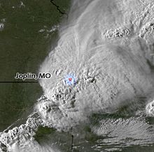
The afternoon of May 22, 2011, etched itself into the annals of American history as a monstrous EF5 tornado, the highest rating on the Enhanced Fujita scale, ripped through the city of Joplin, Missouri. This catastrophic event left a trail of devastation, claiming 158 lives and injuring over 1,000 people. The tornado, with winds exceeding 200 mph, carved a path of destruction a mile wide and 13 miles long, reducing homes to splinters, tossing cars like toys, and leaving the landscape scarred beyond recognition.

The day began with a sense of foreboding. The Storm Prediction Center had issued a high-risk warning for severe weather, highlighting the potential for strong, long-track tornadoes across the Midwest. As the afternoon progressed, supercell thunderstorms began to develop, their towering structures visible from miles away. At approximately 5:41 pm, the devastating tornado touched down on the western edge of Joplin, near the intersection of 20th Street and Schifferdecker Avenue.

The tornado rapidly intensified as it moved eastward, growing in size and strength. It tore through residential areas, commercial districts, and St. John’s Regional Medical Center, leaving a path of unimaginable destruction in its wake. The hospital, a beacon of hope and healing, suffered a direct hit, its windows shattered, roof ripped off, and interior ravaged by the ferocious winds.

  • Homes Obliterated: Approximately 7,500 homes were damaged or destroyed, leaving nearly a third of the city’s residents displaced. Entire neighborhoods were flattened, with houses reduced to piles of debris. Personal belongings were scattered for miles, a poignant reminder of the lives disrupted and the memories lost.
  • Businesses Battered: The tornado’s path included the city’s main commercial district, leaving countless businesses in ruins. The Joplin Plaza Shopping Center and the nearby Walmart Supercenter were severely damaged, their structures mangled beyond recognition. Smaller businesses, the lifeblood of the local economy, also suffered immensely, facing the daunting challenge of rebuilding and recovering.
  • Schools Shattered: Joplin High School, a symbol of community pride and academic excellence, was directly in the tornado’s path. The building suffered extensive damage, with entire sections of the roof torn off and walls caved in. Several other schools, including elementary and middle schools, also sustained significant damage, disrupting the education of thousands of students.
  • Landmark Losses: The iconic St. John’s Regional Medical Center, a cornerstone of the community’s healthcare system, was severely impacted. The tornado ripped through the building, shattering windows, collapsing walls, and compromising the structural integrity of the entire facility. The hospital was rendered inoperable, forcing the evacuation and relocation of patients and staff.
  • Infrastructure Incapacitated: The tornado’s impact extended beyond buildings and homes, crippling essential infrastructure. Power lines were downed, leaving thousands without electricity for days and weeks. Communication systems were disrupted, making it difficult for residents to connect with loved ones and emergency services. The city’s water supply and sewage systems were also damaged, posing public health concerns.
  • Trees Toppled and Debris Everywhere: The landscape of Joplin was dramatically altered, with thousands of trees uprooted and stripped bare. The debris from destroyed buildings, vehicles, and personal belongings was scattered across the city, creating a scene of utter devastation. The sheer volume of debris posed a significant challenge for recovery efforts, requiring a massive cleanup operation.

The meteorological factors that contributed to the Joplin tornado were complex and multifaceted. A strong low-pressure system over the Great Plains provided the necessary lift for thunderstorm development. Abundant moisture streaming north from the Gulf of Mexico fueled the storms, while a strong jet stream aloft provided the wind shear needed for rotation. These ingredients, combined with the unstable atmosphere, created the perfect environment for the development of supercell thunderstorms and the potential for violent tornadoes.

The specific dynamics of the Joplin tornado were particularly noteworthy. The storm exhibited a phenomenon known as a “hook echo” on radar, a telltale sign of a rotating thunderstorm capable of producing a tornado. Additionally, the storm’s updraft, the column of rising air that feeds the thunderstorm, was exceptionally strong, allowing the tornado to maintain its intensity and longevity.

As the tornado moved through Joplin, it displayed characteristics of multiple vortices, smaller tornadoes rotating within the larger parent circulation. This phenomenon, known as a multi-vortex tornado, contributes to the extreme damage often observed with EF5 tornadoes.

  • Total Estimated Damage: $2.8 billion
  • Residential Losses:
    • 7,500 homes damaged or destroyed
    • Insurance claims for residential property exceeding $2 billion
  • Commercial Losses:
    • 500+ businesses impacted
    • Estimated $500 million in commercial property damage
    • Significant job losses due to business closures
  • Public Infrastructure Damage:
    • $150 million in damage to public infrastructure (including schools, hospitals, government buildings)
    • Extensive damage to roads, bridges, and utilities
  • Debris Removal:
    • Over 4 million cubic yards of debris generated
    • Estimated $150 million in debris removal costs
  • Recovery and Rebuilding:
    • Long-term reconstruction costs exceeding $1 billion
    • Ongoing expenses related to community redevelopment and economic revitalization

Hurricane Ian’s Destructive Path: A Florida Peninsula Battered (September 28, 2022)

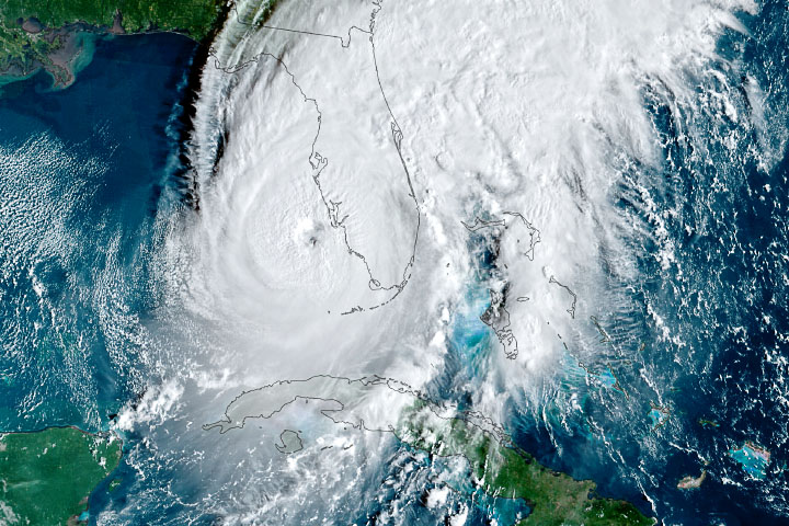
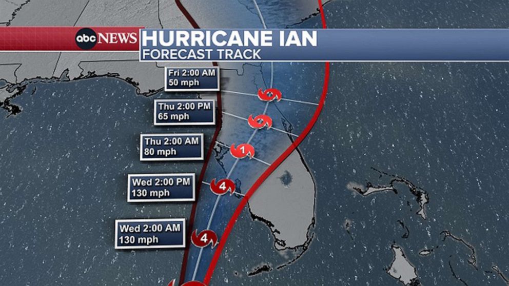
On September 28, 2022, Hurricane Ian, a Category 4 monster with sustained winds of 150 mph, etched its name into the annals of Florida’s hurricane history. The storm, which had undergone rapid intensification in the warm waters of the Gulf of Mexico, made landfall near Cayo Costa, an island off the coast of Fort Myers, bringing with it a catastrophic storm surge, torrential rains, and winds capable of pulverizing structures. Ian’s impact was far-reaching, leaving a trail of destruction across the Florida peninsula and impacting millions of residents.

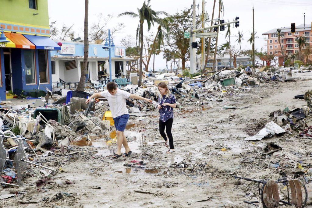
Fort Myers Beach, a popular tourist destination known for its white-sand beaches and vibrant atmosphere, bore the brunt of Ian’s fury. The storm surge, a wall of water reaching heights of 12-18 feet, inundated the island, sweeping away homes, businesses, and landmarks. Videos and images captured the devastation, showing buildings ripped from their foundations and debris floating amidst a sea of churning water. The storm surge’s impact extended inland, flooding communities along the Caloosahatchee River and causing widespread damage.

As Ian moved across the Florida peninsula, it weakened but continued to unleash its destructive power. Heavy rains, exceeding 20 inches in some areas, triggered widespread flooding, transforming streets into rivers and inundating homes. Orlando, a city typically associated with theme parks and sunshine, experienced record rainfall and significant flooding, disrupting daily life and causing extensive damage. The storm’s winds, though diminished, remained strong enough to down trees and power lines, leaving millions without electricity.

The morning of September 27, 2022, dawned with a sense of foreboding for residents along Florida’s Gulf Coast. Hurricane Ian, having churned and intensified in the warm waters of the Gulf of Mexico, was now a Category 3 behemoth, its sights set on the Sunshine State. Mandatory evacuations were ordered for low-lying areas, and a mass exodus began as residents heeded the warnings, fleeing inland in search of safety. Those who remained, either by choice or circumstance, braced for the impending impact, boarding up windows, securing belongings, and seeking shelter in sturdy structures or local shelters.

As the hours ticked by, the storm’s outer bands began to lash the coast, bringing with them squalls of rain and increasingly strong winds. Fort Myers Beach, a vibrant tourist destination known for its white-sand beaches and lively atmosphere, transformed into a ghost town. Palm trees swayed violently, their fronds whipping in the wind, and the normally calm Gulf waters turned into a churning, angry sea. A sense of anxiety and uncertainty hung thick in the air as residents huddled indoors, listening to the howling wind and the relentless pounding of the rain.

By afternoon, Ian’s approach was undeniable. The sky turned an ominous gray, and the wind intensified, carrying with it the roar of the approaching storm. At approximately 3:05 pm, the moment residents had dreaded arrived. Hurricane Ian made landfall near Cayo Costa as a powerful Category 4 storm, its sustained winds of 150 mph capable of ripping buildings apart. The storm surge, a towering wall of water reaching heights of 12-18 feet, roared ashore, engulfing Fort Myers Beach and surrounding areas. Homes were lifted from their foundations and carried away by the raging waters, businesses crumbled into piles of debris, and landmarks that had stood for decades vanished beneath the waves.

The devastation on Fort Myers Beach was catastrophic. The once-idyllic island was transformed into a scene of utter destruction, a tangled mess of debris, destroyed buildings, and flooded streets. Rescue crews, braving the treacherous conditions, began the daunting task of searching for survivors and assessing the damage. Residents who had evacuated returned to find their homes gone, their belongings scattered, and their lives irrevocably changed.

As Ian moved across the Florida peninsula, it weakened but continued to unleash its fury. Heavy rains, exceeding 20 inches in some areas, triggered widespread flooding. In Orlando, a city known for theme parks and sunshine, streets became rivers, cars were submerged, and homes were inundated with water. The storm’s winds, though diminished, downed trees and power lines, leaving millions across the state without electricity and plunging communities into darkness.

The meteorological factors that contributed to Ian’s intensification were a combination of warm waters in the Gulf of Mexico, low wind shear, and a favorable atmospheric pattern. Sea surface temperatures in the Gulf were well above average, providing ample fuel for the storm’s growth. Additionally, wind shear, the change in wind speed and direction with height, which can disrupt hurricane development, was minimal. This allowed Ian to maintain its structure and strengthen rapidly. Finally, a steering pattern in the upper atmosphere guided Ian towards the Florida peninsula, setting the stage for a devastating landfall.

Ian’s impact extended beyond the immediate devastation of wind and water. The storm disrupted supply chains, leading to shortages of gasoline and other essential goods. The tourism industry, a vital part of Florida’s economy, suffered a significant blow, as hotels, attractions, and beaches were damaged or closed. The agricultural sector also experienced losses, with citrus groves and other crops impacted by the storm’s winds and flooding.

Meteorological Genesis and Escalation:

  • September 23, 2022: A tropical wave emerges off the coast of Africa, embarking on a journey across the Atlantic.
  • September 24-26, 2022: The tropical wave strengthens into a tropical depression and then Tropical Storm Ian, churning westward through the Caribbean Sea.
  • September 27, 2022: Ian undergoes rapid intensification, exploding into a major hurricane as it enters the Gulf of Mexico’s warm waters. Florida residents brace for impact as mandatory evacuations are issued for vulnerable coastal areas.

Landfall and the Unleashing of Fury:

  • September 28, 2022 (Morning): Hurricane Ian, now a monstrous Category 4 storm with sustained winds of 150 mph, takes aim at the Florida Gulf Coast. The atmosphere is thick with anticipation and dread as residents finalize preparations or evacuate inland.
  • September 28, 2022 (Afternoon): At approximately 3:05 pm, Ian makes landfall near Cayo Costa, an island off the coast of Fort Myers. The storm surge, a towering wall of water reaching heights of 12-18 feet, slams ashore, engulfing coastal communities and causing catastrophic damage. Fort Myers Beach is particularly hard hit, with homes swept away, businesses destroyed, and landmarks obliterated.

Unfolding Devastation and Inland Inundation:

  • September 28, 2022 (Evening): Ian continues its destructive path across the Florida peninsula, weakening but still packing a powerful punch. Heavy rains, exceeding 20 inches in some areas, trigger widespread flooding. Orlando and other inland cities experience record rainfall, transforming streets into rivers and inundating homes and businesses.
  • September 29, 2022: The storm weakens further as it moves across central Florida and emerges into the Atlantic Ocean. However, its impact continues to be felt, with widespread power outages, disrupted infrastructure, and ongoing flooding.

The Wake of Destruction and the Road to Recovery:

  • September 30 – October 2022: The full extent of the devastation becomes clear as floodwaters recede and search and rescue efforts transition to recovery operations. Communities across Florida face the daunting task of rebuilding homes, businesses, and infrastructure. The economic toll of the storm is staggering, with estimates exceeding $100 billion.

Hurricane Katrina: The Destruction of New Orleans

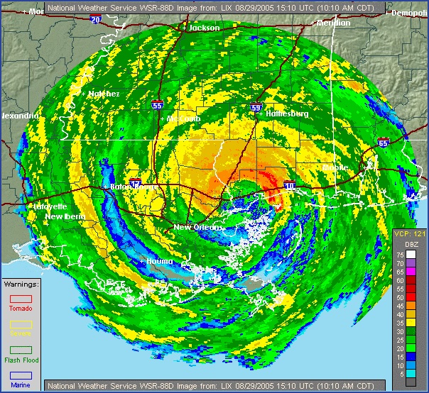
The date August 29, 2005, remains etched in the annals of American history, a day when Hurricane Katrina, a tempest of unimaginable fury, unleashed its wrath upon the Gulf Coast. New Orleans, a city celebrated for its vibrant culture, rich history, and unique spirit, found itself at the epicenter of the disaster. As Katrina’s winds howled and storm surge swelled, the city’s levee system, a supposed bulwark against the encroaching waters, failed catastrophically.

Meteorological Timeline:

  • August 23, 2005: A tropical depression forms over the Bahamas, later strengthening into Tropical Storm Katrina.
  • August 25, 2005: Katrina intensifies into a Category 1 hurricane and makes landfall in southern Florida, causing flooding and wind damage.
  • August 26-27, 2005: Katrina emerges into the Gulf of Mexico and undergoes rapid intensification, reaching Category 5 strength with sustained winds of 160 mph.
  • August 28, 2005: Katrina weakens slightly to a Category 3 hurricane but remains a formidable storm as it approaches the Gulf Coast.

Landfall and Immediate Aftermath:

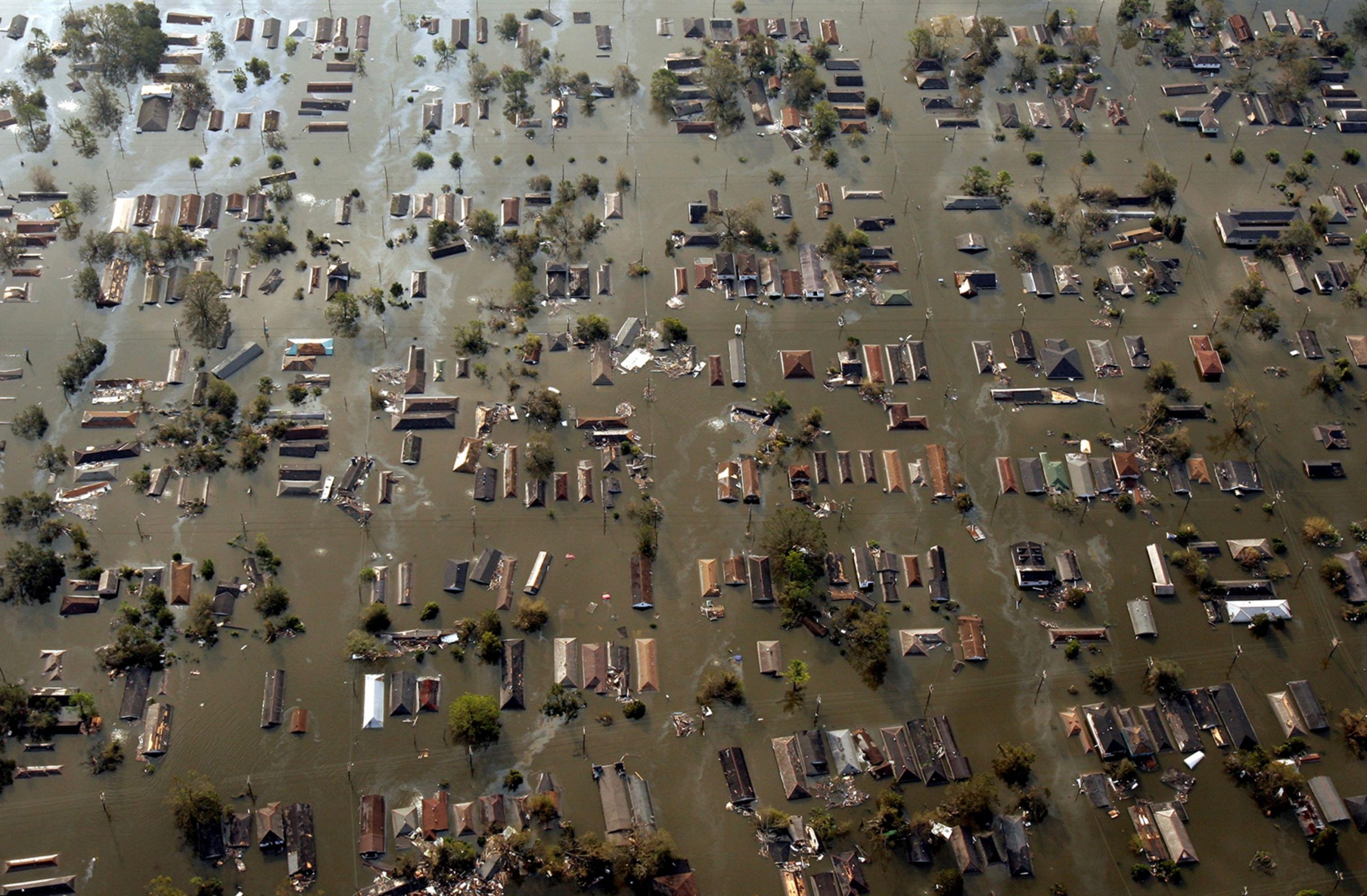
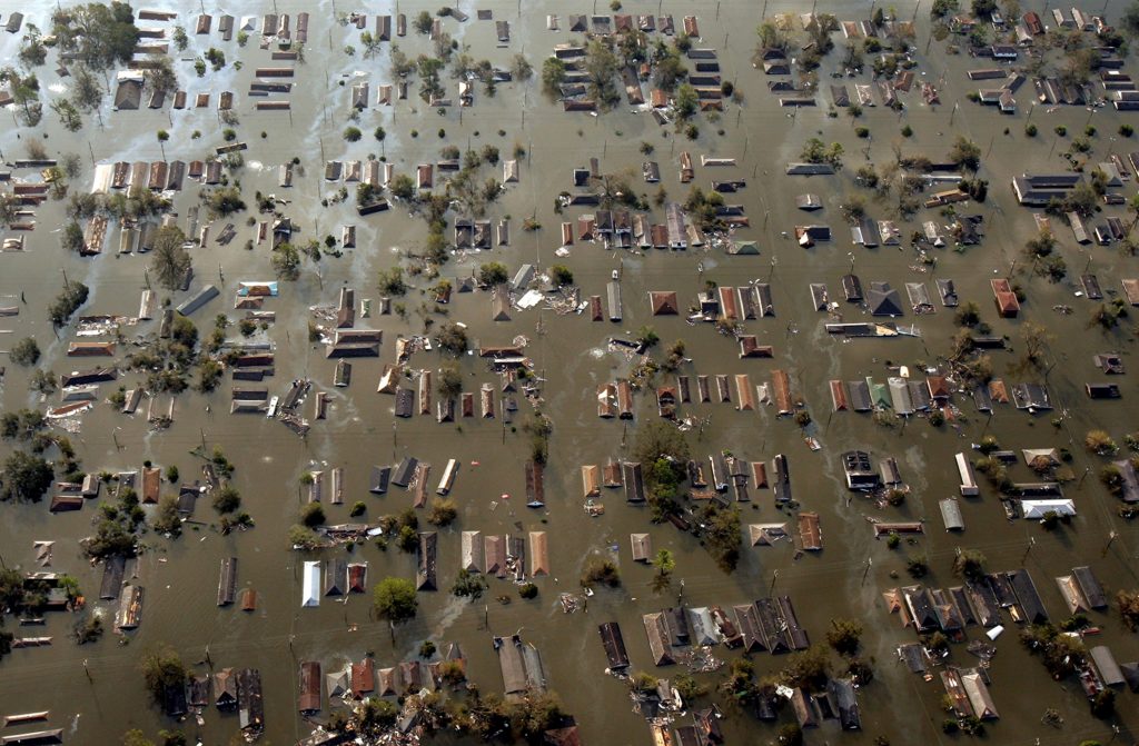
  • August 29, 2005: Hurricane Katrina makes landfall near Buras-Triumph, Louisiana, as a Category 3 hurricane with sustained winds of 125 mph. The storm surge, exceeding 20 feet in some areas, breaches levees in New Orleans, leading to catastrophic flooding.
  • August 29-30, 2005: Floodwaters inundate New Orleans, submerging entire neighborhoods and stranding residents. The Superdome, serving as a shelter, becomes overcrowded and conditions deteriorate. Rescue efforts begin, but the scale of the disaster overwhelms response capabilities.

Unfolding Disaster and Response Efforts:

  • August 31 – September 4, 2005: The magnitude of the disaster becomes increasingly apparent as floodwaters remain stagnant and rescue efforts continue. The Lower Ninth Ward and other low-lying areas of New Orleans remain submerged, with residents trapped and desperate for help. Criticism mounts over the slow and inadequate response from federal, state, and local authorities.
  • September 5-10, 2005: Floodwaters begin to recede slowly, revealing the extent of the devastation. Search and rescue efforts transition to recovery operations, as debris removal and damage assessments begin. The death toll rises, and the displacement of hundreds of thousands of residents creates a humanitarian crisis.

The consequences were immediate and devastating. Floodwaters surged through breaches in the levees, transforming streets into raging rivers and submerging entire neighborhoods. The iconic French Quarter, with its historic architecture and lively atmosphere, became an island amidst a sea of brown, polluted water. The Superdome, a massive stadium that had served as a shelter of last resort for thousands of evacuees, became a symbol of the city’s plight, its roof peeled back and its interior conditions deteriorating rapidly.

Across the city, tales of survival and heartbreak unfolded. Residents trapped in attics and on rooftops awaited rescue, desperate for any sign of help. Families were separated, loved ones lost, and homes destroyed. The Lower Ninth Ward, a predominantly African American neighborhood, suffered some of the worst flooding, its residents left stranded and forgotten for days. The stories that emerged from Katrina’s aftermath were a testament to the human spirit’s resilience in the face of unimaginable adversity.

Katrina’s impact extended far beyond New Orleans. Coastal communities across Mississippi, Alabama, and the Florida Panhandle were battered by the storm’s fury. In Biloxi, Mississippi, a once-thriving tourist destination, the storm surge swept away homes, businesses, and casinos, leaving behind a desolate landscape of debris and destruction. Gulfport, Mississippi, another coastal city, faced similar devastation, its harbor and waterfront areas obliterated by the storm’s power.

As Katrina moved inland, it weakened but continued to unleash torrential rains, leading to widespread flooding across the Southeast. Rivers and streams overflowed their banks, inundating homes and businesses and displacing thousands. The storm’s impact on infrastructure was equally devastating, with power outages affecting millions and transportation networks crippled. The economic toll of Katrina was staggering, estimated at over $100 billion, making it one of the costliest natural disasters in U.S. history.

The meteorological factors that contributed to Katrina’s formation and intensification were a perfect storm of conditions. Warm waters in the Gulf of Mexico provided ample fuel for the storm’s growth, while low wind shear allowed it to maintain its structure and strengthen rapidly. A high-pressure system over the southeastern United States steered Katrina on a direct path towards the Gulf Coast, giving residents little time to prepare for the impending disaster.

Katrina’s legacy is complex and multifaceted. The storm exposed deep-seated social and economic inequalities, as marginalized communities disproportionately bore the brunt of the disaster. The failure of the levee system in New Orleans raised questions about infrastructure investment and disaster preparedness, prompting a national conversation about the nation’s vulnerability to extreme weather events. The storm’s aftermath was marked by a slow and often chaotic response, leading to criticism of government agencies at all levels and calls for reform.

Hurricane Katrina serves as a stark reminder of the destructive power of nature and the importance of preparedness, infrastructure investment, and social equity in mitigating the impact of such catastrophic events. The storm’s legacy continues to shape policy and planning, as communities strive to build resilience and ensure that the lessons learned from Katrina are not forgotten. The stories of survival, loss, and community spirit that emerged from the storm’s aftermath continue to inspire and remind us of the indomitable human spirit in the face of adversity.

The Midwest Derecho: An Unforgettable Tempest’s Trail of Wind Destruction (August 10, 2020)

The date August 10, 2020, is etched in the memories of millions across the Midwest, a day when the skies unleashed a tempest of unimaginable fury. A derecho, a powerful and expansive windstorm, ripped through the heartland, leaving a trail of devastation that stretched from South Dakota to Ohio. This wasn’t just a storm; it was a meteorological monster, its ferocity exceeding expectations and its impact leaving communities reeling in its wake.

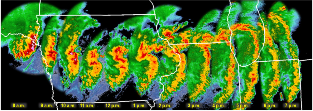
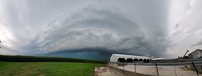
The storm’s genesis lay in the atmospheric instability brewing over South Dakota and Nebraska. Thunderstorms erupted, fueled by a potent mix of warm, moist air and strong upper-level winds. These storms, initially isolated, began to coalesce into a line, forming a squall line, a telltale sign of a developing derecho. This line of storms, propelled by the jet stream, raced eastward at speeds exceeding 70 mph, evolving into a meteorological juggernaut.

Iowa found itself directly in the derecho’s path, bearing the brunt of its wrath. Wind gusts of up to 140 mph, equivalent to a Category 4 hurricane, tore through cities and towns. Cedar Rapids, a city of over 130,000, was particularly devastated. The winds, relentless and unforgiving, peeled roofs off buildings, tossed vehicles like rag dolls, and uprooted centuries-old trees. The city’s landscape was transformed into a scene of utter chaos, with debris littering the streets and power lines dangling precariously.

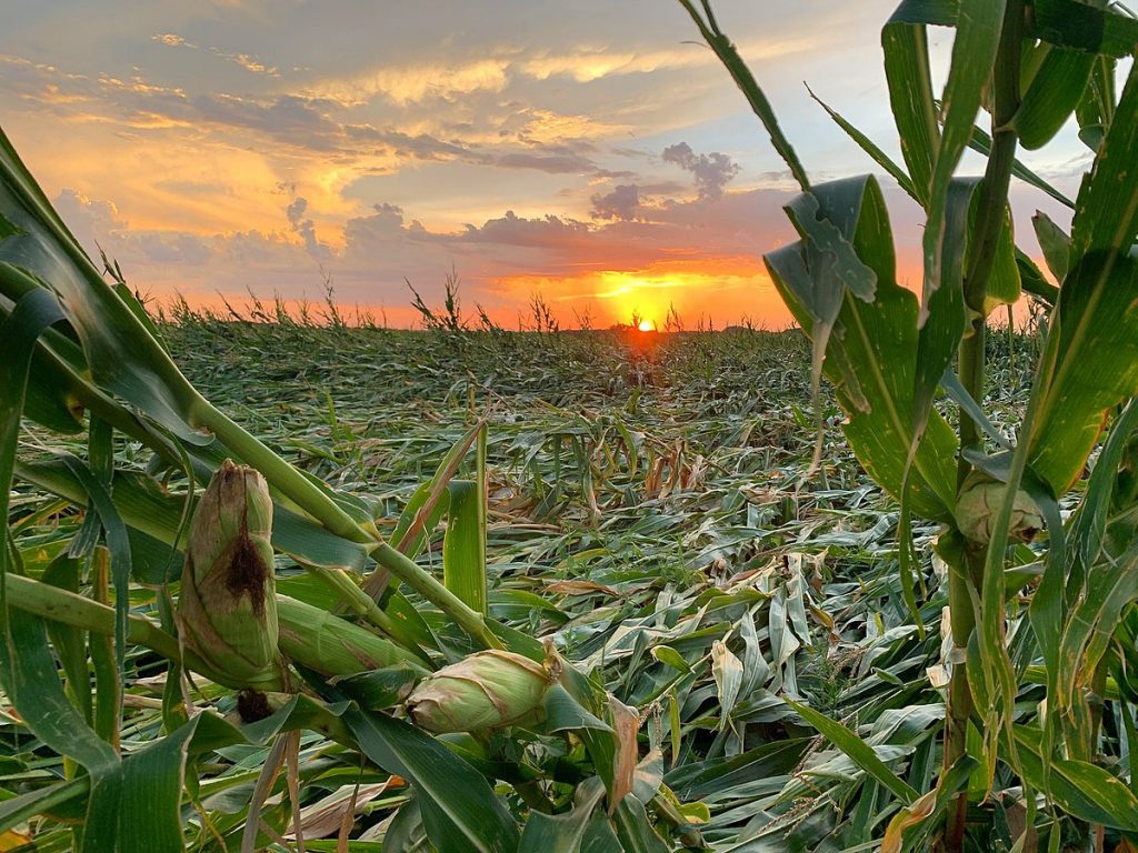
The derecho’s impact extended far beyond Cedar Rapids. Across Iowa, an estimated 14 million acres of cropland were damaged or destroyed, representing roughly a third of the state’s corn and soybean crops. The agricultural industry, the backbone of Iowa’s economy, suffered a staggering blow, with losses estimated in the billions of dollars. The storm’s fury also left millions without power, plunging homes and businesses into darkness and disrupting daily life for weeks.

In Cedar Rapids, Iowa, the derecho’s arrival was swift and brutal. At approximately 11:15 am, the sky turned an ominous green as the leading edge of the storm approached. Within minutes, the city was engulfed in a maelstrom of wind and rain. Residents huddled in basements and interior rooms as the deafening roar of the wind filled the air. Trees snapped like twigs, roofs were peeled off buildings, and debris flew through the air like missiles. One resident recounted the terrifying experience of watching a large tree crash through his living room window, narrowly missing him and his family.

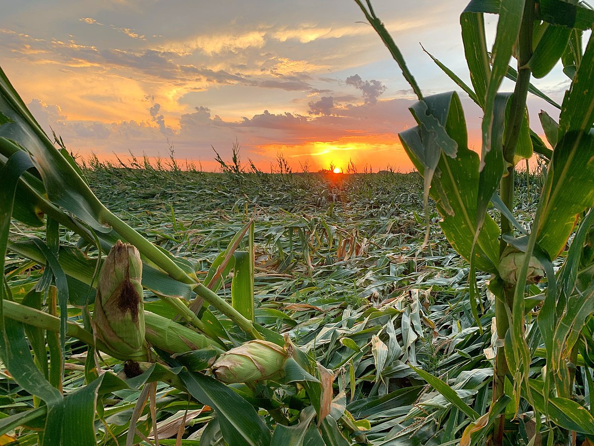
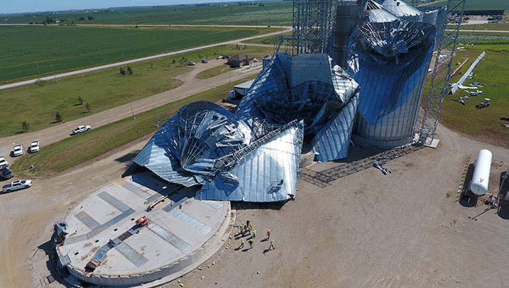
The storm’s impact on rural communities was equally devastating. Farmers watched in disbelief as their corn and soybean fields, once lush and green, were flattened in a matter of minutes. Grain bins were crumpled like soda cans, and barns and outbuildings were reduced to piles of debris. One farmer, who had worked the land for over 50 years, described the scene as “total devastation,” his livelihood wiped away in an instant. The derecho’s impact on agriculture reverberated throughout the region, disrupting supply chains and causing food prices to rise.

As the derecho continued its eastward rampage, it maintained its intensity, leaving its mark on Illinois, Indiana, and Ohio. Chicago experienced wind gusts exceeding 90 mph, causing widespread power outages and bringing the city’s bustling transportation system to a standstill. In Indiana, the storm spawned several tornadoes, adding to the destruction. Even as the derecho weakened, it continued to produce damaging winds and heavy rain, extending its reach over 770 miles and impacting millions.

The meteorological intricacies that birthed and sustained this derecho were complex. A key factor was the presence of a strong upper-level jet stream, which provided the necessary wind shear to organize the thunderstorms into a line and propel them forward at breakneck speeds. Additionally, a pre-existing mesoscale convective system (MCS), a large cluster of thunderstorms, served as the derecho’s building block, providing a source of lift and moisture.

As the derecho matured, it developed a bow echo, a characteristic radar signature associated with destructive straight-line winds. The bow echo, shaped like an archer’s bow, indicated the presence of a powerful downdraft, which spread out upon reaching the ground, generating the hurricane-force winds that ravaged the Midwest. The combination of these factors created a perfect storm, a derecho of unprecedented power and scope.

Derechos have a long and destructive history in the United States, with several notable events leaving their mark on the nation’s memory. One of the most infamous derechos occurred on June 29, 2012, sweeping across the Mid-Atlantic region and causing widespread damage from Indiana to the East Coast. This derecho, known as the “Super Derecho” due to its exceptional intensity and scope, produced wind gusts exceeding 100 mph and left millions without power. The 2012 derecho traveled over 700 miles and caused an estimated $2.9 billion in damage, highlighting the destructive potential of these powerful windstorms.

Another significant derecho event occurred on May 8, 1995, impacting a large portion of the Midwest. This derecho, which originated in Kansas, traveled over 1,000 miles and produced wind gusts of up to 120 mph. The storm caused widespread damage to trees, power lines, and structures, leaving over 2 million people without power. The 1995 derecho was particularly notable for its long duration, lasting for over 12 hours, and its extensive path, which stretched from Kansas to the East Coast.

The Midwest derecho of 2020 stands out for several reasons. Its peak wind gusts of 140 mph were among the highest ever recorded for a derecho, rivaling the intensity of a major hurricane. The storm’s impact on agriculture was particularly severe, with millions of acres of crops damaged or destroyed, causing significant economic losses. Additionally, the derecho’s rapid intensification and relatively short warning time caught many off guard, underscoring the challenges of forecasting and preparing for these powerful windstorms. While derechos are not uncommon in the Midwest, the 2020 event served as a stark reminder of their destructive potential and the importance of remaining vigilant during severe weather events.

The Midwest derecho of 2020 stands as a stark reminder of the unpredictable and destructive nature of severe weather. Its impact extended far beyond the immediate damage to infrastructure and agriculture, leaving a lasting mark on the lives of millions. The storm exposed vulnerabilities in infrastructure and emergency response systems, prompting a reevaluation of preparedness measures and a call for increased investment in resilient infrastructure. As communities rebuild and recover, the memory of the derecho serves as a powerful motivator to strengthen defenses against future storms and ensure the safety and well-being of those who call the Midwest home.

Hurricane Laura’s Wrath: A Catastrophic Landfall in Louisiana (August 27, 2020)

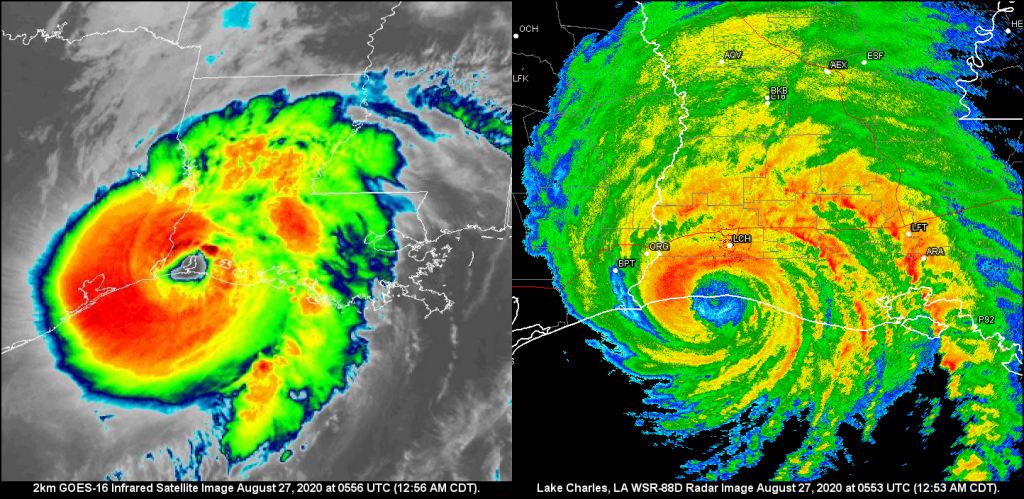
The morning of August 27, 2020, dawned with a sense of foreboding for residents of southwestern Louisiana and southeastern Texas. Hurricane Laura, a formidable Category 4 storm with sustained winds of 150 mph, was churning in the Gulf of Mexico, its sights set on the coastline. This wasn’t just another storm; Laura was poised to become one of the most powerful hurricanes to ever strike the region, leaving an indelible mark on the landscape and its people.

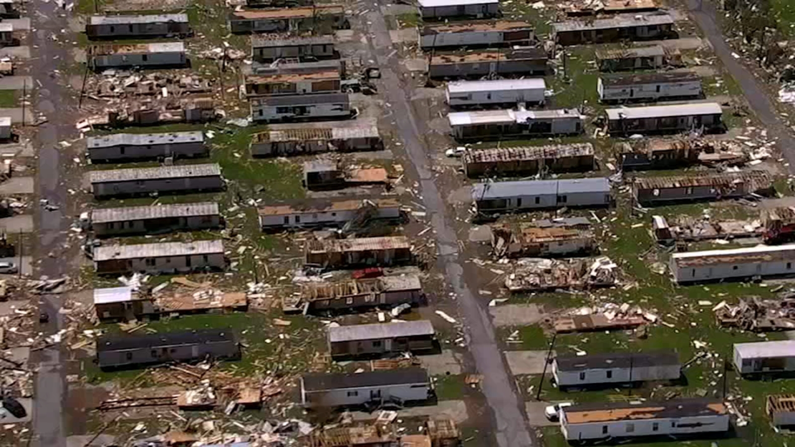
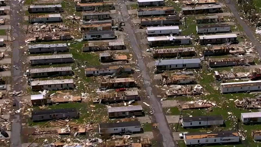
Landfall occurred around 1 am near Cameron, Louisiana, a small community southwest of Lake Charles. The storm surge, a towering wall of water, surged ashore reaching heights of 15-20 feet in some areas. Homes were ripped from their foundations, businesses pulverized, and entire communities inundated with seawater. The relentless winds, equivalent to a high-end EF3 tornado, tore through structures, snapping trees and power lines like twigs. In Lake Charles, the Capital One Tower, a prominent 22-story building, sustained significant damage, its windows shattered and facade peeled away.

As Laura pushed inland, its fury continued unabated. Devastating wind damage extended far beyond the coast, reaching well into central Louisiana. The city of Alexandria, roughly 100 miles inland, experienced wind gusts of up to 97 mph, toppling trees and causing widespread power outages. Tragically, the storm claimed the lives of at least 30 people across Louisiana and Texas, with many succumbing to carbon monoxide poisoning from unsafe generator use during the widespread power outages.

The meteorological factors that fueled Laura’s intensification were a confluence of warm Gulf waters, low wind shear, and a favorable upper-level atmospheric pattern. Sea surface temperatures in the Gulf of Mexico were exceptionally warm, providing ample fuel for the storm’s growth. Additionally, wind shear, the change in wind speed and direction with height, which can disrupt hurricane development, was minimal. This allowed Laura to maintain its structure and strengthen rapidly. Finally, a strong high-pressure system over the central United States steered Laura on a direct path towards the Louisiana coastline, giving residents little time to prepare for the impending disaster.

Laura’s impact extended far beyond the immediate devastation of wind and surge. The storm triggered widespread flooding, as torrential rains inundated rivers and streams. Over 15 inches of rain fell in parts of Louisiana, leading to flash flooding and prolonged river flooding that lasted for days. Agricultural losses were extensive, with damage to crops and livestock estimated in the billions of dollars. The timber industry also suffered a significant blow, with millions of acres of forest flattened by Laura’s ferocious winds.

In the aftermath of the storm, communities across Louisiana and Texas began the long and arduous process of recovery. The Federal Emergency Management Agency (FEMA) and other organizations provided assistance with debris removal, temporary housing, and financial aid. However, the scars left by Hurricane Laura will take years, if not decades, to fully heal. The storm serves as a stark reminder of the destructive power of nature and the importance of preparedness in the face of such formidable forces.

The Tri-State Tornado: A Trail of Destruction Across Three States – March 18, 1925

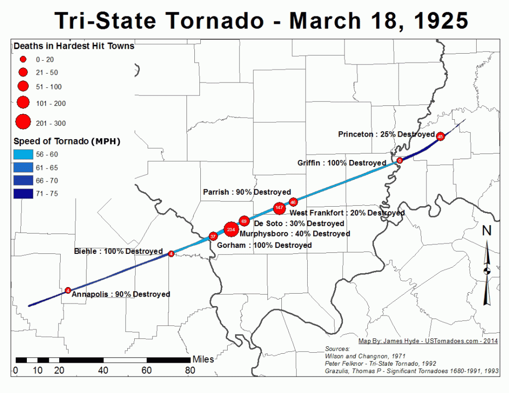
The afternoon of March 18, 1925, etched itself into the annals of American history as the deadliest tornado event the nation has ever witnessed. A single, monstrous tornado tore through portions of Missouri, Illinois, and Indiana, leaving behind a 219-mile path of devastation. In its wake, the Tri-State Tornado, as it came to be known, claimed 695 lives, injured over 2,000 people, and caused catastrophic damage to homes, businesses, and the landscape itself. The roar of the tornado was said to be audible from miles away, described by survivors as sounding like a freight train or the continuous rumble of thunder.

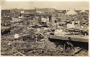
Emerging in southeastern Missouri, the tornado first touched down around 1 p.m. near Ellington. Witnesses reported seeing a dark, swirling funnel cloud descend from the sky, growing in size and intensity as it moved across the countryside. The small community of Annapolis, Missouri was directly in its path, and within minutes, the town was reduced to rubble. Homes were obliterated, trees uprooted, and the local schoolhouse was completely destroyed with over 100 students inside. Miraculously, only one child lost their life due to the quick actions of the teachers who ushered the children into the basement just before the tornado struck. Sadly, 38 people lost their lives in Annapolis alone. Continuing its northeastward track, the tornado crossed the Mississippi River into southern Illinois, striking the towns of Gorham and Murphysboro. Murphysboro suffered the most significant loss of life with 234 fatalities. The business district was completely leveled, and the remains of the Murphysboro High School were scattered for miles.

As the tornado moved into Indiana, its path widened, reaching an astonishing 2.5 miles at its maximum width. The towns of Griffin and Owensville were heavily impacted, with countless homes and businesses leveled. In Griffin, a local church was destroyed while a service was in progress, resulting in the tragic loss of 69 lives. The Tri-State Tornado finally dissipated near Petersburg, Indiana, after a horrifying 3.5-hour rampage. In total, 19 communities were directly affected, with thousands of buildings destroyed and an estimated $17 million in property damage (equivalent to over $250 million today). The aftermath resembled a war zone, with debris strewn across the landscape and survivors left in shock and despair.

The meteorological conditions that spawned the Tri-State Tornado were a potent mix of atmospheric ingredients. A strong low-pressure system tracked across the central plains, dragging a warm front northward. To the south, warm, moist air surged from the Gulf of Mexico, while cold, dry air aloft created an unstable atmosphere. As the warm front collided with the colder air, powerful thunderstorms erupted, providing the energy needed for tornadic development.

The specific dynamics of the storm system, including wind shear (changes in wind speed and direction with height), contributed to the tornado’s longevity and intensity. The wind shear created a horizontal rolling motion in the atmosphere, which helped to concentrate and stretch the storm’s rotation, leading to the formation of a long-lasting and powerful tornado. Additionally, the relatively flat terrain of the region offered little resistance to the twister’s path, allowing it to maintain its strength over a longer distance.

The Tri-State Tornado remains a stark reminder of the destructive power of nature and the importance of severe weather preparedness. Its legacy has contributed to advancements in tornado research, forecasting, and warning systems, ultimately saving countless lives in the decades since this devastating event. The storm’s impact on the field of meteorology is undeniable, as it prompted further study of tornado formation and behavior, leading to improved understanding and prediction of these destructive forces.

One of the closest comparisons in terms of path length is the Great Natchez Tornado of 1840. This devastating tornado, which struck Natchez, Mississippi and surrounding areas, carved a path estimated to be between 150 and 200 miles long. However, due to limitations in record-keeping and population density at the time, the exact number of fatalities remains uncertain, with estimates ranging from 100 to 317 deaths.

Another notable tornado event was the 1974 Super Outbreak, which unleashed 148 tornadoes across 13 states in just 18 hours. This outbreak resulted in 330 fatalities and caused extensive damage. However, the Super Outbreak was characterized by numerous individual tornadoes, rather than a single, long-track event like the Tri-State Tornado.

The Destructive Dallas 2012 Hail Storm

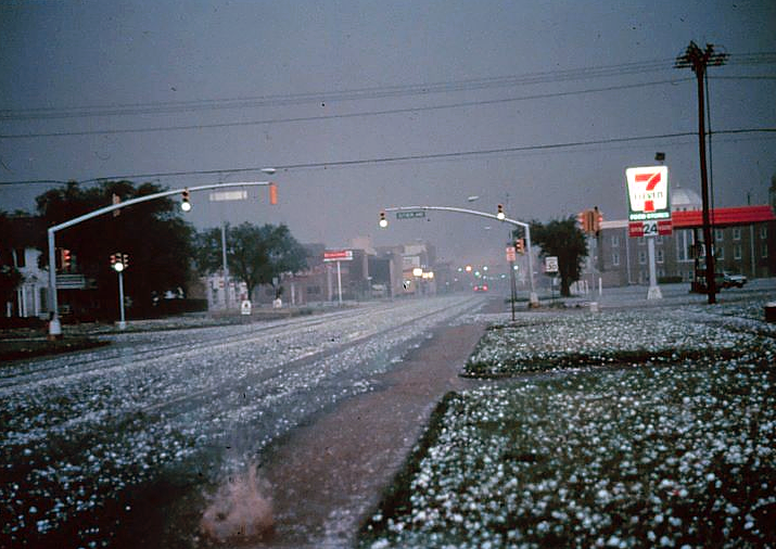
On June 13, 2012, a single, isolated supercell thunderstorm pummeled the Dallas-Fort Worth (DFW) metroplex with golfball-sized hail, ranging from 1.75 inches (4.4 cm) to a staggering 4.25 inches (10.8 cm) in diameter – some exceeding the size of softballs. This event, classified as a PDS (Particularly Destructive Storm) by the National Weather Service (NWS), caused widespread devastation, with estimated costs reaching $900 million. This white paper delves into the meteorological setup, the extent of the damage, and the community’s response and recovery efforts.

2. Meteorological Conditions

An analysis by the NWS Fort Worth office revealed the following key factors:

  • High CAPE (Cape Accumulation of Potential Energy): The atmosphere held a significant amount of potential energy (CAPE) exceeding 3,000 J/kg, which fueled the storm’s intensity.
  • Strong Vertical Wind Shear: A strong change in wind speed and direction with increasing altitude created powerful updrafts within the storm, allowing hailstones to grow significantly.
  • Moist Mid-Levels: Abundant moisture present in the middle levels of the atmosphere provided ample water vapor for hailstone formation.

3. Extent of Damage

Data from various sources paints a grim picture:

  • Hailstone Size Distribution: According to insurance claim data, approximately 60% of the hail measured between 1.75-2.75 inches (4.4-7 cm), with 25% reaching 2.75-3.75 inches (7-9.5 cm), and the remaining 15% exceeding 3.75 inches (9.5 cm).
  • Property Damage: Over 150,000 residential and commercial property claims were filed, with an estimated 70,000 roofs punctured or destroyed.
  • Vehicle Damage: Insurance companies reported over 600,000 auto hail damage claims, with many vehicles deemed totaled.
  • Infrastructure Damage: Power outages affected over 200,000 residents, and numerous communication towers were damaged, disrupting phone and internet services.
  • Agricultural Damage: Over 50,000 acres of crops were destroyed, impacting local agriculture and raising food prices.

4. Economic Impact

The estimated economic cost of the storm was staggering:

  • $600 million: Property damage repairs and replacements.
  • $200 million: Vehicle repairs and replacements.
  • $50 million: Lost business revenue due to power outages and infrastructure disruptions.
  • $50 million: Infrastructure repair costs.
  • $100 million: Crop losses and agricultural impact.

These figures highlight the significant economic burden placed on individuals, businesses, and local governments.

5. Community Response and Recovery

The DFW community demonstrated remarkable resilience:

  • Emergency Response: Over 1,000 emergency responders worked tirelessly to ensure public safety, clear debris, and provide assistance to affected residents.
  • Volunteer Efforts: Thousands of volunteers emerged to help with cleanup efforts, organize donation drives, and provide emotional support.
  • Government Assistance: Local, state, and federal governments declared disaster zones, offering financial assistance to individuals and businesses for repairs.
  • Building Code Review: Building code revisions were initiated, focusing on strengthening roof structures and improving hail resistance for new construction.