Chasing the Storm: How To Become a Storm Chaser

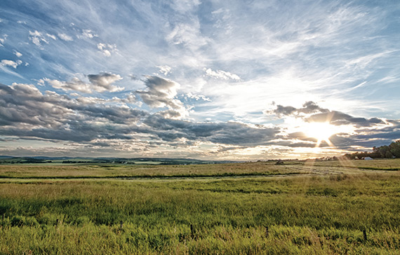
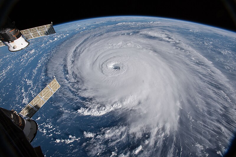
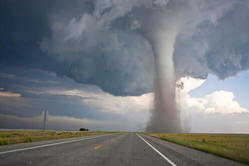
The allure of severe weather, with its raw power and captivating beauty, has drawn countless individuals to the world of storm chasing. The thrill of witnessing nature’s fury firsthand, capturing awe-inspiring images, and contributing to scientific understanding is undeniably enticing. However, venturing into the realm of storm chasing requires more than just a thirst for adventure; it demands meticulous preparation, a deep understanding of meteorology, and a profound respect for the inherent dangers involved.

Building Your Knowledge Base:

Before embarking on your storm chasing journey, a solid foundation in meteorology is crucial. Dive into the world of weather dynamics and familiarize yourself with the following:

  • Thunderstorm Formation: Understand the processes that lead to thunderstorm development, including atmospheric instability, lift mechanisms, and moisture sources.
  • Severe Weather Ingredients: Learn about the specific conditions that contribute to the formation of tornadoes, hail, damaging winds, and flash flooding.
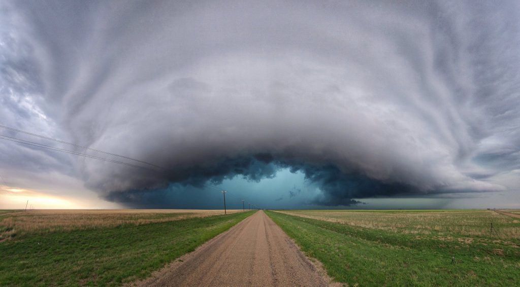
  • Storm Structure Identification: Become adept at recognizing different types of clouds and thunderstorm structures, such as supercells, squall lines, and multicell clusters.
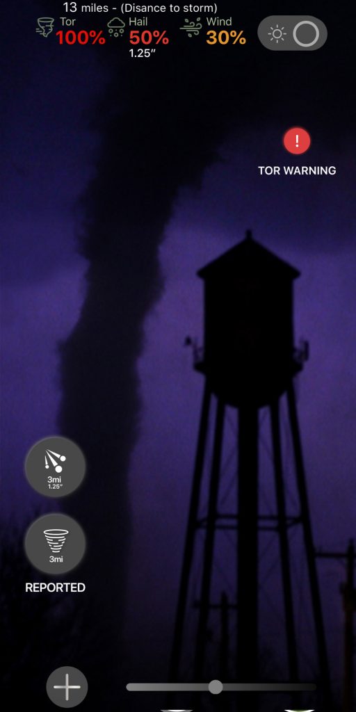
  • Radar Interpretation: Develop the ability to analyze radar data, including reflectivity, velocity, and storm relative motion, to track storm development and movement.
  • Weather Models: Familiarize yourself with various weather models and their limitations to gain insights into potential storm development and severity.

Essential Resources:

Expand your meteorological knowledge through various resources:

  • Online Courses & Tutorials: Numerous online platforms offer comprehensive meteorology courses and tutorials, ranging from basic weather principles to advanced storm analysis techniques.
  • Books & Field Guides: Invest in reputable books and field guides that cover storm structure identification, radar interpretation, and severe weather forecasting.
  • National Weather Service (NWS) Resources: The NWS website provides a wealth of information on severe weather, including safety tips, spotter training materials, and real-time weather data.

Equipping Yourself for the Chase:

The right equipment can make a significant difference in your storm chasing experience:

  • Vehicle: Choose a reliable vehicle with good fuel efficiency, ample storage space for equipment, and sturdy construction to handle rough terrain and potential hail damage.
  • GPS Navigation: Invest in a high-quality GPS system with real-time traffic updates and off-road capabilities to navigate unfamiliar areas and avoid hazards.
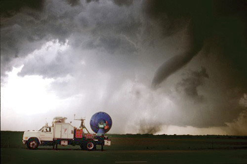
  • Mobile Weather Station: Consider a portable weather station to gather real-time data on temperature, humidity, wind speed, and barometric pressure, providing valuable insights into local atmospheric conditions.
  • Communication Equipment: Two-way radios or HAM radios are essential for staying connected with other chasers and monitoring weather updates from the NWS. Ensure you have the appropriate licenses and understand proper radio etiquette.
  • Cameras & Videography Equipment: Capture the awe-inspiring beauty of storms with high-quality cameras and video equipment. Invest in sturdy tripods and protective cases to safeguard your gear from the elements.

Safety First and Always:

Storm chasing inherently involves risk, and prioritizing safety is paramount:

  • Never Chase Alone: Always chase with a partner or team to ensure mutual support and assistance in case of emergencies.
  • Plan Escape Routes: Before embarking on a chase, meticulously plan escape routes and identify potential shelter locations in case of a sudden tornado threat or other hazards.
  • Monitor Weather Conditions Closely: Stay vigilant and continuously monitor weather updates from the NWS, radar data, and visual cues to assess storm development and potential threats.
  • Avoid Complacency: Even experienced chasers can fall victim to complacency. Never underestimate the power of a storm and be prepared to abandon a chase if conditions deteriorate or become too dangerous.
  • Respect Nature’s Power: Always maintain a healthy respect for the destructive forces of severe weather. Avoid placing yourself in unnecessary danger and prioritize your safety over capturing the perfect shot.

Ethical Chasing Practices:

Responsible storm chasing entails adhering to a strict code of ethics:

  • Respect Private Property: Never trespass on private land without permission, even in pursuit of a captivating storm structure.
  • Avoid Interference: Steer clear of emergency responders and avoid impeding traffic flow. Your presence should not hinder rescue efforts or create additional hazards.
  • Share Information Responsibly: Disseminate your observations and reports to the NWS and other chasers accurately and responsibly, avoiding exaggeration or sensationalism.
  • Promote Safety Awareness: Advocate for safe chasing practices and educate others about the potential dangers of severe weather.

Building Experience and Skill:

Start your storm chasing journey gradually and methodically:

  • Local Storms: Begin by chasing local storms in familiar territory to gain experience and confidence in identifying storm structures, navigating challenging road conditions, and making sound decisions under pressure.
  • Storm Chasing Tours: Consider joining organized storm chasing tours led by experienced professionals. These tours provide valuable learning opportunities and allow you to observe best practices firsthand.
  • Partnering with Experienced Chasers: Collaborate with seasoned storm chasers to learn from their expertise, gain insights into advanced chasing techniques, and expand your understanding of storm behavior.

Contributing to Science and Public Safety:

Storm chasers play a crucial role in advancing scientific understanding and improving public safety:

Citizen Science: Submit your storm reports and observations to the NWS through platforms like mPING or Spotter Network. This real-time data contributes to improving forecasts and warnings, potentially saving lives.

  • Collaboration with Researchers: Partner with meteorological researchers and universities to provide valuable data for storm analysis and modeling efforts, furthering our understanding of severe weather phenomena.
  • Educational Outreach: Share your experiences and knowledge with the public through presentations, workshops, or social media platforms. Promote awareness of severe weather preparedness and safety measures.

Beyond the Chase: Community and Advocacy

Storm chasing is not just about the adrenaline rush of witnessing nature’s power; it’s also about building a community and advocating for responsible practices:

  • Connect with Other Chasers: Join online forums, attend conferences, and participate in local storm spotter groups to connect with fellow enthusiasts, share experiences, and learn from one another.
  • Promote Ethical Chasing: Advocate for responsible chasing practices and encourage others to prioritize safety, ethics, and respect for private property and emergency responders.
  • Support Storm Research & Education: Contribute to organizations and initiatives that support storm research, public education, and severe weather preparedness efforts.

Becoming a successful storm chaser is a journey, not a destination. It requires dedication, continuous learning, and a healthy dose of respect for the power of nature. By prioritizing safety, ethics, and education, you can embark on a rewarding and thrilling adventure, chasing the storm while contributing to the greater good. As you embark on this exciting path, remember that the most valuable tools you possess are not just your equipment and knowledge but also your judgment, responsibility, and unwavering respect for the awe-inspiring forces of nature.

Storm Chasing Destinations Around the World: Exploring Nature’s Fury

Storm chasing is a thrilling and awe-inspiring pursuit that takes enthusiasts on a journey to witness the raw power of nature. From massive thunderstorms to tornadoes and hurricanes, storm chasers seek out these dramatic weather phenomena in various locations around the globe. In this article, we’ll delve deeper into some of the top storm chasing destinations, each offering unique experiences and challenges for adventurous souls.

1. The Great Plains, United States: A Hotbed for Tornado Activity

Encompassing parts of Texas, Oklahoma, Kansas, Nebraska, South Dakota, and Iowa, the Great Plains region in the central United States is a legendary storm chasing ground. This region, infamous for its high frequency of tornadoes during spring and early summer months, attracts professionals and enthusiasts alike. The flat terrain of the Great Plains, coupled with clash zones between warm, moist air from the Gulf of Mexico and cooler air from the Rockies, creates ideal conditions for tornado formation. Witnessing a supercell thunderstorm erupt into a tornado against the vast, open canvas of the Great Plains is an unforgettable experience.

  • Annual Average: Approximately 1,200 tornadoes
  • Most Deadly/Destructive: The Tri-State Tornado of 1925, which ripped through Missouri, Illinois, and Indiana, remains the deadliest tornado in US history, with an estimated 695 fatalities.

2. Arid Fury: Storm Chasing in the Australian Outback

For those seeking a unique storm chasing adventure, Australia’s vast and remote Outback offers a rugged environment. During the Australian summer, regions like Queensland, the Northern Territory, and parts of Western Australia witness a range of severe weather, including thunderstorms, cyclones, and dust storms. The stark contrast of red desert landscapes against dramatic storm clouds creates breathtaking scenes for photographers and adventurers alike. The Outback’s isolation and unpredictable weather add an extra element of challenge and excitement to storm chasing expeditions. Imagine capturing a colossal dust storm engulfing the horizon, a sight unique to the Australian Outback.

  • Annual Average: Around 100 tornadoes, with a concentration in the southeastern states.
  • Most Deadly/Destructive: The 1970 Bulahdelah tornado remains one of Australia’s most destructive tornadoes, causing significant damage and several fatalities.

3. North American Expansion: Chasing Storms in Canada’s Prairies

Canada’s prairie provinces, particularly Alberta, Saskatchewan, and Manitoba, form a northern extension of the storm chasing territory. While less frequent than in the southern United States, tornadoes do occur here, alongside powerful supercell thunderstorms and impressive hailstorms. Chasing storms in Canada presents a different perspective due to the unique weather patterns influenced by the Rocky Mountains and the Arctic. The vast Canadian prairies, dotted with lakes and farmland, offer a picturesque backdrop for capturing the drama of a supercell thunderstorm.

  • Annual Average: Around 62 tornadoes, primarily in the southern Prairie provinces and Ontario.
  • Most Deadly/Destructive: The Regina Cyclone of 1912 devastated the city of Regina, Saskatchewan, claiming 28 lives and causing extensive damage.

4. Southern Hemisphere Spectacle: Argentina’s High Plains

Spring and summer in Argentina transform the Pampas region, also known as the High Plains, into a storm chaser’s paradise. Here, rapid development of thunderstorms occurs due to warm, moist air from the Atlantic colliding with cool air from the Andes Mountains. The result? Spectacular lightning displays and occasional severe weather events that draw storm enthusiasts from across South America. The vast grasslands and dramatic skies of Argentina’s High Plains provide a visually captivating backdrop for chasing storms. Imagine witnessing a mesmerizing electrical storm illuminate the endless expanse of the Pampas.

Annual Average: Argentina experiences a moderate number of tornadoes, particularly in the Pampas region, with estimates ranging from 20 to 60 tornadoes per year. The spring and summer months (October-March) are the peak season for tornado activity.

Most Deadly/Destructive: The 1973 San Justo Tornado: This powerful tornado, estimated to be an F4 or F5, tore through the town of San Justo in the Buenos Aires Province on January 10, 1973. The tornado caused significant casualties, with estimates ranging from 63 to 120 fatalities, and left a path of destruction through the town, leveling homes and businesses. This event remains one of the deadliest tornado disasters in Argentina’s history and serves as a reminder of the potential for destructive tornadoes in the region.

5. European Encounters: Unveiling the Power of European Storms

While Europe may not experience tornadoes with the same frequency as the United States, it has its fair share of dramatic weather. Countries like the United Kingdom, France, and Germany witness intense thunderstorms and supercells during specific times of the year. The diverse landscapes of Europe, from rolling hills to scenic coastlines, offer a unique opportunity to capture the fury of nature in various settings. Imagine capturing electrifying lightning shows illuminating iconic landmarks or dramatic cloud formations gathering over picturesque countrysides.

  • Annual Average: Europe experiences a variable number of tornadoes, with an estimated average of around 300-400 tornadoes per year across the continent.
  • Most Deadly/Destructive: The 1984 Ivanovo tornado outbreak in Russia resulted in significant destruction and loss of life.

6. Monsoon Majesty: Unveiling the Power of India’s Seasonal Storms

From June to September, India’s monsoon season blankets the country in heavy rainfall, dramatic thunderstorms, and occasional cyclones. Regions on the western coast, including Goa and Kerala, as well as northeastern states like Assam, witness some of the most spectacular weather events, attracting both local and international storm chasers seeking the intense displays of the monsoon. The monsoon’s impact on India’s diverse landscapes, from lush forests to coastal plains, creates a dynamic and visually rich environment for storm chasing and photography. Imagine witnessing a powerful monsoon storm unleash its fury over the lush jungles of India.

Annual Average: While comprehensive data is limited due to underreporting, estimates suggest India experiences around 100-200 tornadoes annually. These tornadoes are often associated with the monsoon season (April-June) and post-monsoon season (September-November).

Most Deadly/Destructive: The 1998 Andhra Pradesh Tornado: This devastating tornado, estimated to be an F4 on the Fujita scale, struck the East Godavari district of Andhra Pradesh in May 1998. It resulted in over 100 fatalities and caused widespread destruction to homes, infrastructure, and crops. The tornado’s impact highlighted the vulnerability of rural communities in India to severe weather events and the need for improved disaster preparedness and response systems.

10 Essential Tools Every Storm Chaser Needs to Ride the Winds

Storm chasing is an exhilarating pursuit that demands both courage and meticulous preparation. While the raw power of a storm itself is undeniable, venturing into such conditions requires a carefully curated arsenal of tools to ensure safety, capture the moment, and navigate the ever-changing environment. Here’s a breakdown of the 10 essential tools every storm chaser should have:

1. Real-Time Weather Monitoring:

  • Weather Stations and Apps: Live weather data is paramount. Reliable weather stations and mobile applications provide crucial information on storm location, movement, intensity, and potential hazards like hail and tornadoes. Popular options include GRLevel3, Warn on Radar, and National Weather Service (NWS) apps.
  • Satellite Imagery: Real-time satellite imagery allows chasers to visualize cloud formations and storm structure. Services like GOES-16 and Himawari-8 offer valuable insights into storm development and movement.

2. Navigation and Communication:

  • GPS Device: A reliable GPS device ensures you don’t get lost amidst confusing road closures or shifting weather patterns. Consider a ruggedized model with offline mapping capabilities for areas with spotty cellular reception.
  • Ham Radio: While cellular service might be unreliable during storms, a ham radio with proper licensing provides a vital communication lifeline. It allows chasers to connect with other storm chasers, emergency services, and weather spotters, sharing real-time updates and ensuring everyone’s safety.

3. Safety Gear:

  • First-Aid Kit: A comprehensive first-aid kit is a must-have for any situation. Include essential supplies like bandages, antiseptic wipes, pain relievers, and medications specific to your needs.
  • Helmet: Flying debris is a real threat during storms. A sturdy helmet protects your head from hail, wayward branches, and other potential projectiles.

4. Chasing Vehicle:

  • Reliable Transportation: Your vehicle is your mobile command center, so ensure it’s up to the challenge. Regular maintenance is crucial, and consider features like high ground clearance for navigating flooded roads and rough terrain.
  • Spare Tire and Tools: A flat tire in the middle of nowhere can be disastrous. Pack a spare tire, a jack, and basic tools for roadside repairs.

5. Storm Documentation:

  • DSLR Camera with Sturdy Tripod: Capturing the raw beauty and power of a storm requires a high-quality camera. A DSLR allows for manual adjustments for optimal low-light and fast-action photography. A sturdy tripod ensures clear, shake-free footage.
  • Extra Batteries and Memory Cards: Running out of power or storage at a critical moment can be frustrating. Pack extra batteries and memory cards to ensure you don’t miss a single shot.

6. Additional Considerations:

  • Flashlight and Headlamp: A reliable flashlight and headlamp provide hands-free illumination during low-visibility situations.
  • Cooler and Non-Perishable Food: Storm chases can be long and unpredictable. Pack a cooler with plenty of non-perishable food and water to stay hydrated and energized.
  • Weatherproof Clothing and Sturdy Boots: Dress for the conditions. Waterproof clothing, sturdy boots with good tread, and layers for varying temperatures are essential.

7. Learning Cloud Formations and Storm Types:

While sophisticated apps and weather stations provide valuable data, a storm chaser’s own knowledge of cloud formations and storm types is an invaluable tool. Understanding the visual cues associated with different storm types allows for better anticipation of their behavior and potential severity. Here are a few key cloud formations to be familiar with:

  • Wall Cloud: A low, rotating cloud base often associated with tornadoes.
  • Mammatus Clouds: Pouches or bulges that form on the underside of a thunderstorm, often an indicator of strong updrafts within the storm.
  • Supercell Storms: These powerful thunderstorms have rotating updrafts and are capable of producing tornadoes, large hail, and damaging winds.

By recognizing these formations, storm chasers can make more informed decisions about approaching storms and maintain a safe distance from particularly hazardous weather phenomena.

8. Choosing the Right Camera Settings for Storm Photography:

Capturing the raw power and beauty of a storm requires an understanding of camera settings. Here are some basic tips:

  • Aperture: A wider aperture (lower f-number) allows more light in, which is crucial for low-light storm photography. However, be mindful of achieving a good depth of field to keep both the foreground and background in focus.
  • Shutter Speed: Adjust shutter speed based on the desired effect. A slower shutter speed creates motion blur, ideal for capturing lightning strikes or swirling cloud formations. Conversely, a faster shutter speed freezes action, useful for capturing hail or debris.
  • ISO: ISO controls camera sensitivity to light. Increase ISO in low-light situations, but be aware of introducing noise (graininess) into your image.

Experimenting with these settings in different weather conditions allows storm chasers to develop their unique photographic style and capture stunning storm visuals.

9. Storm Chaser Etiquette and Responsible Chasing:

The thrill of the chase should never come at the expense of public safety or responsible storm observation. Here are some essential storm chaser ethics to follow:

  • Respect Road Closures: Never drive through flooded roads or enter restricted areas. This not only puts yourself at risk but also hinders emergency services.
  • Maintain a Safe Distance: Don’t crowd emergency vehicles or get dangerously close to a storm. There’s a difference between capturing a thrilling image and putting yourself in harm’s way.
  • Minimize Environmental Impact: Leave no trace behind. Respect private property and avoid causing damage to the environment while chasing storms.

By following these guidelines, storm chasers can contribute to a positive and responsible storm chasing community.

10. Documenting Your Chase Experiences:

Storm chasing isn’t just about the adrenaline rush; it’s about capturing the experience and sharing it with others. Here’s how to effectively document your chase:

  • Detailed Notes: Jot down important details throughout your chase, including time, location, weather observations, and any interesting phenomena you encounter. These notes will become invaluable when reviewing footage or writing about your experience later.
  • Photography and Videography: As discussed, capture high-quality photos and videos that showcase the storm’s power and beauty. Experiment with different angles and techniques to create a compelling visual narrative.
  • Sharing Your Story: Consider creating a blog, social media channel, or online portfolio to share your storm chasing experiences with others. This allows you to educate the public about severe weather, contribute to storm chasing discussions, and inspire others to appreciate the wonders of nature.

Beyond the Essentials:

While the above tools form a strong foundation, storm chasers can further enhance their preparedness with:

  • Storm Chasing Community Forums: Participating in online forums allows chasers to connect with experienced individuals, share intel, and learn valuable safety tips.
  • Weather Spotter Training: Consider becoming a trained weather spotter. This not only enhances your own understanding of storm behavior but also allows you to contribute valuable data to weather services.
  • Power Inverter: A power inverter allows you to power essential electronics like laptops and cameras using your vehicle’s battery.

Remember: Safety Always Comes First

Storm chasing is an activity that demands respect for the immense power of nature. Always prioritize safety. Never chase into a tornado, maintain a safe distance from storms, and be prepared to retreat if conditions deteriorate. By using the right tools, staying informed, and prioritizing safety, storm chasers can capture the awe-inspiring power of storms while minimizing risks.pen_spark

Enigma of Destruction: Unraveling the 1884 Tornado Outbreak

The year was 1884. A time before radar, before storm chasing, before the intricate understanding of tornadoes we possess today. It was during this era that a mysterious and devastating tornado outbreak swept across the southeastern United States, leaving behind a trail of destruction and unanswered questions. This event, known as the Enigma tornado outbreak, remains one of the most enigmatic and deadly tornado events in American history.

On February 19th, 1884, a series of violent tornadoes ripped through Alabama, Georgia, North Carolina, South Carolina, Tennessee, and Virginia. Due to the limitations of the time, the exact number of tornadoes remains unknown, with estimates ranging from 20 to 60 individual twisters. What is known, however, is the scale of devastation. Entire towns were leveled, homes were swept away, and landscapes were forever altered.

In North Carolina, the town of Rockingham was nearly obliterated by a massive tornado, estimated to be a mile and a half wide. Witnesses described the terrifying sight of a “huge black cloud rolling along the ground” as it tore through the town, leaving behind a scene of utter devastation. Homes were reduced to splinters, trees were uprooted, and the local cotton mill was destroyed, leaving many without livelihoods.

Further south, in Georgia, the town of Gainesville was also struck by a powerful tornado. The twister carved a path of destruction through the heart of the town, leveling homes and businesses. The local newspaper reported that “the air was filled with flying debris, and the roar of the wind was deafening.” Tragically, the tornado struck a local schoolhouse, claiming the lives of several children.

The death toll from the outbreak is estimated to be between 800 and 1,200 individuals, making it one of the deadliest tornado events in US history. The lack of advanced warning systems and the vulnerability of structures at the time contributed to the high number of fatalities. Stories of survival and loss emerged from the wreckage, painting a picture of the terror and awe that these storms inspired.

One account from a survivor in Alabama described the moment the tornado struck their home: “The house began to shake violently, and then it seemed to explode. I was thrown into the air and landed in a field some distance away. When I looked back, all I could see was a pile of rubble where my home had once stood.”

The meteorological factors that contributed to this outbreak remain somewhat shrouded in mystery due to the lack of data from that time period. However, it is believed that a strong low-pressure system tracking across the southeastern states provided the necessary instability and lift for thunderstorm development. Additionally, strong wind shear, likely present due to the clash of contrasting air masses, would have created an environment conducive to the formation of rotating supercell thunderstorms, the breeding grounds for tornadoes.

The Enigma tornado outbreak serves as a stark reminder of the destructive power of nature and the importance of understanding and respecting severe weather. While technology and our understanding of tornadoes have advanced significantly since 1884, the threat posed by these storms remains real. By studying historical events like the Enigma outbreak, we can learn valuable lessons about tornado behavior and continue to improve our forecasting and warning systems, ultimately saving lives and protecting communities.

Tornado Vision: App Review

Tornado Vision is an app that combines three separate features to be the ultimate assistant for those who are interested to keep situational awareness of severe weather.

For one the app uses augmented reality to display the nearest storm to you with the latest data including the chance of hail, tornado and wind as well as information about warnings and storm reports as well as direction and distance. You can click on any of these icons to get a more detailed display.

Here you can see a tutorial of all the individual augmented reality features for a storm when using Tornado Vision.

Tornado Vision also has filters that were tested on hundreds of low contrast tornadoes, usually those hidden in the rain that help you bring out the details.

This tornado WAS NOT visible to the naked eye at this point but with the help of Tornado Vision is 100% visible. The last feature of Tornado Vision is the lightning trigger, at night it’s incredibly hard to see a torando except for a momentary flash of lightning, by switching to night mode you can have it freeze whenever a certain illumination point is reached, this will help you see tornadoes more easily.

Here are videos of Tornado Vision being used around severe storms.

The full features of TornadoVision are:

Augmented Reality displays chance of tornado, hail (and size) and wind when looking at a storm.

Augmented Reality displays if you are in tornado or severe thunderstorm warning.

Augmented reality displays any Tornado or Hail reports.

Four specially designed camera filters help bring out tornadoes hiding in the rain.

Night mode automatically captures hidden night-time tornadoes.

Bring up data on storm characteristics, including rotation, maximum hail size and lightning flash rate.

Bring up environmental data like storm relative helicity, CAPE and bulk wind.

Predict Now – The Ultimate Weather Forecasting App for Enthusiasts

As the creator of Predict Now, I wanted an app that fit the needs of meteorologists, storm chasers, and weather enthusiasts who are passionate about forecasting severe weather. Predict Now is the result of thousands of hours of research, development, and conversations with people who forecast weather.

One of the standout features of Predict Now is its detailed radar maps. I have ensured that the app provides a comprehensive view of radar activity across the entire United States, enabling users to easily track storms and precipitation. Whether you’re monitoring a local thunderstorm or following the path of a hurricane, Predict Now’s radar maps will keep you informed and ahead of the game with updates every 2 minutes.

In addition to radar, I have incorporated a powerful front tracking feature in Predict Now. This allows users to visualize the movement of warm fronts, cold fronts, and other weather systems, providing valuable insights into upcoming changes in the weather pattern. By staying informed about frontal movements, users can make more accurate predictions and better prepare for potential severe weather events.

I am particularly proud of the integration of the Storm Prediction Center’s mesoanalysis tool in Predict Now. This feature grants users access to a wealth of data and visualizations, offering insights into current weather conditions and severe weather potential. Users can explore various indices like CAPE, wind shear, and more, empowering them to make well-informed forecasts and assess the likelihood of severe weather outbreaks.

Predict Now also includes a comprehensive surface observations feature, displaying detailed METARs from numerous locations across different regions, including the infamous Tornado Alley. This allows users to access real-time weather updates and monitor conditions on the ground, which is crucial for storm chasers and those in areas prone to severe weather. There are thousands of surface observations available in Predict Now.

To provide users with the most advanced satellite imagery available, I have integrated data from the cutting-edge GOES-16 satellite into Predict Now. This offers high-resolution visuals of water vapor, infrared, and visible satellite data, giving users a comprehensive understanding of atmospheric conditions. The GOES-16 imagery is a game-changer for weather enthusiasts, enabling them to analyze and predict weather patterns with unprecedented accuracy.

Predict Now also leverages the power of the High-Resolution Rapid Refresh (HRRR) model, which is particularly useful for tracking rapidly changing weather events. The HRRR provides short-term, high-resolution forecasts, allowing users to stay on top of evolving weather situations. Additionally, the app includes other weather models like the NAM and NSSL WRF, offering users a variety of forecasting perspectives to enhance their understanding and prediction capabilities.

I have designed Predict Now with the specific goal of aiding individuals interested in monitoring and preparing for severe weather events like tornadoes, hailstorms, hurricanes and flash floods. The app’s high-resolution data, sourced from advanced models and satellite imagery, ensures accurate and detailed weather visualization. Moreover, Predict Now is optimized for iPhone, providing a smooth and efficient user experience while minimizing data usage.

With its wide coverage spanning the United States and Southern Canada, Predict Now caters to a large user base, making it the go-to app for weather enthusiasts across the region.

I am confident that Predict Now will revolutionize the way you track, analyze, and forecast severe weather. Whether you’re a seasoned meteorologist, a passionate storm chaser, or simply someone who wants to stay informed about the weather, Predict Now is the ultimate tool to elevate your forecasting skills.

Download Predict Now today and join the community of weather enthusiasts who rely on this powerful app to stay one step ahead of the storm. I am committed to continuously improving and updating Predict Now based on user feedback, ensuring that it remains the leading choice for severe weather forecasting.