10 Essential Tools Every Storm Chaser Needs to Ride the Winds

Storm chasing is an exhilarating pursuit that demands both courage and meticulous preparation. While the raw power of a storm itself is undeniable, venturing into such conditions requires a carefully curated arsenal of tools to ensure safety, capture the moment, and navigate the ever-changing environment. Here’s a breakdown of the 10 essential tools every storm chaser should have:

1. Real-Time Weather Monitoring:

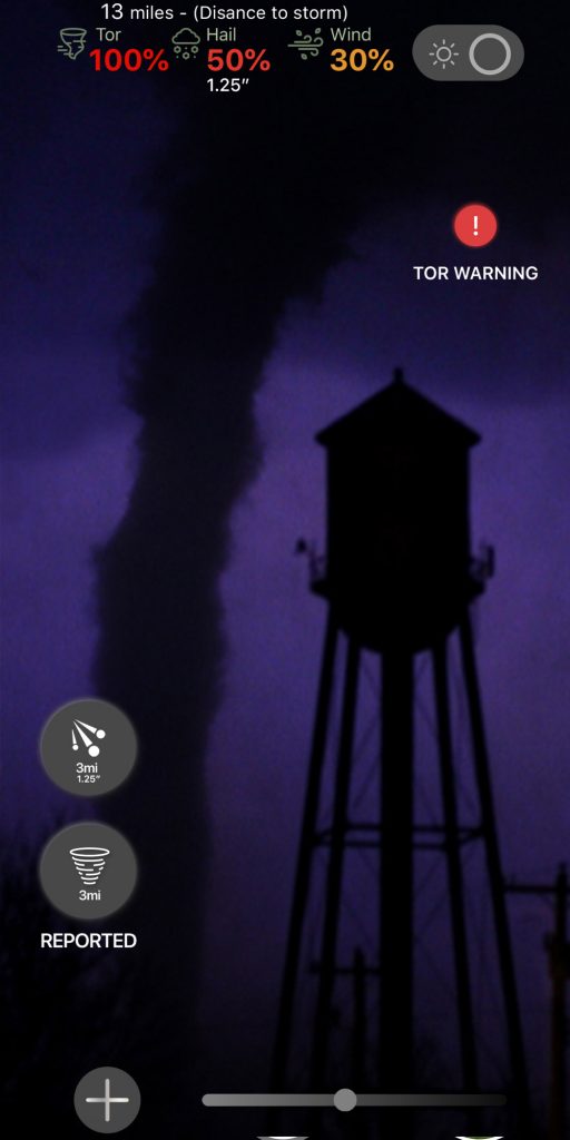
  • Weather Stations and Apps: Live weather data is paramount. Reliable weather stations and mobile applications provide crucial information on storm location, movement, intensity, and potential hazards like hail and tornadoes. Popular options include GRLevel3, Warn on Radar, and National Weather Service (NWS) apps.
  • Satellite Imagery: Real-time satellite imagery allows chasers to visualize cloud formations and storm structure. Services like GOES-16 and Himawari-8 offer valuable insights into storm development and movement.

2. Navigation and Communication:

  • GPS Device: A reliable GPS device ensures you don’t get lost amidst confusing road closures or shifting weather patterns. Consider a ruggedized model with offline mapping capabilities for areas with spotty cellular reception.
  • Ham Radio: While cellular service might be unreliable during storms, a ham radio with proper licensing provides a vital communication lifeline. It allows chasers to connect with other storm chasers, emergency services, and weather spotters, sharing real-time updates and ensuring everyone’s safety.

3. Safety Gear:

  • First-Aid Kit: A comprehensive first-aid kit is a must-have for any situation. Include essential supplies like bandages, antiseptic wipes, pain relievers, and medications specific to your needs.
  • Helmet: Flying debris is a real threat during storms. A sturdy helmet protects your head from hail, wayward branches, and other potential projectiles.

4. Chasing Vehicle:

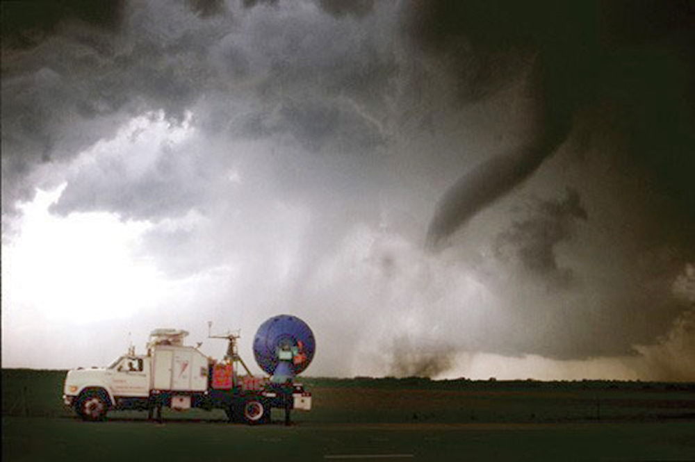
  • Reliable Transportation: Your vehicle is your mobile command center, so ensure it’s up to the challenge. Regular maintenance is crucial, and consider features like high ground clearance for navigating flooded roads and rough terrain.
  • Spare Tire and Tools: A flat tire in the middle of nowhere can be disastrous. Pack a spare tire, a jack, and basic tools for roadside repairs.

5. Storm Documentation:

  • DSLR Camera with Sturdy Tripod: Capturing the raw beauty and power of a storm requires a high-quality camera. A DSLR allows for manual adjustments for optimal low-light and fast-action photography. A sturdy tripod ensures clear, shake-free footage.
  • Extra Batteries and Memory Cards: Running out of power or storage at a critical moment can be frustrating. Pack extra batteries and memory cards to ensure you don’t miss a single shot.

6. Additional Considerations:

  • Flashlight and Headlamp: A reliable flashlight and headlamp provide hands-free illumination during low-visibility situations.
  • Cooler and Non-Perishable Food: Storm chases can be long and unpredictable. Pack a cooler with plenty of non-perishable food and water to stay hydrated and energized.
  • Weatherproof Clothing and Sturdy Boots: Dress for the conditions. Waterproof clothing, sturdy boots with good tread, and layers for varying temperatures are essential.

7. Learning Cloud Formations and Storm Types:

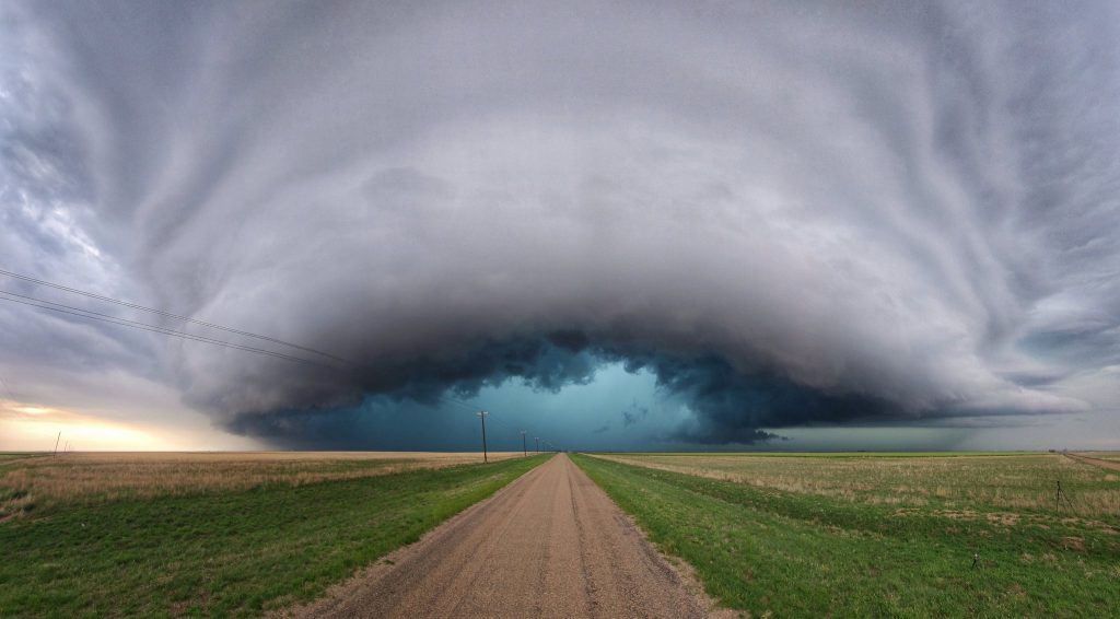
While sophisticated apps and weather stations provide valuable data, a storm chaser’s own knowledge of cloud formations and storm types is an invaluable tool. Understanding the visual cues associated with different storm types allows for better anticipation of their behavior and potential severity. Here are a few key cloud formations to be familiar with:

  • Wall Cloud: A low, rotating cloud base often associated with tornadoes.
  • Mammatus Clouds: Pouches or bulges that form on the underside of a thunderstorm, often an indicator of strong updrafts within the storm.
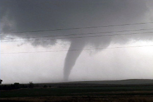
  • Supercell Storms: These powerful thunderstorms have rotating updrafts and are capable of producing tornadoes, large hail, and damaging winds.

By recognizing these formations, storm chasers can make more informed decisions about approaching storms and maintain a safe distance from particularly hazardous weather phenomena.

8. Choosing the Right Camera Settings for Storm Photography:

Capturing the raw power and beauty of a storm requires an understanding of camera settings. Here are some basic tips:

  • Aperture: A wider aperture (lower f-number) allows more light in, which is crucial for low-light storm photography. However, be mindful of achieving a good depth of field to keep both the foreground and background in focus.
  • Shutter Speed: Adjust shutter speed based on the desired effect. A slower shutter speed creates motion blur, ideal for capturing lightning strikes or swirling cloud formations. Conversely, a faster shutter speed freezes action, useful for capturing hail or debris.
  • ISO: ISO controls camera sensitivity to light. Increase ISO in low-light situations, but be aware of introducing noise (graininess) into your image.

Experimenting with these settings in different weather conditions allows storm chasers to develop their unique photographic style and capture stunning storm visuals.

9. Storm Chaser Etiquette and Responsible Chasing:

The thrill of the chase should never come at the expense of public safety or responsible storm observation. Here are some essential storm chaser ethics to follow:

  • Respect Road Closures: Never drive through flooded roads or enter restricted areas. This not only puts yourself at risk but also hinders emergency services.
  • Maintain a Safe Distance: Don’t crowd emergency vehicles or get dangerously close to a storm. There’s a difference between capturing a thrilling image and putting yourself in harm’s way.
  • Minimize Environmental Impact: Leave no trace behind. Respect private property and avoid causing damage to the environment while chasing storms.

By following these guidelines, storm chasers can contribute to a positive and responsible storm chasing community.

10. Documenting Your Chase Experiences:

Storm chasing isn’t just about the adrenaline rush; it’s about capturing the experience and sharing it with others. Here’s how to effectively document your chase:

  • Detailed Notes: Jot down important details throughout your chase, including time, location, weather observations, and any interesting phenomena you encounter. These notes will become invaluable when reviewing footage or writing about your experience later.
  • Photography and Videography: As discussed, capture high-quality photos and videos that showcase the storm’s power and beauty. Experiment with different angles and techniques to create a compelling visual narrative.
  • Sharing Your Story: Consider creating a blog, social media channel, or online portfolio to share your storm chasing experiences with others. This allows you to educate the public about severe weather, contribute to storm chasing discussions, and inspire others to appreciate the wonders of nature.

Beyond the Essentials:

While the above tools form a strong foundation, storm chasers can further enhance their preparedness with:

  • Storm Chasing Community Forums: Participating in online forums allows chasers to connect with experienced individuals, share intel, and learn valuable safety tips.
  • Weather Spotter Training: Consider becoming a trained weather spotter. This not only enhances your own understanding of storm behavior but also allows you to contribute valuable data to weather services.
  • Power Inverter: A power inverter allows you to power essential electronics like laptops and cameras using your vehicle’s battery.

Remember: Safety Always Comes First

Storm chasing is an activity that demands respect for the immense power of nature. Always prioritize safety. Never chase into a tornado, maintain a safe distance from storms, and be prepared to retreat if conditions deteriorate. By using the right tools, staying informed, and prioritizing safety, storm chasers can capture the awe-inspiring power of storms while minimizing risks.pen_spark

Enigma of Destruction: Unraveling the 1884 Tornado Outbreak

The year was 1884. A time before radar, before storm chasing, before the intricate understanding of tornadoes we possess today. It was during this era that a mysterious and devastating tornado outbreak swept across the southeastern United States, leaving behind a trail of destruction and unanswered questions. This event, known as the Enigma tornado outbreak, remains one of the most enigmatic and deadly tornado events in American history.

On February 19th, 1884, a series of violent tornadoes ripped through Alabama, Georgia, North Carolina, South Carolina, Tennessee, and Virginia. Due to the limitations of the time, the exact number of tornadoes remains unknown, with estimates ranging from 20 to 60 individual twisters. What is known, however, is the scale of devastation. Entire towns were leveled, homes were swept away, and landscapes were forever altered.

In North Carolina, the town of Rockingham was nearly obliterated by a massive tornado, estimated to be a mile and a half wide. Witnesses described the terrifying sight of a “huge black cloud rolling along the ground” as it tore through the town, leaving behind a scene of utter devastation. Homes were reduced to splinters, trees were uprooted, and the local cotton mill was destroyed, leaving many without livelihoods.

Further south, in Georgia, the town of Gainesville was also struck by a powerful tornado. The twister carved a path of destruction through the heart of the town, leveling homes and businesses. The local newspaper reported that “the air was filled with flying debris, and the roar of the wind was deafening.” Tragically, the tornado struck a local schoolhouse, claiming the lives of several children.

The death toll from the outbreak is estimated to be between 800 and 1,200 individuals, making it one of the deadliest tornado events in US history. The lack of advanced warning systems and the vulnerability of structures at the time contributed to the high number of fatalities. Stories of survival and loss emerged from the wreckage, painting a picture of the terror and awe that these storms inspired.

One account from a survivor in Alabama described the moment the tornado struck their home: “The house began to shake violently, and then it seemed to explode. I was thrown into the air and landed in a field some distance away. When I looked back, all I could see was a pile of rubble where my home had once stood.”

The meteorological factors that contributed to this outbreak remain somewhat shrouded in mystery due to the lack of data from that time period. However, it is believed that a strong low-pressure system tracking across the southeastern states provided the necessary instability and lift for thunderstorm development. Additionally, strong wind shear, likely present due to the clash of contrasting air masses, would have created an environment conducive to the formation of rotating supercell thunderstorms, the breeding grounds for tornadoes.

The Enigma tornado outbreak serves as a stark reminder of the destructive power of nature and the importance of understanding and respecting severe weather. While technology and our understanding of tornadoes have advanced significantly since 1884, the threat posed by these storms remains real. By studying historical events like the Enigma outbreak, we can learn valuable lessons about tornado behavior and continue to improve our forecasting and warning systems, ultimately saving lives and protecting communities.

Plains Punished: The August 24th, 2006 Tornado Outbreak in Minnesota and South Dakota

The date was August 24th, 2006. While most of the nation basked in the waning days of summer, residents of Minnesota and South Dakota were about to experience a meteorological event that would forever be etched in their memories. This seemingly ordinary Thursday transformed into a day of chaos and destruction as a series of tornadoes ripped through the region, leaving behind a trail of devastation and forever altering the lives of those impacted.

The morning began with an atmosphere pregnant with potential. A warm front stretched across the region, ushering in a surge of warm, moist air from the Gulf of Mexico. This unstable air mass provided the fuel for thunderstorm development, while a potent upper-level disturbance lurking to the west provided the necessary spin and energy to set the stage for a dramatic meteorological performance.

By early afternoon, the atmosphere’s volatile energy began to manifest. The first tornado, a relatively weak EF0, touched down near Wilmont, Minnesota, around 2:30 PM. This was merely a prelude to the main event. Over the next several hours, a staggering 27 confirmed tornadoes pirouetted across the region, carving paths of destruction through the landscape. These twisters ranged in intensity, with some causing minor damage while others, reaching EF3 status, packed winds up to 165 mph.

One of the most destructive tornadoes, an EF3, began its rampage near Chandler, Minnesota, around 4:30 PM. It tore through Murray and Pipestone counties, leaving a 38-mile scar across the land. Homes were reduced to splintered remnants, trees were ripped from the earth, and power lines lay tangled and broken. The town of Ruthton bore the brunt of the tornado’s fury, with numerous homes and businesses suffering significant damage. Tragically, this tornado claimed one life and left several others injured.

As the evening progressed, the storms continued their relentless assault. Around 7:00 PM, an EF2 tornado touched down near Lake Wilson, Minnesota, carving a 17-mile path of destruction through farmlands and rural properties. While no fatalities were reported, several individuals sustained injuries. Later that evening, around 7:30 PM, an EF1 tornado touched down near Tyler, Minnesota, causing damage to trees, power lines, and several structures.

The meteorological ingredients that fueled this tornado outbreak were a textbook example of nature’s fury. The warm, moist air from the Gulf of Mexico provided the instability necessary for thunderstorm development, while the strong jet stream winds aloft provided wind shear, the change in wind speed and direction with height that causes thunderstorms to rotate. The approaching upper-level disturbance acted as a trigger, lifting the unstable air and initiating the development of supercell thunderstorms, the breeding grounds for tornadoes.

Specifically, on this day, a tongue of warm, moist air surged northward ahead of the warm front, colliding with cooler, drier air aloft. This clash of air masses created an environment conducive to the rapid rising of air parcels, the building blocks of thunderstorms. The strong jet stream winds interacted with these rising air parcels, creating horizontal rolling tubes of air. When tilted vertically by the updraft, these tubes spawned rotating thunderstorms, or supercells. The approaching upper-level disturbance then provided the necessary lift, forcing the unstable air to rise and giving birth to the monstrous supercells that spawned the tornadoes.

The August 24th tornado outbreak serves as a stark reminder of the awesome and often unpredictable power of nature. By understanding the specific meteorological factors that contributed to this event, we can gain a deeper appreciation for the complex dance of atmospheric elements that can lead to such destructive consequences. While we may never be able to fully control the weather, we can certainly strive to be informed and prepared, ensuring that when the skies darken and the winds begin to swirl, we have the knowledge and tools necessary to protect ourselves and our communities.

Greensburg, Kansas: When the Sky Fell – May 4th, 2007

The small town of Greensburg, Kansas, nestled amidst the vast plains, exuded a sense of timeless tranquility. Its residents went about their lives, their days marked by the rhythm of the seasons and the gentle sway of the prairie winds. Little did they know that on May 4th, 2007, the sky itself would become an instrument of destruction, forever altering the landscape and etching a story of resilience into the heart of the community.

As the afternoon sun cast long shadows across the fields, a monstrous supercell thunderstorm developed to the northwest of Greensburg. Unbeknownst to the town’s residents, this storm harbored a dark secret within its swirling mass: a violent EF5 tornado, the most powerful category on the Enhanced Fujita scale.

Around 9:45 PM, the tornado, a swirling vortex of devastation with winds exceeding 205 mph, descended upon Greensburg. It tore through the town with unrelenting fury, leaving a path of destruction a mile and a half wide and nearly 22 miles long. Homes were obliterated, businesses reduced to rubble, and landmarks that had stood for generations were swept away as if they were mere toys in the wind’s grasp. The darkness of the night was illuminated by the eerie green glow of power flashes and the surreal dance of debris swirling in the air.

When the winds finally subsided and the dust settled, the town of Greensburg lay in ruins. 95% of the town’s structures were destroyed or severely damaged. The landscape was unrecognizable, a scene of utter devastation that resembled a war zone more than a peaceful Midwestern town. Tragically, eleven lives were lost that night, and countless others were injured.

The atmospheric setup on May 4th was extremely favorable for severe thunderstorms and tornadoes over the central Plains. A powerful jet stream was digging southeast into the region, providing strong wind shear and upward motion. At the same time, a warm, moist airmass was surging north at the surface. This created an environment with abundant instability – in other words, the fuel needed for explosive thunderstorm development.

By early evening, the first thunderstorms began erupting along a dryline in western Kansas. One particular cell quickly became dominant and took on supercell characteristics as it moved northeast. Storm chasers reported a “left-split” appearance to the storm early on, indicating a powerful updraft.

As the supercell approached Greensburg around 9:00 pm CDT, it was a monster. The storm had an extremely unstable airmass to work with, with CAPE values estimated over 5000 J/kg – an extraordinary amount of available energy. It also had incredible wind shear, especially at low levels, allowing it to maintain its intense rotation.

Radar imagery from the Dodge City, Kansas WSR-88D radar (KDDC) showed a classic supercell structure, with a hook echo and bounded weak echo region (BWER) evident. But what was especially remarkable were the Doppler velocity signatures. The tornado cyclone (TC) signature associated with the developing Greensburg tornado was sampled by KDDC to be 2-4 km wide, with gate-to-gate velocity differences of 100-130 knots at times. This is an incredibly intense circulation, on par with the strongest ever measured.

As the tornado struck Greensburg around 9:45 pm, it was at peak intensity. Damage surveys indicate the tornado was at least 1.7 miles wide at this point, with winds estimated at 205 mph. The tornado was so strong that it scoured the ground and erased the town of Greensburg in a matter of minutes. Miraculously, advance warning and sturdy shelters limited the death toll to 11.

In the aftermath, meteorologists pieced together the evolution of this remarkable storm. Unique features were identified in the radar data, including a “vortex hole” – a column of weak reflectivity coincident with the intense tornado cyclone. This may have represented centrifuging of precipitation particles and debris out of the tornado core.

As the supercell thunderstorm grew, it encountered strong wind shear, a change in wind speed and direction with height. This wind shear caused the updraft within the storm to rotate, forming a mesocyclone, the rotating heart of the storm and the birthplace of tornadoes. The mesocyclone tightened and intensified, eventually giving birth to the EF5 monster that would leave its mark on Greensburg.

The Greensburg tornado stands as a stark reminder of the destructive power of nature and the importance of respecting severe weather warnings. In the aftermath of the disaster, the people of Greensburg demonstrated remarkable resilience and a spirit of community that transcended the devastation. They rebuilt their town, incorporating sustainable building practices and a renewed commitment to community, transforming tragedy into an opportunity for a brighter future. The story of Greensburg serves as a testament to the human spirit’s ability to endure and rebuild, even in the face of unimaginable loss.

Tornado Vision: App Review

Tornado Vision is an app that combines three separate features to be the ultimate assistant for those who are interested to keep situational awareness of severe weather.

For one the app uses augmented reality to display the nearest storm to you with the latest data including the chance of hail, tornado and wind as well as information about warnings and storm reports as well as direction and distance. You can click on any of these icons to get a more detailed display.

Here you can see a tutorial of all the individual augmented reality features for a storm when using Tornado Vision.

Tornado Vision also has filters that were tested on hundreds of low contrast tornadoes, usually those hidden in the rain that help you bring out the details.

This tornado WAS NOT visible to the naked eye at this point but with the help of Tornado Vision is 100% visible. The last feature of Tornado Vision is the lightning trigger, at night it’s incredibly hard to see a torando except for a momentary flash of lightning, by switching to night mode you can have it freeze whenever a certain illumination point is reached, this will help you see tornadoes more easily.

Here are videos of Tornado Vision being used around severe storms.

The full features of TornadoVision are:

Augmented Reality displays chance of tornado, hail (and size) and wind when looking at a storm.

Augmented Reality displays if you are in tornado or severe thunderstorm warning.

Augmented reality displays any Tornado or Hail reports.

Four specially designed camera filters help bring out tornadoes hiding in the rain.

Night mode automatically captures hidden night-time tornadoes.

Bring up data on storm characteristics, including rotation, maximum hail size and lightning flash rate.

Bring up environmental data like storm relative helicity, CAPE and bulk wind.

Predict Now – The Ultimate Weather Forecasting App for Enthusiasts

As the creator of Predict Now, I wanted an app that fit the needs of meteorologists, storm chasers, and weather enthusiasts who are passionate about forecasting severe weather. Predict Now is the result of thousands of hours of research, development, and conversations with people who forecast weather.

One of the standout features of Predict Now is its detailed radar maps. I have ensured that the app provides a comprehensive view of radar activity across the entire United States, enabling users to easily track storms and precipitation. Whether you’re monitoring a local thunderstorm or following the path of a hurricane, Predict Now’s radar maps will keep you informed and ahead of the game with updates every 2 minutes.

In addition to radar, I have incorporated a powerful front tracking feature in Predict Now. This allows users to visualize the movement of warm fronts, cold fronts, and other weather systems, providing valuable insights into upcoming changes in the weather pattern. By staying informed about frontal movements, users can make more accurate predictions and better prepare for potential severe weather events.

I am particularly proud of the integration of the Storm Prediction Center’s mesoanalysis tool in Predict Now. This feature grants users access to a wealth of data and visualizations, offering insights into current weather conditions and severe weather potential. Users can explore various indices like CAPE, wind shear, and more, empowering them to make well-informed forecasts and assess the likelihood of severe weather outbreaks.

Predict Now also includes a comprehensive surface observations feature, displaying detailed METARs from numerous locations across different regions, including the infamous Tornado Alley. This allows users to access real-time weather updates and monitor conditions on the ground, which is crucial for storm chasers and those in areas prone to severe weather. There are thousands of surface observations available in Predict Now.

To provide users with the most advanced satellite imagery available, I have integrated data from the cutting-edge GOES-16 satellite into Predict Now. This offers high-resolution visuals of water vapor, infrared, and visible satellite data, giving users a comprehensive understanding of atmospheric conditions. The GOES-16 imagery is a game-changer for weather enthusiasts, enabling them to analyze and predict weather patterns with unprecedented accuracy.

Predict Now also leverages the power of the High-Resolution Rapid Refresh (HRRR) model, which is particularly useful for tracking rapidly changing weather events. The HRRR provides short-term, high-resolution forecasts, allowing users to stay on top of evolving weather situations. Additionally, the app includes other weather models like the NAM and NSSL WRF, offering users a variety of forecasting perspectives to enhance their understanding and prediction capabilities.

I have designed Predict Now with the specific goal of aiding individuals interested in monitoring and preparing for severe weather events like tornadoes, hailstorms, hurricanes and flash floods. The app’s high-resolution data, sourced from advanced models and satellite imagery, ensures accurate and detailed weather visualization. Moreover, Predict Now is optimized for iPhone, providing a smooth and efficient user experience while minimizing data usage.

With its wide coverage spanning the United States and Southern Canada, Predict Now caters to a large user base, making it the go-to app for weather enthusiasts across the region.

I am confident that Predict Now will revolutionize the way you track, analyze, and forecast severe weather. Whether you’re a seasoned meteorologist, a passionate storm chaser, or simply someone who wants to stay informed about the weather, Predict Now is the ultimate tool to elevate your forecasting skills.

Download Predict Now today and join the community of weather enthusiasts who rely on this powerful app to stay one step ahead of the storm. I am committed to continuously improving and updating Predict Now based on user feedback, ensuring that it remains the leading choice for severe weather forecasting.