The Future of Weather Forecasting: How AI is Revolutionizing Meteorology

One of the key ways AI is being used in weather forecasting is through machine learning algorithms. These algorithms can analyze vast amounts of historical weather data, including temperature, humidity, wind speed, and precipitation, to identify patterns and make predictions about future weather events. By continuously learning from new data, these algorithms can improve their accuracy over time, leading to more reliable forecasts.

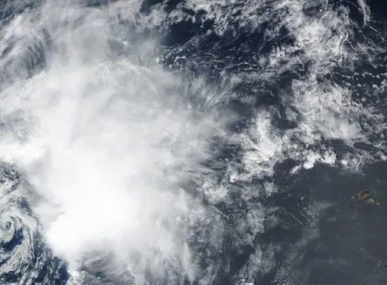
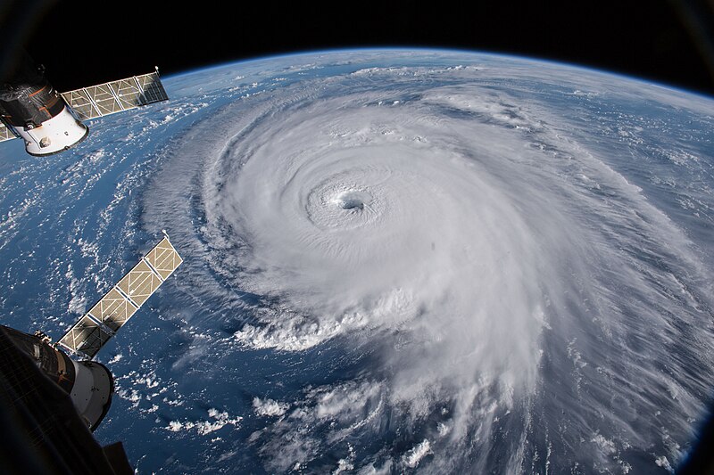
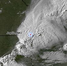
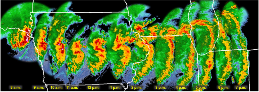
Another area where AI is making a significant impact is in the interpretation of weather satellite imagery. Traditional methods of analyzing satellite data can be time-consuming and prone to human error. However, AI-powered systems can quickly and accurately identify weather patterns and anomalies in satellite images, providing meteorologists with valuable insights into developing weather systems.

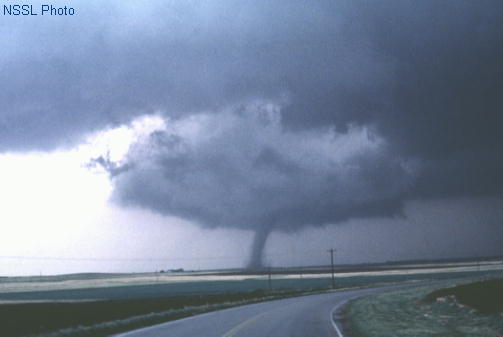
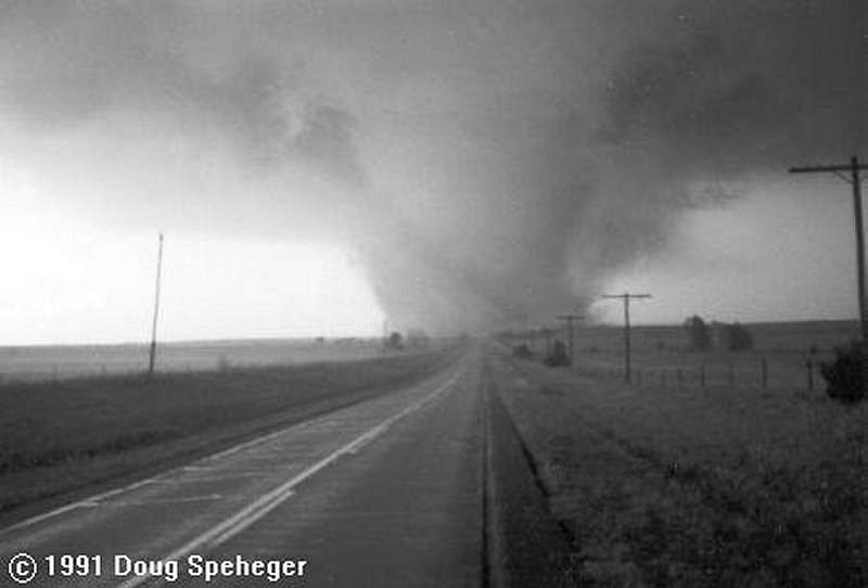
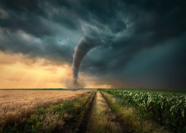
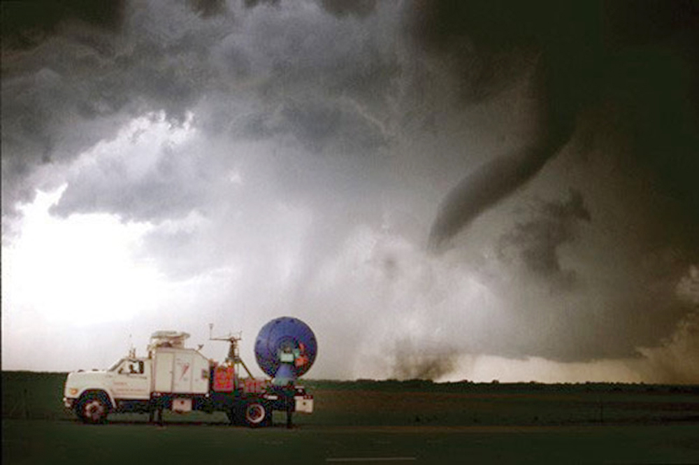
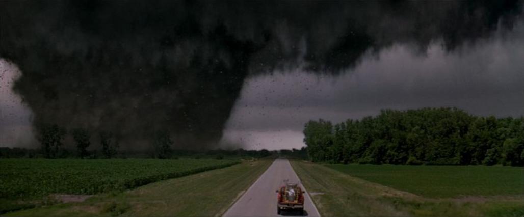
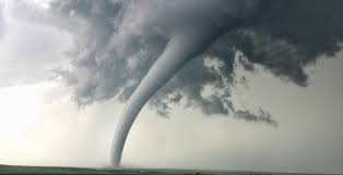
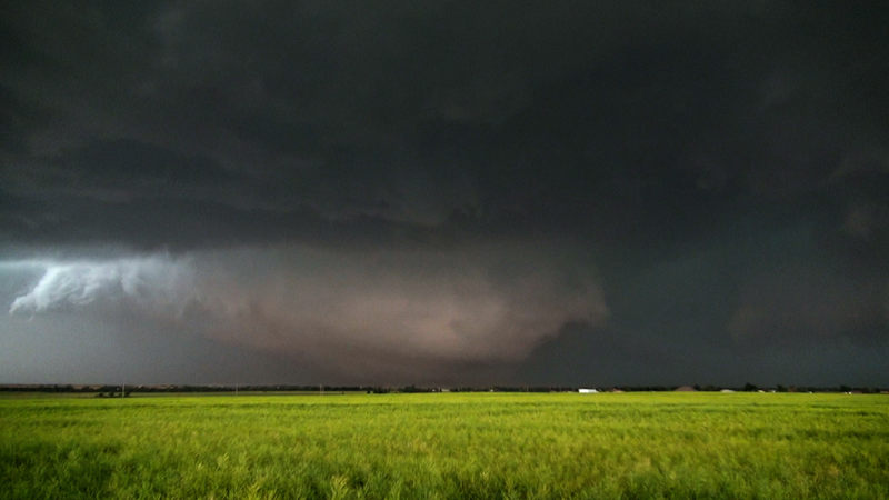
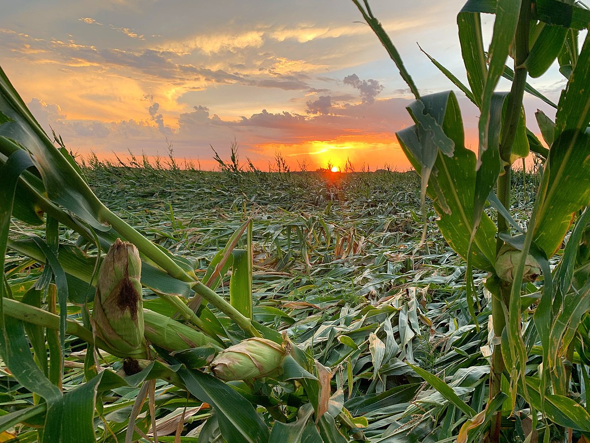
AI is also being used to improve the resolution and accuracy of weather models. By incorporating machine learning techniques, researchers can create more detailed and precise models that can simulate weather conditions down to the neighborhood level. This level of granularity can be particularly useful for predicting the impact of severe weather events, such as hurricanes and tornadoes, on specific communities.

In addition to improving the accuracy of weather forecasts, AI is also helping to make them more accessible and user-friendly. Many weather apps and websites now use AI-powered chatbots and virtual assistants to provide personalized weather information and alerts based on a user’s location and preferences. This can help individuals and businesses make more informed decisions about their daily activities and operations.

Title: The Future Potential of AI in Weather Forecasting: Building on Google’s GraphCast

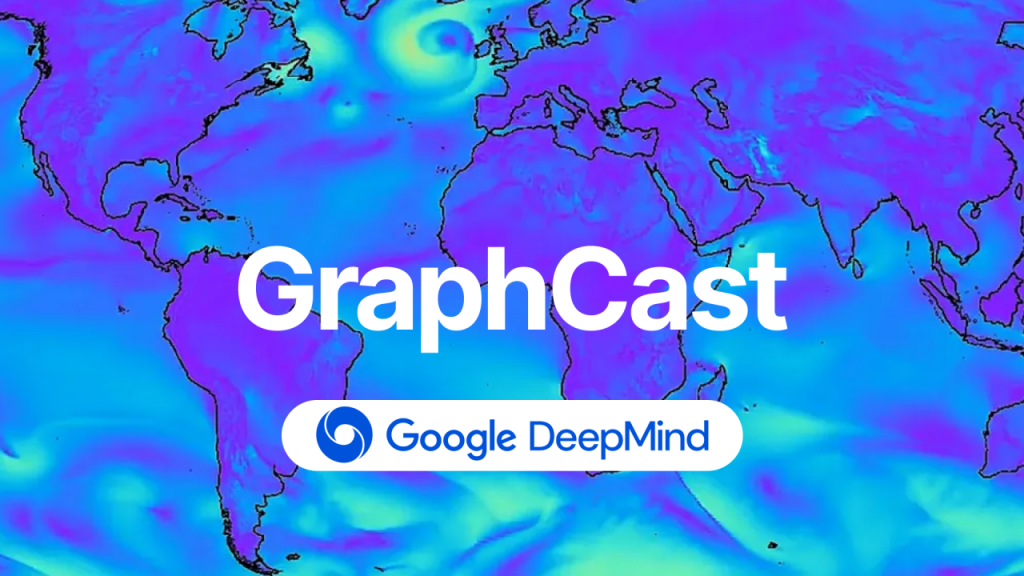
Google’s GraphCast represents a significant advancement in the field of weather forecasting, utilizing artificial intelligence (AI) and Graph Neural Networks (GNNs) to deliver highly accurate 10-day weather predictions in a fraction of the time required by traditional methods. This groundbreaking technology not only improves the accuracy and efficiency of weather forecasts but also demonstrates the potential for AI to revolutionize the field of meteorology.

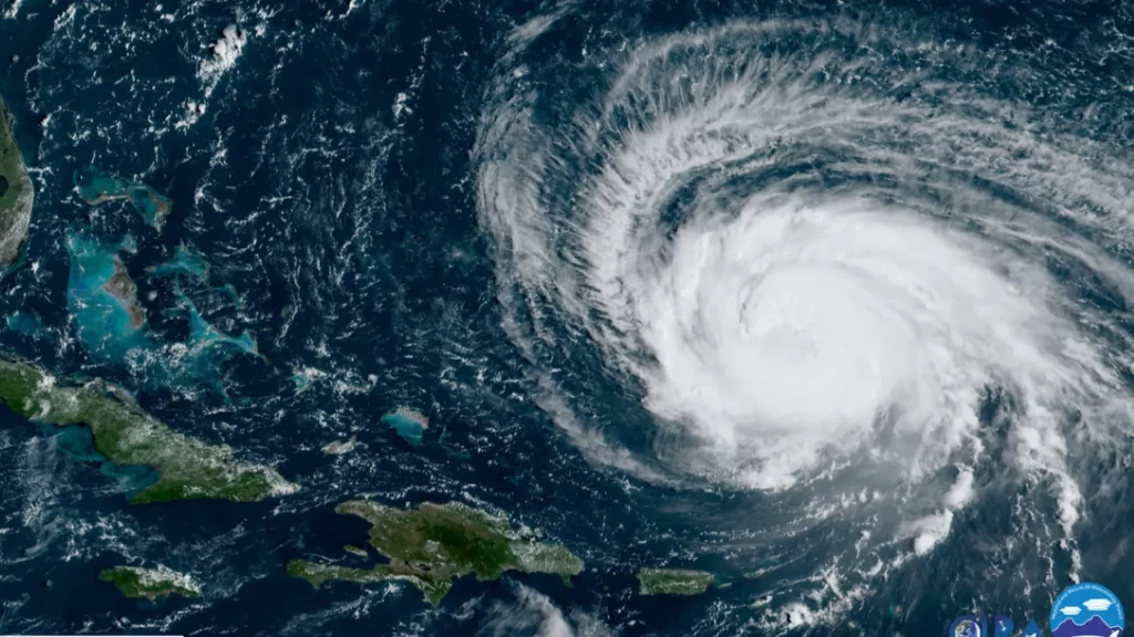
One of the most promising aspects of GraphCast is its ability to identify and predict extreme weather events, such as cyclones, atmospheric rivers, and heat waves, with greater accuracy and lead time than traditional forecasting models. This early warning capability could prove invaluable in saving lives and minimizing the impact of severe weather on communities. As AI continues to advance, it is likely that models like GraphCast will become even more adept at detecting and predicting these extreme events, allowing for better preparedness and response.

Looking to the future, the potential applications of AI in weather forecasting are vast. By building upon the foundation laid by GraphCast, researchers and meteorologists could develop even more sophisticated models that incorporate additional data sources, such as satellite imagery, radar, and weather station observations. These enhanced models could provide even greater accuracy and granularity in weather predictions, allowing for more localized and personalized forecasts. Additionally, AI could be used to develop long-term climate models, helping scientists better understand and predict the impacts of climate change on weather patterns and extreme events. As the world continues to grapple with the challenges posed by a changing climate, the insights provided by AI-powered weather and climate models will become increasingly critical in informing policy decisions and guiding adaptation and mitigation efforts.

Despite the many benefits of AI in weather forecasting, there are also some challenges and limitations to consider. One concern is the potential for AI systems to perpetuate biases or errors in historical weather data, leading to inaccurate predictions. Another challenge is the need for large amounts of high-quality data to train and validate AI models, which can be difficult and expensive to obtain.

Despite these challenges, the future of weather forecasting looks bright thanks to the continued advancement of AI technologies. As more data becomes available and AI algorithms become more sophisticated, we can expect to see even more accurate and detailed weather forecasts in the years to come. This will not only help us better prepare for and respond to severe weather events but also enable us to make more informed decisions about everything from agriculture to transportation to energy production.

A History of Storm Chasers and Storm Chasing

Storm Chasing: The Thrilling Pursuit of Nature’s Fury

Since the dawn of human civilization, storms have captivated and terrified us in equal measure. However, it wasn’t until the 20th century that a group of intrepid individuals began actively pursuing these meteorological marvels, giving birth to the exhilarating and often dangerous field of storm chasing.

Before the advent of modern storm chasing, the study of tornadoes and severe weather was a far cry from the sophisticated pursuit we know today. In the 1800s, the scientific understanding of these powerful natural phenomena was still in its infancy, and the concept of actively seeking out storms was virtually unheard of.

During this time, the primary sources of information about tornadoes were the accounts of those who had witnessed them firsthand. These eyewitness reports, often filled with vivid descriptions and harrowing tales of survival, laid the foundation for our early understanding of severe weather. One of the most famous accounts from this era is that of John Park Finley, a sergeant in the U.S. Army Signal Corps who became fascinated with tornadoes after surviving a close encounter in 1882.

Finley’s experience sparked a lifelong passion for studying severe weather, and he went on to become one of the most influential figures in the field. In 1884, he published the first comprehensive study of tornadoes in the United States, titled “Report on the Character of Six Hundred Tornadoes.” This groundbreaking work, which included detailed descriptions and classifications of tornadoes, served as a cornerstone for future research.

Despite the efforts of individuals like Finley, the scientific community of the 1800s was largely skeptical of the idea that tornadoes could be studied in a systematic way. Many believed that these powerful storms were too unpredictable and chaotic to be understood, and the notion of actively pursuing them was considered foolhardy at best.

However, this began to change in the late 1800s, as advances in technology and communication made it easier to track and study severe weather. The invention of the telegraph allowed for the rapid dissemination of weather reports, and the establishment of a national weather service in 1870 marked a significant step forward in the organized study of meteorology.

In the heart of Oklahoma, at Tinker Air Force Base, a groundbreaking event took place on March 25, 1948, that would forever change the course of severe weather forecasting. On this fateful day, a group of Air Force meteorologists, led by the visionary Captain Robert C. Miller and Major Ernest J. Fawbush, issued the world’s first tornado forecast. This remarkable achievement marked a turning point in our understanding of these powerful storms and paved the way for the development of modern storm chasing and severe weather research.

The events leading up to this historic moment were nothing short of extraordinary. Miller and Fawbush, both brilliant meteorologists, had been tasked with investigating the devastating tornado that struck Tinker Air Force Base on March 20, 1948, causing significant damage and injuring several personnel. As they pored over weather data and eyewitness accounts, the two men began to notice patterns and conditions that seemed to precede the formation of tornadoes. With a powerful cold front approaching and similar atmospheric conditions to the March 20th tornado in place, Miller and Fawbush made a bold decision: they would issue a tornado forecast for the following day.

The forecast, which was met with skepticism by some of their colleagues, proved to be remarkably accurate. On March 25, 1948, a tornado touched down just miles from Tinker Air Force Base, causing damage but no fatalities thanks to the advance warning provided by Miller and Fawbush’s forecast. This incredible success story quickly spread throughout the meteorological community, sparking a renewed interest in the study of tornadoes and severe weather. The Tinker Air Force Base breakthrough not only demonstrated the potential for tornado forecasting but also highlighted the critical importance of understanding these powerful storms. As a result, the field of storm chasing began to evolve, with a growing number of researchers and enthusiasts dedicating themselves to unlocking the secrets of nature’s fury.

The roots of storm chasing can be traced back to the 1950s when a handful of weather enthusiasts, armed with little more than their curiosity and a few rudimentary instruments, ventured out to observe storms up close. Among these early pioneers was David Hoadley, widely regarded as the father of storm chasing. Hoadley’s fascination with severe weather led him to found the Storm Track magazine in 1977, which became a bible for aspiring storm chasers.

Another notable figure in the history of storm chasing is Neil Ward, a meteorology professor at the University of Oklahoma. In the early 1970s, Ward began taking his students on field trips to observe severe weather, laying the groundwork for what would eventually become a thriving research community. His work paved the way for future scientists to study storms in their natural environment, leading to significant advancements in our understanding of severe weather.

The 1980s saw a surge in the popularity of storm chasing, thanks in part to the advent of Doppler radar and the increasing availability of portable video cameras. This decade also witnessed the rise of some of the most iconic figures in storm chasing history, including Tim Marshall, Gene Moore, and the late Al Moller. These individuals, along with many others, helped to establish storm chasing as a legitimate field of study and a thrilling pursuit for adventure seekers.

One of the most significant milestones in storm chasing history occurred on April 26, 1991, when a group of chasers, including Tim Marshall and Gene Moore, captured the first-ever footage of a tornado from start to finish. This groundbreaking achievement not only provided scientists with invaluable data but also sparked a renewed interest in storm chasing among the general public.

The 1990s and early 2000s saw storm chasing enter the mainstream, with the release of popular films like “Twister” and the rise of television shows dedicated to severe weather. This increased visibility brought with it a new generation of storm chasers, eager to experience the thrill of the chase and contribute to our understanding of these awe-inspiring natural phenomena.

As we entered the 21st century, storm chasing underwent a dramatic transformation, fueled by rapid advancements in technology, improved forecasting models, and a growing public fascination with severe weather. The period from 2000 to 2024 saw an explosion in the popularity of storm chasing, with a new generation of chasers pushing the boundaries of what was possible in the pursuit of nature’s fury.

One of the most significant developments during this time was the rise of high-resolution weather models and the increasing availability of mobile weather radar applications. These tools allowed storm chasers to track and predict the movement of storms with unprecedented accuracy, revolutionizing the way they approached their craft. No longer were chasers reliant on radio reports or their own intuition to guide them; now, they could access real-time data and detailed forecasts at the touch of a button. This technological leap forward not only made storm chasing safer and more efficient but also opened up the field to a wider range of participants, from seasoned researchers to amateur enthusiasts.

The 2000s also saw the emergence of a new breed of storm chaser, epitomized by the likes of Reed Timmer. Timmer, a meteorologist and extreme storm chaser, gained notoriety for his daring exploits and his custom-built armored vehicle, designed to withstand the forces of even the most violent tornadoes. His adventures, along with those of other extreme chasers, captured the public’s imagination and helped to fuel a growing interest in storm chasing as a recreational pursuit. The launch of the Discovery Channel’s “Storm Chasers” television series in 2007 further cemented the popularity of storm chasing, bringing the thrills and dangers of the chase into living rooms across the country.

Today, storm chasing remains a vital tool for researchers seeking to unravel the mysteries of severe weather. While technology has advanced significantly since the early days of Hoadley and Ward, the spirit of adventure and the desire to witness nature’s raw power continue to drive storm chasers to pursue their passion. As climate change contributes to an increasing frequency and intensity of severe weather events, the work of these dedicated individuals has never been more important.

Choosing the Best Tornado Tour Company: A Guide for New Storm Chasers

If you’re an adventurous soul looking to witness the raw power of nature up close, a tornado tour might be just the thrill you’re seeking. However, with numerous companies offering storm chasing experiences, it’s important to choose a reputable and experienced outfit to ensure your safety and satisfaction. We’ll guide you through the process of selecting the best tornado tour company and provide a list of well-known operators along with their website addresses.

Factors to Consider When Choosing a Tornado Tour Company:

  1. Experience and expertise: Look for companies with experienced guides who have a proven track record of successfully navigating severe weather conditions. Ensure that the guides are knowledgeable about meteorology and have the necessary skills to keep you safe.
  2. Safety measures: Your chosen company should prioritize safety above all else. Inquire about their safety protocols, emergency procedures, and the equipment they use to monitor and track storms.
  3. Group size: Smaller group sizes often lead to a more personalized experience and better access to the guides. Consider the company’s maximum group size and whether it aligns with your preferences.
  4. Tour duration and itinerary: Tornado tours can vary in length from a single day to a week or more. Consider your availability and the specific areas you’d like to explore when choosing a tour duration and itinerary.
  5. Reviews and testimonials: Read reviews and testimonials from previous clients to gauge the company’s reputation and the quality of their tours. Look for consistent positive feedback and how the company responds to any negative reviews.

Top Tornado Tour Companies:

1.Tempest Tours
Website: https://tempesttours.com/
Tempest Tours has been offering storm chasing expeditions since 2000 and is known for their experienced guides and commitment to safety.

    2. Silver Lining Tours
    Website: https://www.silverliningtours.com/
    With over 20 years of experience, Silver Lining Tours provides educational and thrilling storm chasing adventures across Tornado Alley.

      3. Storm Chasing Adventure Tours
      Website: https://stormchasing.com/
      Storm Chasing Adventure Tours offers a variety of tour options, from single-day excursions to week-long expeditions, led by experienced meteorologists and storm chasers.

        4. Extreme Tornado Tours
        Website: https://extremetornadotours.com/
        Extreme Tornado Tours specializes in small-group tours led by seasoned storm chasers, ensuring a personalized and immersive experience.

          5. Cloud 9 Tours
          Website: https://cloud9tours.com/
          Cloud 9 Tours offers both storm chasing and photography-focused tours, catering to those who want to capture the beauty and power of severe weather.

            Storm chasing tornado tours offer a unique and exhilarating experience for thrill-seekers and weather enthusiasts alike. These guided adventures take participants on a journey into the heart of Tornado Alley, where they witness the awe-inspiring power of nature firsthand. Experienced storm chasers lead the tours, using their expertise in meteorology and forecasting to navigate the group towards active storms. Participants can expect to spend long hours on the road, tracking weather patterns and chasing down potential tornado outbreaks. When a tornado does form, the rush of adrenaline is unparalleled as the group carefully positions themselves at a safe distance to observe the twisting vortex.

            However, storm chasing is not without its risks. Tornadoes are unpredictable and can change course or intensify rapidly, putting chasers in danger if they are not careful. Flying debris, hail, and strong winds can also pose a threat to safety. Storm chasing tour companies prioritize the well-being of their clients, but participants must be aware of the inherent dangers and follow instructions closely. Choose a reputable company with experienced guides who prioritize safety above all else. Participants should also be prepared for the physical demands of the tour, as it often involves long periods of driving and potentially rough terrain. Storm chasing is endless driving and sometimes you won’t see much so you have to be prepared to be on the road for up to 10 days.

            Despite the risks, the benefits of a storm chasing tornado tour are significant for those who crave adventure and have a deep appreciation for the power of nature. Witnessing a tornado up close is a once-in-a-lifetime experience that few people have the opportunity to enjoy. Storm chasing tours provide a controlled environment for this experience, with knowledgeable guides who can help participants understand the science behind the storms. Additionally, the tours often foster a sense of camaraderie among participants, as they bond over their shared passion for weather and adventure. For many, the thrill of the chase and the incredible photographs and memories they capture make the risks worthwhile.

            Tornado Forecasting Checklist

            Tornado Forecasting Checklist:

            1. Analyze the synoptic-scale environment:
            • Identify the location and strength of the jet stream:
              • Strong upper-level jet stream (>75 knots) with divergence aloft
              • Jet streak positioning favorable for upper-level support
            • Determine the position and intensity of upper-level troughs and ridges:
              • Negatively tilted trough or closed low approaching the region
              • Difluence in the upper-level wind field
            • Assess the presence and strength of low-level and upper-level wind shear:
              • 0-6 km bulk shear >40 knots
              • 0-1 km storm-relative helicity (SRH) >150 m²/s²
              • 0-3 km SRH >250 m²/s²
            • Evaluate the potential for moisture advection and instability:
              • Moisture pooling with dew points >60°F (15°C)
              • Steep mid-level lapse rates (>6.5°C/km in the 700-500 mb layer)
            1. Assess thermodynamic instability:
            • Analyze soundings for the presence of a “loaded gun” profile:
              • Steep lapse rates in the lowest 3 km of the atmosphere
              • High moisture content in the lower levels (dew points >60°F or 15°C)
              • Strong vertical wind shear (0-6 km bulk shear >40 knots)
            • Calculate convective available potential energy (CAPE) and convective inhibition (CIN):
              • Surface-based CAPE (SBCAPE) >1500 J/kg
              • Mixed-layer CAPE (MLCAPE) >1000 J/kg
              • CIN <50 J/kg
            • Determine the lifted condensation level (LCL) and the level of free convection (LFC):
              • LCL heights <1500 meters AGL
              • LFC heights <2500 meters AGL
            • Evaluate the potential for convective initiation:
              • Presence of a lifting mechanism (frontal boundary, dryline, outflow boundary, etc.)
              • Daytime heating and destabilization of the boundary layer
            1. Identify mesoscale features:
            • Locate frontal boundaries, drylines, and outflow boundaries:
              • Strong moisture gradients and wind shifts along boundaries
              • Confluence and convergence along boundaries
            • Assess the strength and orientation of low-level convergence and upper-level divergence:
              • Surface convergence >10⁻⁴ s⁻¹
              • Upper-level divergence >10⁻⁵ s⁻¹
            • Determine the presence and strength of low-level jets and their role in moisture transport and wind shear:
              • Low-level jet (LLJ) with winds >30 knots at 850 mb
              • LLJ oriented perpendicular to the frontal boundary or dryline
            • Evaluate the potential for mesoscale convective systems (MCSs) and supercell thunderstorms:
              • Presence of a “tail-end Charlie” or “pendant” echo on radar
              • Discrete supercell thunderstorms with strong rotation and hook echoes
            1. Consider composite parameters:
            • Significant Tornado Parameter (STP) >1
            • Supercell Composite Parameter (SCP) >4
            • Energy Helicity Index (EHI) >2
            • Vorticity Generation Parameter (VGP) >0.2

            When analyzing soundings for the presence of a “loaded gun” profile, look for the following characteristics:

            1. Steep lapse rates in the lowest 3 km of the atmosphere:
            • Lapse rates should be close to or exceed dry adiabatic (9.8°C/km)
            • Steep lapse rates indicate a highly unstable lower atmosphere
            • This instability allows for rapid vertical acceleration of air parcels, which is crucial for the development of strong updrafts in thunderstorms
            1. High moisture content in the lower levels:
            • Look for dew points greater than 60°F (15°C) in the lowest 1-2 km of the atmosphere
            • High dew points indicate an abundance of moisture, which fuels thunderstorm development and can lead to greater instability
            • Moist air in the lower levels also contributes to lower cloud bases and a greater potential for tornadoes to reach the ground
            1. Strong vertical wind shear:
            • 0-6 km bulk shear should exceed 40 knots
            • Strong vertical wind shear is essential for the development of rotating updrafts (mesocyclones) in supercell thunderstorms
            • The change in wind speed and direction with height helps to create a horizontally rotating column of air, which can be tilted vertically by the updraft, leading to the formation of a mesocyclone
            1. Capping inversion:
            • Look for the presence of a capping inversion, typically characterized by a layer of warm, dry air aloft
            • The capping inversion acts as a “lid” on the atmosphere, preventing the premature release of instability
            • This allows for the buildup of energy (CAPE) and moisture in the lower levels, which can be explosively released when the cap is broken, leading to rapid thunderstorm development
            1. Dry air intrusion in the mid-levels:
            • Look for evidence of dry air in the mid-levels of the atmosphere (typically around 700-500 mb)
            • Dry air in the mid-levels can enhance the potential for strong downdrafts and the development of rear-flank downdrafts (RFDs) in supercell thunderstorms
            • RFDs play a crucial role in the formation and intensification of tornadoes by providing additional rotation and convergence near the surface

            The Ultimate Guide to Becoming a Storm Chaser

            Storm chasing demands more than just a sense of adventure; it requires a solid foundation in meteorology. This section equips aspiring chasers with the essential knowledge to understand the weather phenomena they’ll encounter.

            Demystifying the Atmosphere:

            • Atmospheric Layers: Our atmosphere isn’t a uniform blanket; it’s layered. The troposphere, closest to the Earth, is where most weather happens due to its temperature and pressure variations. Above it lies the stratosphere, home to the ozone layer, and beyond that, further layers with decreasing air density. Understanding these layers helps grasp how weather systems form and move.
            • Atmospheric Pressure: Air pressure, the weight of the air above us, is a key weather driver. High-pressure systems generally bring fair weather, while low-pressure systems often lead to clouds and precipitation. The interaction between these systems generates wind, and their movement dictates weather patterns.
            • Temperature and Moisture: These two factors are critical for storm formation. Warm, moist air is less dense and tends to rise, creating instability. As it rises, it cools and condenses, forming clouds and potentially precipitation. The amount of moisture in the air, known as humidity, influences how much energy is available for storms to develop.

            Decoding Thunderstorms:

            • Thunderstorm Recipe: Thunderstorms need four key ingredients: instability (warm, moist air near the surface and cooler air aloft), lift (a mechanism to force air upwards), moisture (fuel for cloud and rain formation), and wind shear (changing wind speed and direction with height, which helps storms organize and sustain themselves).
            • Thunderstorm Varieties: Not all thunderstorms are created equal. Single-cell storms are brief and isolated, while multi-cell storms are clusters of cells that can produce heavy rain, hail, and strong winds. Supercells, the most intense type, have a rotating updraft and can spawn tornadoes, large hail, and damaging winds.
            • Thunderstorm Anatomy: Visualize a thunderstorm as a towering engine. The updraft is the rising column of warm, moist air that fuels the storm. The downdraft is the cool air and precipitation descending from the storm. The anvil cloud is the flat, spreading top of the storm, and the flanking line is a line of developing cells feeding into the main updraft. Recognizing these features helps assess a storm’s stage and potential severity.

            Tornado Genesis:

            • Supercells and Tornadoes: While not all supercells produce tornadoes, most significant tornadoes come from them. Look for a rotating wall cloud, a lowered area of the storm base with persistent rotation, as a sign that a tornado might form.
            • Tornado Life Cycle: A tornado starts as a funnel cloud extending from the storm base. As it reaches the ground, it becomes a tornado. The mature stage is when the tornado is at its strongest, and it eventually dissipates as the storm weakens or the updraft loses its rotation.
            • Tornado Intensity Scale: The Enhanced Fujita (EF) scale rates tornadoes from EF0 (weakest) to EF5 (strongest) based on the damage they cause. Understanding this scale helps assess the potential danger and provides a common language for describing tornado intensity.

            Tools of the Trade:

            • Weather Radar and Satellite Imagery: Radar shows precipitation intensity, storm structure, and rotation, while satellite imagery provides a broader view of cloud patterns and storm systems. Look for hook echoes on radar, a telltale sign of a rotating mesocyclone, and towering cumulonimbus clouds on satellite images, indicating strong updrafts and potential severe weather.
            • Surface Observations and Weather Maps: Analyze surface observations to identify areas of converging winds, temperature and dew point spreads, and pressure falls, all of which can signal storm development. Weather maps depicting fronts, pressure systems, and wind patterns help predict where storms are likely to form and track.
            • Storm Spotter Reports: Trained storm spotters provide real-time ground truth of hail size, wind damage, and tornado sightings. These reports are invaluable for confirming radar-indicated threats and providing situational awareness during a chase.

            With a foundational understanding of meteorology, you’re ready to delve into the practical aspects of storm chasing. This section will guide you through the steps involved in planning and executing a safe and successful storm chase.

            Preparation is Key:

            • Target Selection: Based on the meteorological factors discussed in Section 1, identify a target area with a high probability of severe weather development. Utilize forecasting tools such as weather models, radar imagery, and surface observations to pinpoint potential hotspots for thunderstorm and tornado formation.
            • Route Planning: Plan your route carefully, considering road networks, potential escape routes, and areas with good visibility of the sky. Be aware of potential hazards such as low-lying areas prone to flooding, and avoid chasing in urban areas where visibility and maneuverability are limited.
            • Vehicle and Equipment: Ensure your vehicle is reliable and in good condition, with a full tank of gas. Essential equipment includes a GPS navigation system, a laptop or tablet with internet access for real-time weather data, a two-way radio for communication, and a camera for documentation.
            • Safety First: Chasing storms inherently involves risks. Always prioritize your safety and the safety of others. Have a plan for seeking shelter in case of a tornado warning, and be aware of lightning dangers. Never attempt to outrun a tornado or drive through flooded roadways.

            The Chase is On:

            • Positioning: Once you’ve reached your target area, position yourself for optimal viewing and intercept of the developing storms. Look for visual cues such as towering cumulonimbus clouds, rotating wall clouds, and inflow bands (lines of clouds feeding into the storm).
            • Visual Observations: While radar and other technological tools are valuable, visual observations remain crucial. Pay attention to the storm’s structure, movement, and any signs of rotation or tornado development.
            • Communication and Collaboration: Maintain communication with other chasers or spotters in the area to share information and coordinate observations. Collaboration enhances situational awareness and helps ensure safety during the chase.
            • Documentation: If conditions allow, document the storm’s evolution through photos and videos. This documentation serves as a valuable record of the event and can contribute to scientific research and understanding of severe weather.

            Ethics and Responsibility:

            • Respect Private Property: Always seek permission before entering private property. Avoid blocking roadways or interfering with emergency responders.
            • Minimize Environmental Impact: Leave no trace of your presence. Dispose of waste properly and avoid disturbing wildlife or vegetation.
            • Responsible Reporting: If you witness a tornado or other severe weather event, report it to the National Weather Service or local authorities to ensure timely warnings are issued.

            Staying ahead of the storm requires access to reliable weather data and forecasting tools. Here’s a list of websites and apps that will empower your storm chasing endeavors:

            Government and Official Sources:

            • National Weather Service (weather.gov): The cornerstone of weather information, the NWS provides forecasts, warnings, and radar data for the entire United States. Check local forecasts, severe weather outlooks, and real-time radar imagery to stay informed about potential threats.
            • Storm Prediction Center (spc.noaa.gov): The SPC is your go-to source for convective outlooks, mesoscale discussions, and watches for severe thunderstorms and tornadoes. These resources offer valuable insights into the potential for severe weather and the areas at highest risk.
            • National Hurricane Center (nhc.noaa.gov): For those chasing tropical cyclones, the NHC is indispensable. Get the latest hurricane forecasts, tracks, and potential impacts, ensuring you’re well-prepared during hurricane season.

            Radar and Satellite Imagery:

            • College of DuPage NEXLAB (weather.cod.edu): NEXLAB grants access to real-time and archived weather radar data, including super-resolution imagery and storm-tracking tools. Dive deeper into storm structure and evolution with this comprehensive resource.
            • RadarScope (radarscope.com): A favorite among chasers, RadarScope provides real-time radar data with advanced features. Track storm cells, analyze velocity data, and utilize hail detection algorithms to gain a comprehensive understanding of storm dynamics.

            Weather Models and Forecasting Tools:

            • Pivotal Weather (pivotalweather.com): Access a suite of weather models, including the GFS and NAM, along with analysis tools and forecast discussions. Pivotal Weather helps you understand the broader atmospheric patterns influencing storm development.
            • WeatherBell Analytics (weatherbell.com): Explore a variety of weather models, forecast maps, and analysis tools, with premium options for more in-depth forecasts. WeatherBell provides insights into the synoptic-scale setup conducive to severe weather.

            Mobile Apps:

            • Predict Now (iOS): The ultimate app for serious weather enthusiasts and chasers. Predict Now provides access to:
            • High-resolution radar data
            • NSSL WRF and HRRR weather models
            • GOES-16 satellite imagery
            • Mesoanalysis tools
            • NCEP surface fronts and analysis
            • NAM 3km model data
            • SPC outlooks and mesoanalysis
            • Surface observations
            • Forecast soundings

            Community and Educational Resources:

            • Stormtrack Website and Forum (stormtrack.org): Access a wealth of information, discussions, and forecasts from experienced chasers and meteorologists. The Stormtrack forum is a valuable platform for learning and sharing knowledge about severe weather.
            • Facebook Groups: Numerous Facebook groups dedicated to storm chasing and weather offer opportunities to connect with other enthusiasts, share observations, and learn from the experiences of others.

            Additional Resources:

            • Spotter Network (spotternetwork.org): This platform allows you to share and access real-time storm reports from trained spotters, providing valuable ground truth information during a chase.

            Twister’s Tornadoes: A Triumph of Special Effects and Practical Magic

            Twister’s depiction of tornadoes was groundbreaking for its time, setting a new standard for realism in disaster films. The film’s success in portraying these destructive forces was a result of a combination of innovative special effects techniques and clever practical methods.

            CGI and Digital Effects:

            • Early Use of CGI: Twister was one of the early films to extensively utilize computer-generated imagery (CGI) to create realistic tornadoes. Industrial Light & Magic (ILM), renowned for their special effects work, used CGI to generate the tornadoes’ funnel clouds, debris fields, and swirling winds. The CGI tornadoes were carefully modeled based on real-world observations and meteorological data, ensuring a level of accuracy that was previously unseen in films.
            • Particle Systems: ILM employed advanced particle systems to simulate the debris fields within the tornadoes. Thousands of individual particles, representing various types of debris, were animated and rendered to create the chaotic and swirling appearance of a tornado’s destructive path.

            Practical Effects:

            • Debris cannons and wind machines: To complement the CGI effects, the filmmakers utilized a variety of practical effects to create a sense of realism and immersion. Debris cannons were used to launch objects into the air, simulating the flying debris often associated with tornadoes. Powerful wind machines generated strong gusts, adding to the chaotic atmosphere and making the actors’ performances more believable.
            • Full-Scale Sets: The production team built full-scale sets of houses, barns, and other structures, which were then subjected to the forces of wind machines and debris cannons to create realistic destruction sequences. These practical effects provided a tangible sense of the tornadoes’ destructive power and added depth to the film’s visual effects.

            Realism and Accuracy:

            • Collaboration with Meteorologists: The filmmakers consulted with meteorologists and storm chasers to ensure a level of accuracy in portraying tornadoes and the experience of chasing them. This collaboration helped to inform the film’s visual effects and the depiction of storm chasing procedures and equipment.
            • Accurate Depiction of Tornado Behavior: Twister accurately captures several aspects of tornado behavior, including their unpredictable movements, the formation of multiple vortices, and the destructive power of their winds. The film also highlights the dangers associated with tornadoes and the importance of seeking shelter when a tornado warning is issued.

            Tornadoes of Twister:

            • The Finger of God: The first major tornado encounter occurs when the team chases a large twister nicknamed “The Finger of God.” This scene showcases the tornado’s immense size and its ability to level structures in its path. The team deploys their research equipment, Dorothy, but it is destroyed before it can collect any data.
            • The Drive-In Tornado: In a visually striking scene, a tornado tears through a drive-in movie theater, tossing cars and debris through the air. The scene highlights the chaotic and unpredictable nature of tornadoes, as well as the danger they pose to anyone caught in their path.
            • The Greenage Tornado: The team encounters a massive wedge tornado near the town of Greenage. This scene is particularly memorable for its depiction of the tornado’s multiple vortices, showcasing the complex structure of these storms. The team successfully deploys Dorothy within the tornado, but it is ripped apart by the extreme winds.
            • The Final Chase: The climax of the film involves a chase with a violent F5 tornado. This scene features some of the most intense and destructive tornado footage in the movie, with houses being completely obliterated and debris swirling through the air. The team finally succeeds in deploying Dorothy within the tornado, collecting valuable data before being caught in the storm’s path.

            The El Reno Tornado: A Colossus on the Oklahoma Plains – May 31, 2013

            The late afternoon of May 31, 2013, witnessed the birth of a meteorological monster on the open plains west of Oklahoma City – the El Reno tornado. This colossal twister, eventually reaching a staggering 2.6 miles wide, etched its name in history as the widest tornado ever recorded. Its immense size and erratic behavior posed a significant challenge for storm chasers and researchers, ultimately claiming the lives of three experienced storm chasers who were caught in its unpredictable path.

            The day began with a heightened sense of awareness among meteorologists and storm chasers. The Storm Prediction Center had issued a high-risk warning for severe weather, highlighting the potential for strong, long-track tornadoes across central Oklahoma. As the afternoon progressed, supercell thunderstorms began to develop, their towering structures visible from miles away. Among these storms, one particular supercell exhibited ominous signs of rotation and quickly became the focus of attention.

            At approximately 6:03 pm, the El Reno tornado touched down, initially as a relatively narrow funnel. However, it rapidly intensified and expanded, growing wider and wider as it churned across the open landscape. The tornado’s erratic movements and multiple vortices made it difficult to track and predict, posing a significant danger to those in its path.

            Caught in the Colossus: Stories of Impact and Loss

            The El Reno tornado’s unpredictable nature and immense size had a profound impact on those who encountered it, including experienced storm chasers and researchers who dedicated their lives to understanding these powerful storms.

            • TWISTEX Team: The TWISTEX (Tactical Weather Instrumented Sampling in/near Tornadoes Experiment) team, a group of researchers studying tornadoes, was caught in the path of the El Reno tornado. Their vehicle was tossed by the tornado’s winds, resulting in injuries to several team members and tragically claiming the life of renowned storm chaser Tim Samaras, his son Paul Samaras, and fellow chaser Carl Young.
            • Other Storm Chasers: Several other storm chasers had close encounters with the El Reno tornado, capturing dramatic footage of the twister’s immense size and erratic movements. Many experienced the dangers of chasing such a large and unpredictable tornado firsthand, highlighting the risks associated with this activity.
            • Record-Breaking Width: At its peak, the El Reno tornado reached a staggering width of 2.6 miles, making it the widest tornado ever recorded. This immense size is attributed to the presence of multiple vortices within the parent circulation, effectively creating a massive wedge tornado with a broad damage path. The sheer width of the tornado made it difficult to perceive its full extent from the ground, leading to challenges in tracking and warning for its path.
            • Fluctuating Intensity: The El Reno tornado exhibited rapid fluctuations in intensity, ranging from EF3 to EF5 on the Enhanced Fujita scale. This variation in strength is a characteristic of many large tornadoes and is influenced by the complex dynamics of the storm’s updraft and the inflow of air feeding the tornado. The tornado’s multiple vortices also likely contributed to its fluctuating intensity, as each subvortex could possess varying degrees of strength.
            • Damage Indicators: Despite its immense size and fluctuating intensity, the El Reno tornado’s damage path was primarily rated EF3. This is because the tornado traversed mostly rural areas with few structures to serve as damage indicators. However, the few structures that were impacted sustained significant damage, indicative of the tornado’s potential for greater destruction had it tracked through a more densely populated area.
            • Reed Timmer and the Dominator Team: Veteran storm chaser Reed Timmer and his Dominator team were in close proximity to the El Reno tornado, capturing dramatic footage of its rapid expansion and erratic movements. They experienced the tornado’s powerful winds firsthand as their armored vehicle, the Dominator, was buffeted and pushed off the road. Timmer described the experience as “the most intense moment of my storm chasing career,” highlighting the sheer power and danger of the El Reno tornado.
            • Mike Bettes and The Weather Channel Team: The Weather Channel team, led by meteorologist Mike Bettes, was also chasing the El Reno tornado. Their SUV was caught in one of the tornado’s subvortices and thrown 200 yards, resulting in injuries to the team members. Bettes later recounted the experience as a “life-changing event” that underscored the unpredictable nature of tornadoes and the importance of safety precautions when chasing storms.

            The Joplin Tornado: A Monster Tears Through the Heart of America – May 22, 2011

            The afternoon of May 22, 2011, etched itself into the annals of American history as a monstrous EF5 tornado, the highest rating on the Enhanced Fujita scale, ripped through the city of Joplin, Missouri. This catastrophic event left a trail of devastation, claiming 158 lives and injuring over 1,000 people. The tornado, with winds exceeding 200 mph, carved a path of destruction a mile wide and 13 miles long, reducing homes to splinters, tossing cars like toys, and leaving the landscape scarred beyond recognition.

            The day began with a sense of foreboding. The Storm Prediction Center had issued a high-risk warning for severe weather, highlighting the potential for strong, long-track tornadoes across the Midwest. As the afternoon progressed, supercell thunderstorms began to develop, their towering structures visible from miles away. At approximately 5:41 pm, the devastating tornado touched down on the western edge of Joplin, near the intersection of 20th Street and Schifferdecker Avenue.

            The tornado rapidly intensified as it moved eastward, growing in size and strength. It tore through residential areas, commercial districts, and St. John’s Regional Medical Center, leaving a path of unimaginable destruction in its wake. The hospital, a beacon of hope and healing, suffered a direct hit, its windows shattered, roof ripped off, and interior ravaged by the ferocious winds.

            • Homes Obliterated: Approximately 7,500 homes were damaged or destroyed, leaving nearly a third of the city’s residents displaced. Entire neighborhoods were flattened, with houses reduced to piles of debris. Personal belongings were scattered for miles, a poignant reminder of the lives disrupted and the memories lost.
            • Businesses Battered: The tornado’s path included the city’s main commercial district, leaving countless businesses in ruins. The Joplin Plaza Shopping Center and the nearby Walmart Supercenter were severely damaged, their structures mangled beyond recognition. Smaller businesses, the lifeblood of the local economy, also suffered immensely, facing the daunting challenge of rebuilding and recovering.
            • Schools Shattered: Joplin High School, a symbol of community pride and academic excellence, was directly in the tornado’s path. The building suffered extensive damage, with entire sections of the roof torn off and walls caved in. Several other schools, including elementary and middle schools, also sustained significant damage, disrupting the education of thousands of students.
            • Landmark Losses: The iconic St. John’s Regional Medical Center, a cornerstone of the community’s healthcare system, was severely impacted. The tornado ripped through the building, shattering windows, collapsing walls, and compromising the structural integrity of the entire facility. The hospital was rendered inoperable, forcing the evacuation and relocation of patients and staff.
            • Infrastructure Incapacitated: The tornado’s impact extended beyond buildings and homes, crippling essential infrastructure. Power lines were downed, leaving thousands without electricity for days and weeks. Communication systems were disrupted, making it difficult for residents to connect with loved ones and emergency services. The city’s water supply and sewage systems were also damaged, posing public health concerns.
            • Trees Toppled and Debris Everywhere: The landscape of Joplin was dramatically altered, with thousands of trees uprooted and stripped bare. The debris from destroyed buildings, vehicles, and personal belongings was scattered across the city, creating a scene of utter devastation. The sheer volume of debris posed a significant challenge for recovery efforts, requiring a massive cleanup operation.

            The meteorological factors that contributed to the Joplin tornado were complex and multifaceted. A strong low-pressure system over the Great Plains provided the necessary lift for thunderstorm development. Abundant moisture streaming north from the Gulf of Mexico fueled the storms, while a strong jet stream aloft provided the wind shear needed for rotation. These ingredients, combined with the unstable atmosphere, created the perfect environment for the development of supercell thunderstorms and the potential for violent tornadoes.

            The specific dynamics of the Joplin tornado were particularly noteworthy. The storm exhibited a phenomenon known as a “hook echo” on radar, a telltale sign of a rotating thunderstorm capable of producing a tornado. Additionally, the storm’s updraft, the column of rising air that feeds the thunderstorm, was exceptionally strong, allowing the tornado to maintain its intensity and longevity.

            As the tornado moved through Joplin, it displayed characteristics of multiple vortices, smaller tornadoes rotating within the larger parent circulation. This phenomenon, known as a multi-vortex tornado, contributes to the extreme damage often observed with EF5 tornadoes.

            • Total Estimated Damage: $2.8 billion
            • Residential Losses:
              • 7,500 homes damaged or destroyed
              • Insurance claims for residential property exceeding $2 billion
            • Commercial Losses:
              • 500+ businesses impacted
              • Estimated $500 million in commercial property damage
              • Significant job losses due to business closures
            • Public Infrastructure Damage:
              • $150 million in damage to public infrastructure (including schools, hospitals, government buildings)
              • Extensive damage to roads, bridges, and utilities
            • Debris Removal:
              • Over 4 million cubic yards of debris generated
              • Estimated $150 million in debris removal costs
            • Recovery and Rebuilding:
              • Long-term reconstruction costs exceeding $1 billion
              • Ongoing expenses related to community redevelopment and economic revitalization

            The Midwest Derecho: An Unforgettable Tempest’s Trail of Wind Destruction (August 10, 2020)

            The date August 10, 2020, is etched in the memories of millions across the Midwest, a day when the skies unleashed a tempest of unimaginable fury. A derecho, a powerful and expansive windstorm, ripped through the heartland, leaving a trail of devastation that stretched from South Dakota to Ohio. This wasn’t just a storm; it was a meteorological monster, its ferocity exceeding expectations and its impact leaving communities reeling in its wake.

            The storm’s genesis lay in the atmospheric instability brewing over South Dakota and Nebraska. Thunderstorms erupted, fueled by a potent mix of warm, moist air and strong upper-level winds. These storms, initially isolated, began to coalesce into a line, forming a squall line, a telltale sign of a developing derecho. This line of storms, propelled by the jet stream, raced eastward at speeds exceeding 70 mph, evolving into a meteorological juggernaut.

            Iowa found itself directly in the derecho’s path, bearing the brunt of its wrath. Wind gusts of up to 140 mph, equivalent to a Category 4 hurricane, tore through cities and towns. Cedar Rapids, a city of over 130,000, was particularly devastated. The winds, relentless and unforgiving, peeled roofs off buildings, tossed vehicles like rag dolls, and uprooted centuries-old trees. The city’s landscape was transformed into a scene of utter chaos, with debris littering the streets and power lines dangling precariously.

            The derecho’s impact extended far beyond Cedar Rapids. Across Iowa, an estimated 14 million acres of cropland were damaged or destroyed, representing roughly a third of the state’s corn and soybean crops. The agricultural industry, the backbone of Iowa’s economy, suffered a staggering blow, with losses estimated in the billions of dollars. The storm’s fury also left millions without power, plunging homes and businesses into darkness and disrupting daily life for weeks.

            In Cedar Rapids, Iowa, the derecho’s arrival was swift and brutal. At approximately 11:15 am, the sky turned an ominous green as the leading edge of the storm approached. Within minutes, the city was engulfed in a maelstrom of wind and rain. Residents huddled in basements and interior rooms as the deafening roar of the wind filled the air. Trees snapped like twigs, roofs were peeled off buildings, and debris flew through the air like missiles. One resident recounted the terrifying experience of watching a large tree crash through his living room window, narrowly missing him and his family.

            The storm’s impact on rural communities was equally devastating. Farmers watched in disbelief as their corn and soybean fields, once lush and green, were flattened in a matter of minutes. Grain bins were crumpled like soda cans, and barns and outbuildings were reduced to piles of debris. One farmer, who had worked the land for over 50 years, described the scene as “total devastation,” his livelihood wiped away in an instant. The derecho’s impact on agriculture reverberated throughout the region, disrupting supply chains and causing food prices to rise.

            As the derecho continued its eastward rampage, it maintained its intensity, leaving its mark on Illinois, Indiana, and Ohio. Chicago experienced wind gusts exceeding 90 mph, causing widespread power outages and bringing the city’s bustling transportation system to a standstill. In Indiana, the storm spawned several tornadoes, adding to the destruction. Even as the derecho weakened, it continued to produce damaging winds and heavy rain, extending its reach over 770 miles and impacting millions.

            The meteorological intricacies that birthed and sustained this derecho were complex. A key factor was the presence of a strong upper-level jet stream, which provided the necessary wind shear to organize the thunderstorms into a line and propel them forward at breakneck speeds. Additionally, a pre-existing mesoscale convective system (MCS), a large cluster of thunderstorms, served as the derecho’s building block, providing a source of lift and moisture.

            As the derecho matured, it developed a bow echo, a characteristic radar signature associated with destructive straight-line winds. The bow echo, shaped like an archer’s bow, indicated the presence of a powerful downdraft, which spread out upon reaching the ground, generating the hurricane-force winds that ravaged the Midwest. The combination of these factors created a perfect storm, a derecho of unprecedented power and scope.

            Derechos have a long and destructive history in the United States, with several notable events leaving their mark on the nation’s memory. One of the most infamous derechos occurred on June 29, 2012, sweeping across the Mid-Atlantic region and causing widespread damage from Indiana to the East Coast. This derecho, known as the “Super Derecho” due to its exceptional intensity and scope, produced wind gusts exceeding 100 mph and left millions without power. The 2012 derecho traveled over 700 miles and caused an estimated $2.9 billion in damage, highlighting the destructive potential of these powerful windstorms.

            Another significant derecho event occurred on May 8, 1995, impacting a large portion of the Midwest. This derecho, which originated in Kansas, traveled over 1,000 miles and produced wind gusts of up to 120 mph. The storm caused widespread damage to trees, power lines, and structures, leaving over 2 million people without power. The 1995 derecho was particularly notable for its long duration, lasting for over 12 hours, and its extensive path, which stretched from Kansas to the East Coast.

            The Midwest derecho of 2020 stands out for several reasons. Its peak wind gusts of 140 mph were among the highest ever recorded for a derecho, rivaling the intensity of a major hurricane. The storm’s impact on agriculture was particularly severe, with millions of acres of crops damaged or destroyed, causing significant economic losses. Additionally, the derecho’s rapid intensification and relatively short warning time caught many off guard, underscoring the challenges of forecasting and preparing for these powerful windstorms. While derechos are not uncommon in the Midwest, the 2020 event served as a stark reminder of their destructive potential and the importance of remaining vigilant during severe weather events.

            The Midwest derecho of 2020 stands as a stark reminder of the unpredictable and destructive nature of severe weather. Its impact extended far beyond the immediate damage to infrastructure and agriculture, leaving a lasting mark on the lives of millions. The storm exposed vulnerabilities in infrastructure and emergency response systems, prompting a reevaluation of preparedness measures and a call for increased investment in resilient infrastructure. As communities rebuild and recover, the memory of the derecho serves as a powerful motivator to strengthen defenses against future storms and ensure the safety and well-being of those who call the Midwest home.